
| Memorials | : | 0 |
| Location | : | Paraparaumu Beach, Kapiti Coast District, New Zealand |
| Website | : | www.kapiticoast.govt.nz/whats-on/things-to-do-in-kapiti/heritage-trail/paraparaumu/arapawaiti-cemetery-reserve/ |
| Coordinate | : | -40.8811810, 175.0047520 |
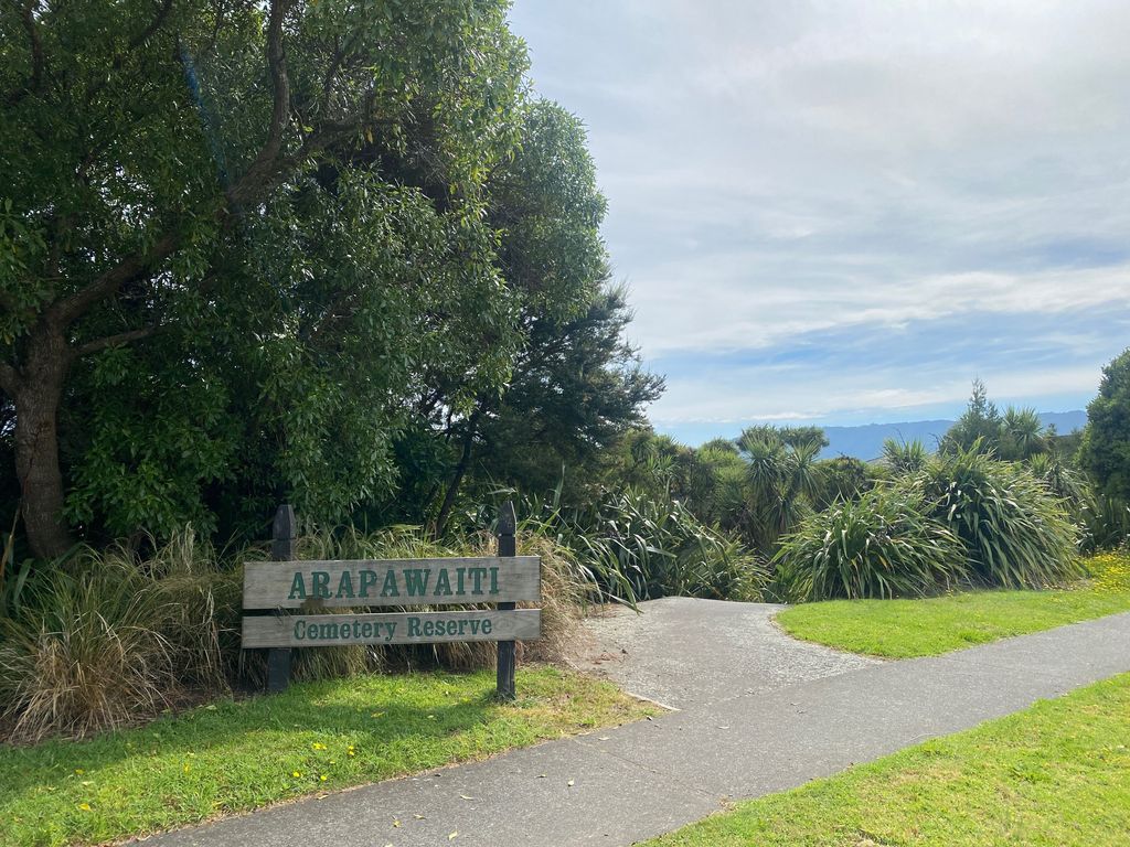
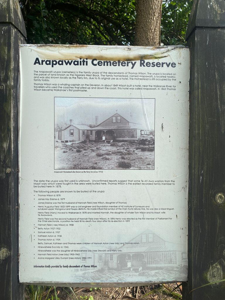
| Description | : | The Arapawaiti urupā (cemetery) is the family urupā of the descendants of Thomas Wilson. It is located on a parcel of land known as the Ngarara West Block. The family homestead, named Arapawaiti, is located nearby. It was known locally as the Ferry Inn due to its original use as a hotel. Thomas Wilson, a whaling captain on the Deveron, built Arapawaiti around 1849. It was built near the Waikanae River for travellers who used the coaches that moved up and down the coast. The homestead is still occupied by the family today. Thomas Wilson also became Waikanae’s... Read More |
frequently asked questions (FAQ):
-
Where is Arapawaiti Cemetery Reserve?
Arapawaiti Cemetery Reserve is located at 327 Manly Street, Paraparaumu Beach, Paraparaumu 5032, New Zealand Paraparaumu Beach, Kapiti Coast District ,Wellington ,New Zealand.
-
Arapawaiti Cemetery Reserve cemetery's updated grave count on graveviews.com?
0 memorials
-
Where are the coordinates of the Arapawaiti Cemetery Reserve?
Latitude: -40.8811810
Longitude: 175.0047520
Nearby Cemetories:
1. Paraparaumu Beach Cemetery
Paraparaumu Beach, Kapiti Coast District, New Zealand
Coordinate: -40.8965800, 174.9862800
2. Takamore Urupā
Waikanae Beach, Kapiti Coast District, New Zealand
Coordinate: -40.8721430, 175.0295190
3. Waikanae Cemetery
Waikanae, Kapiti Coast District, New Zealand
Coordinate: -40.8678660, 175.0513240
4. Awa Tapu Cemetery
Paraparaumu, Kapiti Coast District, New Zealand
Coordinate: -40.9328870, 175.0122070
5. MacKay Family Cemetery
Kapiti Coast District, New Zealand
Coordinate: -40.9726800, 174.9833330
6. Mira Family Urupā
Paraparaumu, Kapiti Coast District, New Zealand
Coordinate: -40.9753380, 174.9643460
7. Rangiatea Churchyard
Otaki, Kapiti Coast District, New Zealand
Coordinate: -40.7499200, 175.1375800
8. Otaki Public Cemetery
Otaki, Kapiti Coast District, New Zealand
Coordinate: -40.7528152, 175.1497955
9. Pukerua Bay Urupā
Pukerua Bay, Porirua City, New Zealand
Coordinate: -41.0300425, 174.8969530
10. Otaki Catholic Cemetery
Otaki, Kapiti Coast District, New Zealand
Coordinate: -40.7453400, 175.1426220
11. Pukekaraka Cemetery
Otaki, Kapiti Coast District, New Zealand
Coordinate: -40.7453310, 175.1434230
12. Battle Hill Burial Ground
Wellington, Wellington City, New Zealand
Coordinate: -41.0578590, 174.9352810
13. Whenua Tapu Cemetery
Porirua, Porirua City, New Zealand
Coordinate: -41.0550200, 174.8757150
14. Manakau Cemetery
Manakau, Horowhenua District, New Zealand
Coordinate: -40.7289340, 175.2067100
15. Hongoeka Urupā
Plimmerton, Porirua City, New Zealand
Coordinate: -41.0651560, 174.8525070
16. Akatarawa Cemetery
Upper Hutt City, New Zealand
Coordinate: -41.0876320, 175.1025870
17. Plimmerton Urupā
Plimmerton, Porirua City, New Zealand
Coordinate: -41.0822790, 174.8641890
18. Saint Albans Burial Ground
Pauatahanui, Porirua City, New Zealand
Coordinate: -41.1067240, 174.9179340
19. Pauatahanui Burial Ground
Pauatahanui, Porirua City, New Zealand
Coordinate: -41.1068190, 174.9173310
20. St Josephs Catholic Cemetery
Pauatahanui, Porirua City, New Zealand
Coordinate: -41.1135060, 174.9196220
21. Bradey Grave
Whitby, Porirua City, New Zealand
Coordinate: -41.1173161, 174.9056161
22. St. Joseph's Church Cemetery
Upper Hutt, Upper Hutt City, New Zealand
Coordinate: -41.1243380, 175.0686570
23. St. John's Anglican Churchyard Cemetery
Trentham, Upper Hutt City, New Zealand
Coordinate: -41.1303100, 175.0443500
24. Wallaceville Cemetery
Wallaceville, Upper Hutt City, New Zealand
Coordinate: -41.1359900, 175.0743300