
| Memorials | : | 0 |
| Location | : | Axson, Atkinson County, USA |
| Coordinate | : | 31.2678000, -82.7358000 |
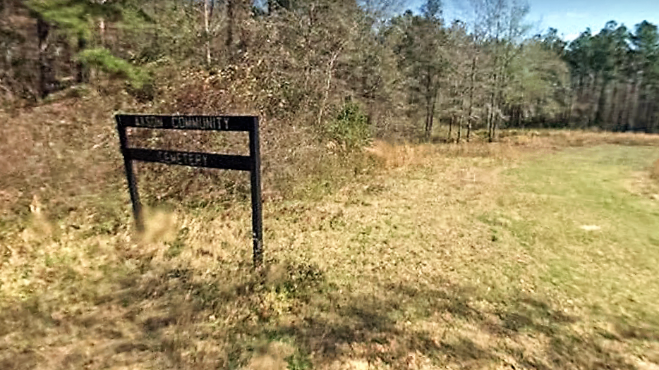
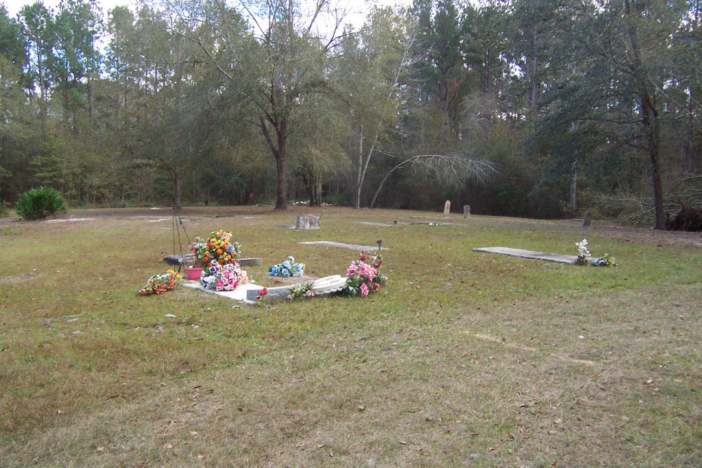
| Description | : | This afro-american cemetery is located at the end of Cemetery Lane off of Boone Road south of the community of Axson in Atkinson County, Georgia - the cemetery is well maintained - in addition to the documented marked graves, there are 20 concrete slabs that have no info on them to indicate whose grave they mark. |
frequently asked questions (FAQ):
-
Where is Axson Community Cemetery?
Axson Community Cemetery is located at Cemetery Lane Axson, Atkinson County ,Georgia , 31624USA.
-
Axson Community Cemetery cemetery's updated grave count on graveviews.com?
0 memorials
-
Where are the coordinates of the Axson Community Cemetery?
Latitude: 31.2678000
Longitude: -82.7358000
Nearby Cemetories:
1. Axson Evangelist Church Cemetery
Axson, Atkinson County, USA
Coordinate: 31.2677059, -82.7295837
2. White Cemetery
Axson, Atkinson County, USA
Coordinate: 31.2528000, -82.7433014
3. Little Utah Cemetery
Axson, Atkinson County, USA
Coordinate: 31.3013992, -82.7117004
4. Mount Zion Cemetery
Axson, Atkinson County, USA
Coordinate: 31.3214090, -82.7581020
5. Union Hill Cemetery
Axson, Atkinson County, USA
Coordinate: 31.2572250, -82.8017020
6. Red Bluff Cemetery
Pearson, Atkinson County, USA
Coordinate: 31.2272960, -82.7846790
7. Ricketson Cemetery
Axson, Atkinson County, USA
Coordinate: 31.2943000, -82.8091000
8. Jowers Chapel Cemetery
Atkinson County, USA
Coordinate: 31.3502998, -82.7647018
9. Stokesville Church Cemetery
Axson, Atkinson County, USA
Coordinate: 31.3549252, -82.7112503
10. Pearson Cemetery
Pearson, Atkinson County, USA
Coordinate: 31.3028400, -82.8558690
11. Sweetwater United Methodist Church Cemetery
Pearson, Atkinson County, USA
Coordinate: 31.3275250, -82.8456800
12. Mount Pleasant Missionary Baptist Church Cemetery
Atkinson County, USA
Coordinate: 31.3617510, -82.8372570
13. Langs Church Cemetery
Homerville, Clinch County, USA
Coordinate: 31.1796494, -82.8526459
14. Tison Cemetery
Atkinson County, USA
Coordinate: 31.3764000, -82.8324966
15. Adams Family Cemetery
Nicholls, Coffee County, USA
Coordinate: 31.4031020, -82.7148610
16. Ozias FreeWill Baptist Cemetery
Pearson, Atkinson County, USA
Coordinate: 31.2163157, -82.8909786
17. Fales Cemetery
Douglas, Coffee County, USA
Coordinate: 31.3952500, -82.8158930
18. Tanner Cemetery
Douglas, Coffee County, USA
Coordinate: 31.4106007, -82.7755966
19. New Bethel Missionary Baptist Church Cemetery
Atkinson County, USA
Coordinate: 31.2650780, -82.9089070
20. Roxie Mae Cemetery
Coffee County, USA
Coordinate: 31.4078007, -82.6635971
21. Giddens Family Cemetery
Kirkland, Atkinson County, USA
Coordinate: 31.3102050, -82.9100740
22. Kirkland United Methodist Church Cemetery
Kirkland, Atkinson County, USA
Coordinate: 31.3101970, -82.9112240
23. Hursey Nettles Davis Family Cemetery
Coffee County, USA
Coordinate: 31.4163589, -82.6799316
24. Teston Cemetery
Coffee County, USA
Coordinate: 31.4202995, -82.6793976