
| Memorials | : | 1 |
| Location | : | Latonia, Gilmer County, USA |
| Coordinate | : | 38.9422222, -81.0058333 |
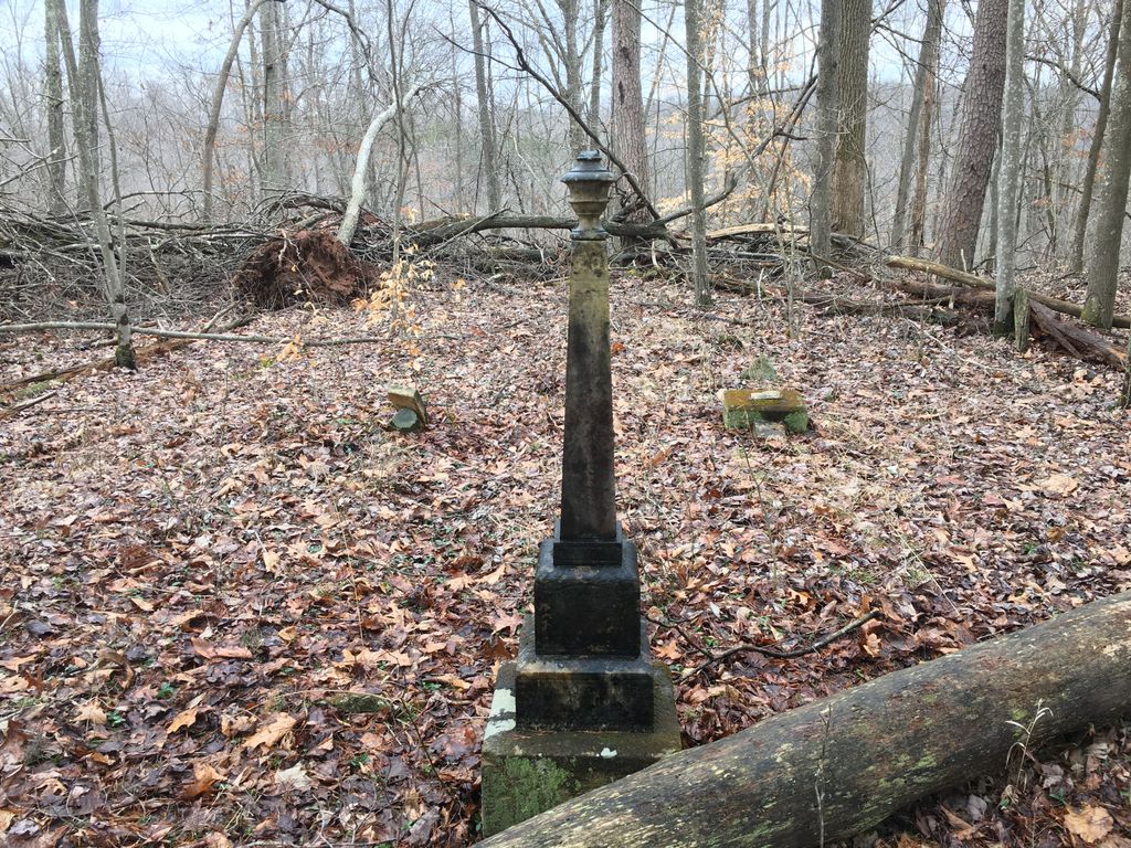
| Description | : | The Ayers Cemetery is located on County Route 38 on the Gilmer / Calhoun County line in central West Virginia. To get to the cemetery from the stoplight in Glenville, drive 11 miles West on State Route 5, then take a right up the hill onto County Route 7 (Tanner Creek Rd). Drive 0.9 miles and make a left across a bridge onto County Route 38. Drive 1.2 miles and you will come to a Y; keep right on County Route 38 and drive another 0.6 miles to a gate and cabin on your right. This is PRIVATE PROPERTY and... Read More |
frequently asked questions (FAQ):
-
Where is Ayers Cemetery?
Ayers Cemetery is located at County Route 38 Latonia, Gilmer County ,West Virginia ,USA.
-
Ayers Cemetery cemetery's updated grave count on graveviews.com?
1 memorials
-
Where are the coordinates of the Ayers Cemetery?
Latitude: 38.9422222
Longitude: -81.0058333

Nearby Cemetories:
1. Chestnut Grove Baptist Church Cemetery
Gilmer County, USA
Coordinate: 38.9340420, -80.9885860
2. Trace Fork United Methodist Church Cemetery
Gilmer County, USA
Coordinate: 38.9743580, -81.0005560
3. Job's Temple Cemetery
Glenville, Gilmer County, USA
Coordinate: 38.9322220, -80.9618810
4. Bethel-Bennett-Burns Cemetery
Grantsville, Calhoun County, USA
Coordinate: 38.9022000, -81.0153000
5. Pleasant Hill Cemetery
Grantsville, Calhoun County, USA
Coordinate: 38.9508018, -81.0627975
6. Nobe Cemetery
Nobe, Calhoun County, USA
Coordinate: 38.9813000, -81.0380300
7. Three Poplar Cemetery
Glenville, Gilmer County, USA
Coordinate: 38.9628600, -80.9445500
8. Tanner Baptist Church Cemetery
Gilmer County, USA
Coordinate: 38.9814310, -80.9480630
9. Good Shepherd Catholic Cemetery
Tanner, Gilmer County, USA
Coordinate: 38.9811830, -80.9447050
10. Pisgah United Methodist Church Cemetery
De Kalb, Gilmer County, USA
Coordinate: 38.9425160, -80.9219560
11. Big Springs Cemetery
Big Springs, Calhoun County, USA
Coordinate: 38.9850006, -81.0708008
12. Bethlehem Cemetery
Grantsville, Calhoun County, USA
Coordinate: 38.9124985, -81.0841980
13. Riddle Cemetery
Lockney, Gilmer County, USA
Coordinate: 38.8854710, -80.9561810
14. Broomstick Cemetery
Calhoun County, USA
Coordinate: 38.9668999, -81.0911026
15. Riddle Cemetery
Hardman, Gilmer County, USA
Coordinate: 38.8961111, -80.9333333
16. Knight Cemetery
Big Springs, Calhoun County, USA
Coordinate: 38.9894000, -81.0800000
17. Mount Liberty Cemetery
Tanner, Gilmer County, USA
Coordinate: 39.0086390, -80.9616440
18. Turner Cemetery
Lockney, Gilmer County, USA
Coordinate: 38.8764000, -80.9555969
19. Maxwell-Collins Cemetery
Hardman, Gilmer County, USA
Coordinate: 38.9043220, -80.9195185
20. Riddle Cemetery
Gilmer County, USA
Coordinate: 38.9547005, -80.9049988
21. Johnny Godfrey Cemetery
Lockney, Gilmer County, USA
Coordinate: 38.8755150, -80.9503720
22. Bennett Cemetery
Calhoun County, USA
Coordinate: 38.8636017, -81.0314026
23. Brown Cemetery
Gilmer County, USA
Coordinate: 38.8869070, -80.9272360
24. Cox Cemetery
Normantown, Gilmer County, USA
Coordinate: 38.8953300, -80.9170500