
| Memorials | : | 1 |
| Location | : | Preble County, USA |
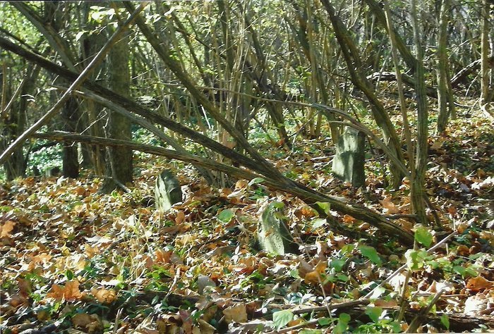
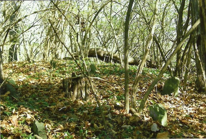
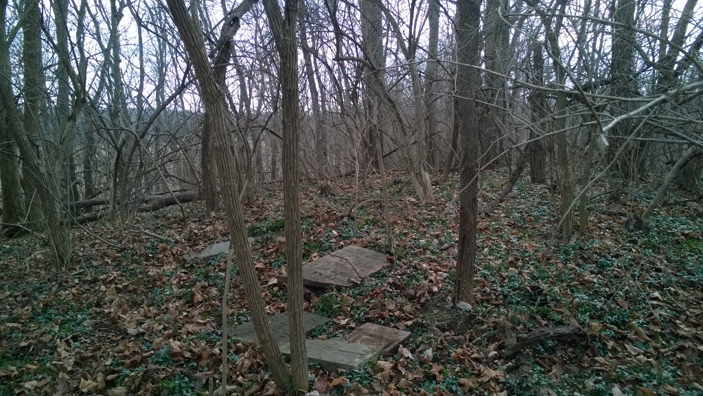
| Description | : | It is in section 14, Gasper Township, Preble County, Ohio. It was the site of the first known burial in the township--an infant child of William and Sarah Sellers in 1805. The railroad, built in 1852, sliced off a portion of the south end of the steep ridge and some graves were moved farther northeast. The cemetery is located on Consolidated Road west of US 127. The cemetery is located in Gasper Township and is #9967 in “Ohio Cemeteries 1803-2003”, compiled by the Ohio Genealogical Society. |
frequently asked questions (FAQ):
-
Where is Backbone Cemetery?
Backbone Cemetery is located at No GPS information available Add GPSGasper Township, Devil's Backbone Preble County ,Ohio ,USA.
-
Backbone Cemetery cemetery's updated grave count on graveviews.com?
0 memorials

Nearby Cemetories:
1. Joseph Ridenour Farm Cemetery
College Corner, Preble County, USA
Coordinate: 39.6850014, -84.7155991
2. Kingery Cemetery
College Corner, Preble County, USA
Coordinate: 39.6758347, -84.6083298
3. Gettysburg Cemetery
Gettysburg, Preble County, USA
Coordinate: 39.6852760, -84.5749969
4. Old North New Paris Cemetery
New Paris, Preble County, USA
Coordinate: 39.6833610, -84.5316390
5. Old Saint John Cemetery
New Paris, Preble County, USA
Coordinate: 39.7329230, -84.4844740
6. Orangeburg Cholera Cemetery
New Paris, Preble County, USA
Coordinate: 39.6365670, -84.7705940
7. Pleasant Hill Cemetery
New Paris, Preble County, USA
Coordinate: 39.6433334, -84.7699966
8. Springlawn Cemetery
New Paris, Preble County, USA
Coordinate: 39.6425018, -84.7425003
9. Spacht Cemetery
Preble County, USA
Coordinate: 39.8453331, -84.5369339
10. Conger Graveyard
Sugar Valley, Preble County, USA
Coordinate: 39.8518982, -84.5428009
11. Friendship Cemetery
Sugar Valley, Preble County, USA
Coordinate: 39.8385620, -84.4880680
12. Marshall Graveyard
Sugar Valley, Preble County, USA
Coordinate: 39.8125000, -84.7936020
13. Sugar Valley Cemetery
Sugar Valley, Preble County, USA
Coordinate: 39.6850014, -84.7155991
14. Camp Run Cemetery
Wheatville, Preble County, USA
Coordinate: 39.6758347, -84.6083298
15. Eikenberry Cemetery
Wheatville, Preble County, USA
Coordinate: 39.6852760, -84.5749969
16. United Brethren Cemetery
Wheatville, Preble County, USA
Coordinate: 39.6833610, -84.5316390
17. Eby Cemetery
County Line, Preble County, USA
Coordinate: 39.7329230, -84.4844740
18. Caldwell Burying Ground
Fairhaven, Preble County, USA
Coordinate: 39.6365670, -84.7705940
19. Fairhaven Cemetery
Fairhaven, Preble County, USA
Coordinate: 39.6433334, -84.7699966
20. Steele Cemetery
Fairhaven, Preble County, USA
Coordinate: 39.6425018, -84.7425003
21. Lower Lewisburg Cemetery
Lewisburg, Preble County, USA
Coordinate: 39.8453331, -84.5369339
22. Roselawn Cemetery
Lewisburg, Preble County, USA
Coordinate: 39.8518982, -84.5428009
23. Saint Johns Evangelical Lutheran Cemetery
Lewisburg, Preble County, USA
Coordinate: 39.8385620, -84.4880680
24. Westville Cemetery
New Westville, Preble County, USA
Coordinate: 39.8125000, -84.7936020