
| Memorials | : | 0 |
| Location | : | Bardney, West Lindsey District, England |
| Coordinate | : | 53.2204000, -0.3336000 |
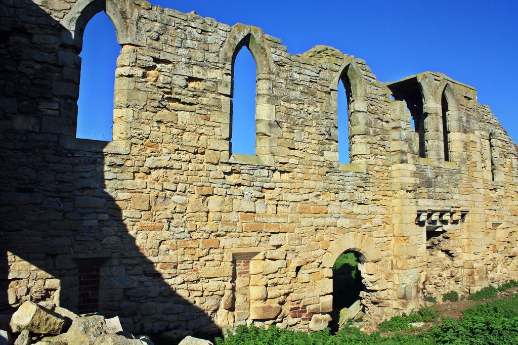
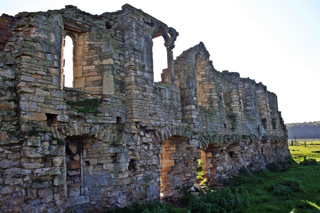
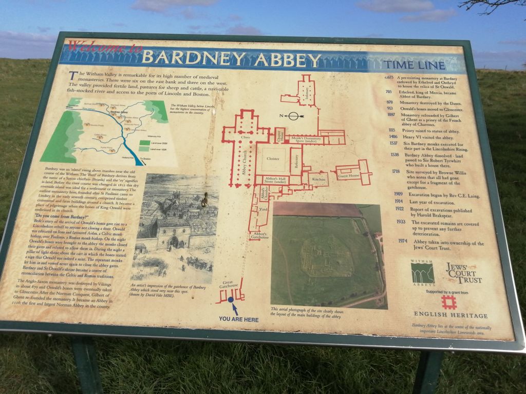
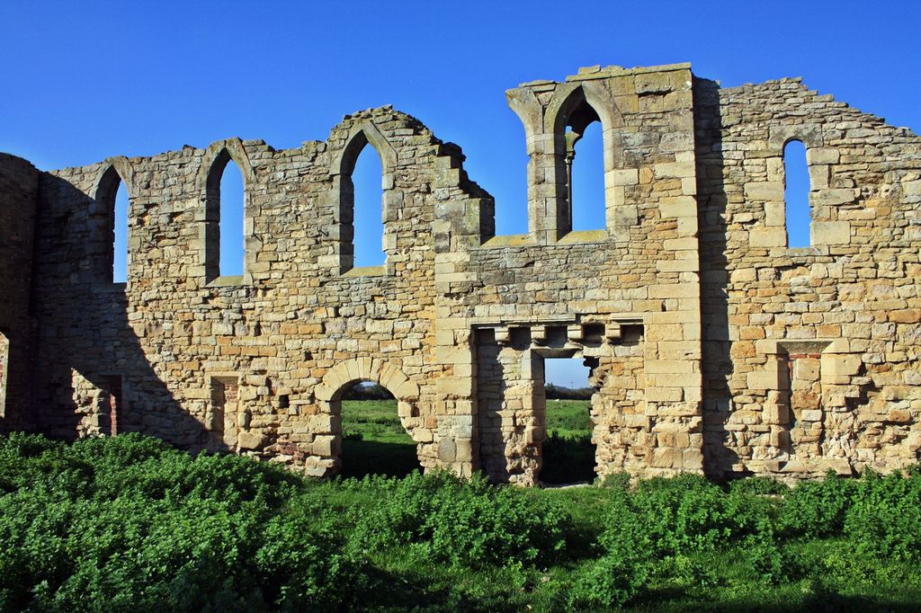
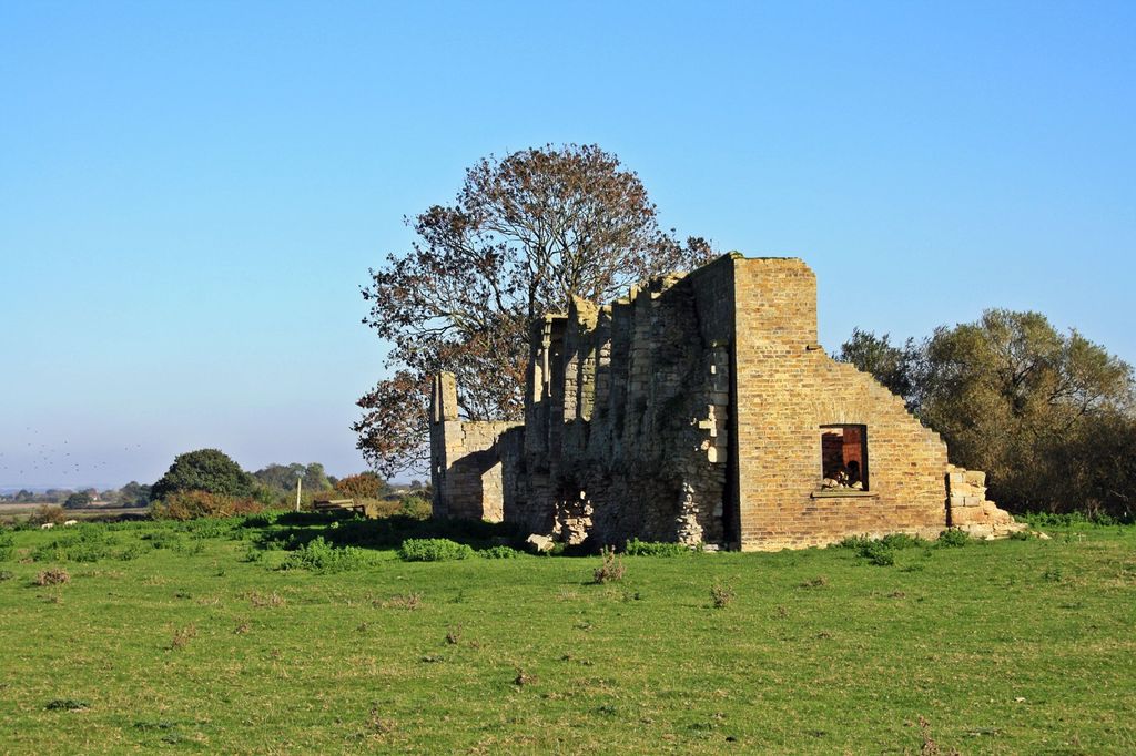
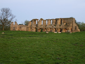
| Description | : | Bardney Abbey in Lincolnshire, England, was a Benedictine monastery founded in 697 by King Æthelred of Mercia, who was to become the first abbot. The monastery is supposed to have been destroyed during a Danish raid in 869.In 1087 it was refounded as a priory, by Gilbert de Gant, Earl of Lincoln, and it regained status as an abbey in 1115. In 1537, six of the monks were executed for their role in the Lincolnshire Rising, and Dissolution followed. In the following year the property was granted to Sir Robert Tirwhit. He retained the abbot's lodging as a house, and the... Read More |
frequently asked questions (FAQ):
-
Where is Bardney Abbey?
Bardney Abbey is located at Bardney, West Lindsey District ,Lincolnshire ,England.
-
Bardney Abbey cemetery's updated grave count on graveviews.com?
0 memorials
-
Where are the coordinates of the Bardney Abbey?
Latitude: 53.2204000
Longitude: -0.3336000
Nearby Cemetories:
1. St. Lawrence Churchyard
Bardney, West Lindsey District, England
Coordinate: 53.2095580, -0.3254380
2. Bardney Cemetery
Bardney, West Lindsey District, England
Coordinate: 53.2078350, -0.3208830
3. St Andrew's Churchyard
Bardney, West Lindsey District, England
Coordinate: 53.2442000, -0.3351800
4. St. Andrew's Churchyard
Apley, West Lindsey District, England
Coordinate: 53.2613400, -0.3390200
5. St. John the Devine Churchyard
Southrey, West Lindsey District, England
Coordinate: 53.1843135, -0.2972542
6. St. Edward's Churchyard
Barlings, West Lindsey District, England
Coordinate: 53.2600000, -0.3890000
7. St. Margaret's Churchyard
Bucknall, East Lindsey District, England
Coordinate: 53.2039920, -0.2513250
8. All Saints Churchyard
Gautby, East Lindsey District, England
Coordinate: 53.2359800, -0.2413800
9. St. Clement's Churchyard
Fiskerton, West Lindsey District, England
Coordinate: 53.2345500, -0.4315200
10. St. Giles' Churchyard
Langton by Wragby, East Lindsey District, England
Coordinate: 53.2764400, -0.2777700
11. St. Andrew Churchyard
Potterhanworth, North Kesteven District, England
Coordinate: 53.1814000, -0.4229000
12. Barlings Cemetery
Langworth, West Lindsey District, England
Coordinate: 53.2728290, -0.4041870
13. All Saints Churchyard
Horsington, East Lindsey District, England
Coordinate: 53.2023100, -0.2160600
14. St. Peter and St. Paul Churchyard
Reepham, West Lindsey District, England
Coordinate: 53.2518050, -0.4450120
15. All Saints Churchyard
Nocton, North Kesteven District, England
Coordinate: 53.1637001, -0.4151000
16. St. Peter & St. Paul Churchyard
Cherry Willingham, West Lindsey District, England
Coordinate: 53.2387000, -0.4553800
17. Hawthorn Road Cemetery
Reepham, West Lindsey District, England
Coordinate: 53.2489252, -0.4513445
18. St. Oswald's Churchyard
Rand, West Lindsey District, England
Coordinate: 53.2970600, -0.3404500
19. St. John the Baptist Churchyard
Langworth, West Lindsey District, England
Coordinate: 53.2843900, -0.4086800
20. St. Stephen's Churchyard
Hatton, East Lindsey District, England
Coordinate: 53.2758321, -0.2357834
21. St Peters Churchyard
Dunston, North Kesteven District, England
Coordinate: 53.1529600, -0.4120730
22. St. John Churchyard
Washingborough, North Kesteven District, England
Coordinate: 53.2229620, -0.4758650
23. Branston Cemetery
Branston, North Kesteven District, England
Coordinate: 53.1937400, -0.4720700
24. All Saints Churchyard
Branston, North Kesteven District, England
Coordinate: 53.1929200, -0.4728800