
| Memorials | : | 0 |
| Location | : | West Mersea, Colchester Borough, England |
| Coordinate | : | 51.7782400, 0.9144400 |
| Description | : | There are ten wargraves here. |
frequently asked questions (FAQ):
-
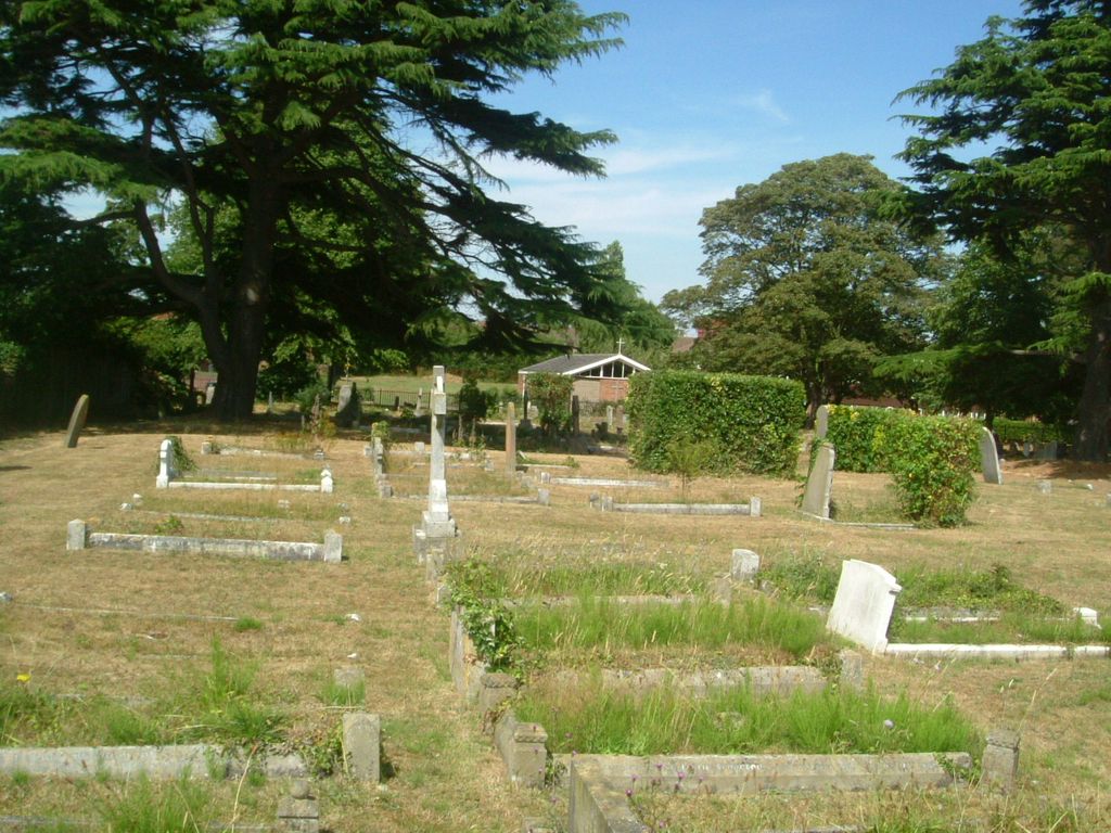
Where is Barfield Road Burial Ground?
Barfield Road Burial Ground is located at West Mersea, Colchester Borough ,Essex ,England.
-
Barfield Road Burial Ground cemetery's updated grave count on graveviews.com?
0 memorials
-
Where are the coordinates of the Barfield Road Burial Ground?
Latitude: 51.7782400
Longitude: 0.9144400
Nearby Cemetories:
1. St Peter & St Paul Churchyard
West Mersea, Colchester Borough, England
Coordinate: 51.7750700, 0.9108780
2. St Nicholas Churchyard
Little Wigborough, Colchester Borough, England
Coordinate: 51.7944230, 0.8712110
3. St Edmund Churchyard
East Mersea, Colchester Borough, England
Coordinate: 51.7886840, 0.9723200
4. St Mary The Virgin Churchyard
Peldon, Colchester Borough, England
Coordinate: 51.8141000, 0.8852800
5. St Stephen the Martyr Churchyard
Great Wigborough, Colchester Borough, England
Coordinate: 51.8047840, 0.8530500
6. St Mary the Virgin, Salcott
Salcott, Colchester Borough, England
Coordinate: 51.7866798, 0.8303322
7. St Mary the Virgin Churchyard
Tollesbury, Maldon District, England
Coordinate: 51.7578300, 0.8329100
8. St Thomas the Apostle Churchyard
Bradwell-on-Sea, Maldon District, England
Coordinate: 51.7243570, 0.9003000
9. St Mary the Virgin, Virley
Salcott, Colchester Borough, England
Coordinate: 51.7881166, 0.8251898
10. Tollesbury Cemetery
Tollesbury, Maldon District, England
Coordinate: 51.7586200, 0.8248200
11. St Andrew Churchyard
Abberton, Colchester Borough, England
Coordinate: 51.8373460, 0.8978390
12. St Mary the Virgin Churchyard
Layer Breton, Colchester Borough, England
Coordinate: 51.8190300, 0.8269200
13. St. Andrew's Churchyard
Fingringhoe, Colchester Borough, England
Coordinate: 51.8452150, 0.9451480
14. St John the Baptist Churchyard
Layer de la Haye, Colchester Borough, England
Coordinate: 51.8361820, 0.8505660
15. St. Nicholas Churchyard
Tolleshunt D'Arcy, Maldon District, England
Coordinate: 51.7706870, 0.7932420
16. Old St. Lawrence Churchyard
East Donyland, Colchester Borough, England
Coordinate: 51.8525110, 0.9383250
17. East Donyland Parish Cemetery
Fingringhoe, Colchester Borough, England
Coordinate: 51.8527840, 0.9378370
18. St Nicholas New Churchyard
Tolleshunt D'Arcy, Maldon District, England
Coordinate: 51.7693270, 0.7910210
19. All Saints with St. James Churchyard
Brightlingsea, Tendring District, England
Coordinate: 51.8285070, 1.0130530
20. St. Lawrence Churchyard
East Donyland, Colchester Borough, England
Coordinate: 51.8556150, 0.9462830
21. St. Mary the Virgin Churchyard
Wivenhoe, Colchester Borough, England
Coordinate: 51.8550794, 0.9594897
22. St. Nicholas' Churchyard
Tillingham, Maldon District, England
Coordinate: 51.6978020, 0.8826830
23. St Michael's Churchyard
Berechurch, Colchester Borough, England
Coordinate: 51.8600000, 0.8926000
24. St Mary the Virgin Church
Layer Marney, Colchester Borough, England
Coordinate: 51.8221000, 0.7965000