| Memorials | : | 0 |
| Location | : | Leiden, Leiden Municipality, Netherlands |
| Website | : | www.begraafplaatsgroenesteeg.nl |
| Coordinate | : | 52.1573700, 4.5029200 |
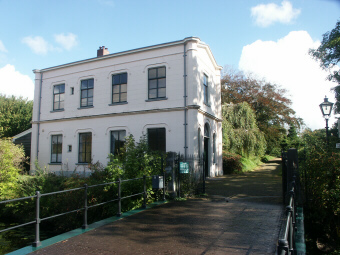
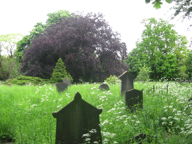
| Description | : | Description: Between 1794 and 1814, the Netherlands was controlled by France. Over time, French laws were also implemented in the Netherlands. Therefore, in 1813, burials within churches were no longer allowed. Leiden therefore decided to build a cemetery at the end of the Groenesteeg. This cemetery was finished on 9 March 1813. However, when the French were defeated, it was decided that burials within churches were allowed once again. The amount of burials in Begraafplaats Groenesteeg drastically decreased. Between 1814 and 1828, only 31 people were buried here. As of 1829, burials inside churches were once again no longer allowed.... Read More |
frequently asked questions (FAQ):
-
Where is Begraafplaats Groenesteeg?
Begraafplaats Groenesteeg is located at Groenesteeg 126 Leiden, Leiden Municipality ,Zuid-Holland , 2312 SRNetherlands.
-
Begraafplaats Groenesteeg cemetery's updated grave count on graveviews.com?
0 memorials
-
Where are the coordinates of the Begraafplaats Groenesteeg?
Latitude: 52.1573700
Longitude: 4.5029200
Nearby Cemetories:
1. Rooms-Katholieke Begraafplaats Zijlpoort
Leiden, Leiden Municipality, Netherlands
Coordinate: 52.1622100, 4.5042700
2. Hooglandse Kerk
Leiden, Leiden Municipality, Netherlands
Coordinate: 52.1579230, 4.4938010
3. Vrouwekerk
Leiden, Leiden Municipality, Netherlands
Coordinate: 52.1610850, 4.4894850
4. Pieterskerk
Leiden, Leiden Municipality, Netherlands
Coordinate: 52.1576200, 4.4877290
5. Dorpskerk Leiderdorp
Leiderdorp, Leiderdorp Municipality, Netherlands
Coordinate: 52.1509480, 4.5234880
6. Algemene Begraafplaats Hoge Rijndijk
Zoeterwoude-Rijndijk, Zoeterwoude Municipality, Netherlands
Coordinate: 52.1448600, 4.5233400
7. Algemene Begraafplaats Leiderdorp
Leiderdorp, Leiderdorp Municipality, Netherlands
Coordinate: 52.1534300, 4.5336210
8. Begraafplaats Rhijnhof
Leiden, Leiden Municipality, Netherlands
Coordinate: 52.1621700, 4.4516900
9. Rooms-Katholiek Kerkhof H. Willibrorduskerk
Oegstgeest, Oegstgeest Municipality, Netherlands
Coordinate: 52.1804520, 4.4634530
10. Nederlands-Hervormde Begraafplaats Dorpskerk
Zoeterwoude-Dorp, Zoeterwoude Municipality, Netherlands
Coordinate: 52.1212195, 4.4971618
11. Rooms Katholiek Kerkhof H. Laurentiuskerk
Voorschoten, Voorschoten Municipality, Netherlands
Coordinate: 52.1299570, 4.4552670
12. Rooms Katholieke Begraafplaats Sint-Matthias
Warmond, Teylingen Municipality, Netherlands
Coordinate: 52.1984410, 4.5006280
13. Dierenbegraafplaats Groenendijk
Groenendijk, Alphen aan den Rijn Municipality, Netherlands
Coordinate: 52.1284310, 4.5529946
14. Begraafplaats Groene Kerk
Oegstgeest, Oegstgeest Municipality, Netherlands
Coordinate: 52.1938800, 4.4677900
15. Rooms-Katholiek Kerkhof Scheepjeskerk
Groenendijk, Alphen aan den Rijn Municipality, Netherlands
Coordinate: 52.1314410, 4.5595410
16. Begraafplaats De Oude Toren
Warmond, Teylingen Municipality, Netherlands
Coordinate: 52.2007210, 4.5012890
17. Nederlands Hervormd Kerkhof Dorpskerk
Voorschoten, Voorschoten Municipality, Netherlands
Coordinate: 52.1251120, 4.4465990
18. Begraafplaats St. Jans Onthoofding
Zuidbuurt, Zoeterwoude Municipality, Netherlands
Coordinate: 52.1091010, 4.5028680
19. Rooms Katholieke Begraafplaats Hoogmade
Hoogmade, Kaag en Braassem Municipality, Netherlands
Coordinate: 52.1684000, 4.5799600
20. Abdij van Rijnsburg
Rijnsburg, Katwijk Municipality, Netherlands
Coordinate: 52.1896310, 4.4436810
21. Begraafplaats van Hervormde Gemeente Rijnsburg
Rijnsburg, Katwijk Municipality, Netherlands
Coordinate: 52.1895160, 4.4431310
22. Algemene Begraafplaats
Valkenburg, Katwijk Municipality, Netherlands
Coordinate: 52.1802730, 4.4314420
23. Begraafplaats Sandtlaan
Rijnsburg, Katwijk Municipality, Netherlands
Coordinate: 52.1894150, 4.4365700
24. Rooms-Katholiek Kerkhof Sint-Bavokerk
Oud Ade, Kaag en Braassem Municipality, Netherlands
Coordinate: 52.1919000, 4.5664600


