
| Memorials | : | 1 |
| Location | : | Rijnsburg, Katwijk Municipality, Netherlands |
| Coordinate | : | 52.1894150, 4.4365700 |
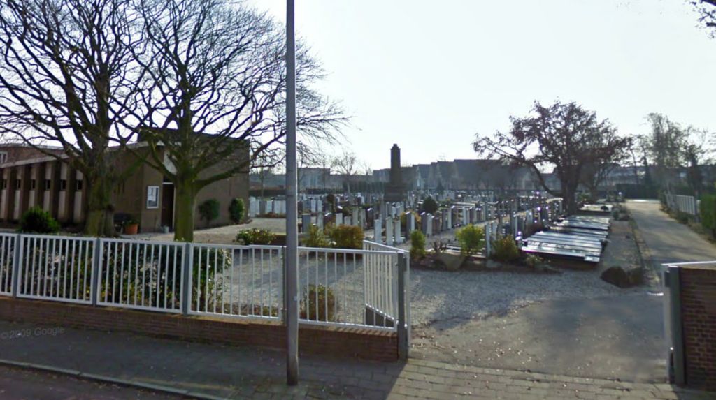
| Description | : | The land where the cemetery is located was granted to the Reformed Church by G. van den Eijkel Azn. The cemetery was constructed in 1893. The cemetery started off as a Reformed cemetery, but in 1968 the cemetery was expanded with a general area, where people of all religions could be buried. |
frequently asked questions (FAQ):
-
Where is Begraafplaats Sandtlaan?
Begraafplaats Sandtlaan is located at Sandtlaan Rijnsburg, Katwijk Municipality ,Zuid-Holland , 2231 CBNetherlands.
-
Begraafplaats Sandtlaan cemetery's updated grave count on graveviews.com?
1 memorials
-
Where are the coordinates of the Begraafplaats Sandtlaan?
Latitude: 52.1894150
Longitude: 4.4365700
Nearby Cemetories:
1. Begraafplaats van Hervormde Gemeente Rijnsburg
Rijnsburg, Katwijk Municipality, Netherlands
Coordinate: 52.1895160, 4.4431310
2. Abdij van Rijnsburg
Rijnsburg, Katwijk Municipality, Netherlands
Coordinate: 52.1896310, 4.4436810
3. Begraafplaats Paters Jezuïeten De Wilbert
Katwijk aan den Rijn, Katwijk Municipality, Netherlands
Coordinate: 52.1932480, 4.4288680
4. Algemene Begraafplaats
Valkenburg, Katwijk Municipality, Netherlands
Coordinate: 52.1802730, 4.4314420
5. Joodse Begraafplaats
Katwijk aan den Rijn, Katwijk Municipality, Netherlands
Coordinate: 52.1982800, 4.4214500
6. Rooms-Katholiek Kerkhof H. Willibrorduskerk
Oegstgeest, Oegstgeest Municipality, Netherlands
Coordinate: 52.1804520, 4.4634530
7. Begraafplaats Groene Kerk
Oegstgeest, Oegstgeest Municipality, Netherlands
Coordinate: 52.1938800, 4.4677900
8. Begraafplaats Duinrust
Katwijk aan Zee, Katwijk Municipality, Netherlands
Coordinate: 52.1989930, 4.4013330
9. Algemene Begraafplaats Katwijk
Katwijk aan Zee, Katwijk Municipality, Netherlands
Coordinate: 52.2018210, 4.4011560
10. Begraafplaats Rhijnhof
Leiden, Leiden Municipality, Netherlands
Coordinate: 52.1621700, 4.4516900
11. Rooms Katholieke Begraafplaats Sint-Matthias
Warmond, Teylingen Municipality, Netherlands
Coordinate: 52.1984410, 4.5006280
12. Begraafplaats De Oude Toren
Warmond, Teylingen Municipality, Netherlands
Coordinate: 52.2007210, 4.5012890
13. Rooms Katholiek Kerkhof St. Bartholomeuskerk
Voorhout, Teylingen Municipality, Netherlands
Coordinate: 52.2211780, 4.4832100
14. Vrouwekerk
Leiden, Leiden Municipality, Netherlands
Coordinate: 52.1610850, 4.4894850
15. Pieterskerk
Leiden, Leiden Municipality, Netherlands
Coordinate: 52.1576200, 4.4877290
16. Hooglandse Kerk
Leiden, Leiden Municipality, Netherlands
Coordinate: 52.1579230, 4.4938010
17. Noordwijk General Cemetery
Noordwijk, Noordwijk Municipality, Netherlands
Coordinate: 52.2382700, 4.4349900
18. Rooms-Katholieke Begraafplaats Zijlpoort
Leiden, Leiden Municipality, Netherlands
Coordinate: 52.1622100, 4.5042700
19. Rooms-Katholieke Begraafplaats Noordwijk
Noordwijk-Binnen, Noordwijk Municipality, Netherlands
Coordinate: 52.2388008, 4.4534885
20. Begraafplaats Groenesteeg
Leiden, Leiden Municipality, Netherlands
Coordinate: 52.1573700, 4.5029200
21. Dorpskerk Begraafplaats
Wassenaar, Wassenaar Municipality, Netherlands
Coordinate: 52.1452800, 4.3900900
22. Rooms Katholieke Begraafplaats Sint Willibrordus
Wassenaar, Wassenaar Municipality, Netherlands
Coordinate: 52.1399480, 4.3906280
23. Rooms Katholiek Kerkhof H. Laurentiuskerk
Voorschoten, Voorschoten Municipality, Netherlands
Coordinate: 52.1299570, 4.4552670
24. Rooms-Katholieke Begraafplaats Sint-Pancratiuskerk
Sassenheim, Teylingen Municipality, Netherlands
Coordinate: 52.2240250, 4.5199560