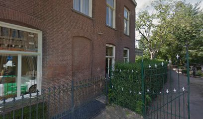
| Memorials | : | 0 |
| Location | : | Lage Zwaluwe, Drimmelen Municipality, Netherlands |
| Coordinate | : | 51.7053186, 4.7091581 |
frequently asked questions (FAQ):
-
Where is Begraafplaats van de Parochie H Johannes de Doper?
Begraafplaats van de Parochie H Johannes de Doper is located at Plantsoen 2 Lage Zwaluwe, Drimmelen Municipality ,Noord-Brabant , 4926 RBNetherlands.
-
Begraafplaats van de Parochie H Johannes de Doper cemetery's updated grave count on graveviews.com?
0 memorials
-
Where are the coordinates of the Begraafplaats van de Parochie H Johannes de Doper?
Latitude: 51.7053186
Longitude: 4.7091581
Nearby Cemetories:
1. Begraafplaats Ned Herv Kerk
Lage Zwaluwe, Drimmelen Municipality, Netherlands
Coordinate: 51.7106170, 4.7017214
2. Protestantse Begraafplaats Hooge Zwaluwe
Hooge Zwaluwe, Drimmelen Municipality, Netherlands
Coordinate: 51.6909173, 4.7376352
3. Sint-Bernardus Kerkhof
Hooge Zwaluwe, Drimmelen Municipality, Netherlands
Coordinate: 51.6852900, 4.7486200
4. Rooms-Katholieke Begraafplaats Zevenbergschen Hoek
Zevenbergschen Hoek, Moerdijk Municipality, Netherlands
Coordinate: 51.6740278, 4.6784423
5. Oude Begraafplaats
Oud-Drimmelen, Drimmelen Municipality, Netherlands
Coordinate: 51.6953428, 4.7815527
6. Begraafplaats Parochie H Gummarus
Wagenberg, Drimmelen Municipality, Netherlands
Coordinate: 51.6646339, 4.7468280
7. Rooms Katholieke Begraafplaats Moerdijk
Moerdijk, Moerdijk Municipality, Netherlands
Coordinate: 51.7012173, 4.6304095
8. Protestantse Begraafplaats Moerdijk
Moerdijk, Moerdijk Municipality, Netherlands
Coordinate: 51.6999519, 4.6233284
9. Made General Cemetery
Made, Drimmelen Municipality, Netherlands
Coordinate: 51.6709734, 4.7794867
10. Begraafplaats van de Bernardusparochie
Made, Drimmelen Municipality, Netherlands
Coordinate: 51.6823618, 4.7934563
11. Oude Begraafplaats
Made, Drimmelen Municipality, Netherlands
Coordinate: 51.6722400, 4.7854625
12. Made-en-Drimmelen Protestant Churchyard
Made, Drimmelen Municipality, Netherlands
Coordinate: 51.6790700, 4.7977900
13. Kerkhof Langeweg
Langeweg, Moerdijk Municipality, Netherlands
Coordinate: 51.6467982, 4.6645953
14. Terheijden Antonius Abt Kerkhof
Terheijden, Drimmelen Municipality, Netherlands
Coordinate: 51.6425700, 4.7518400
15. R.K. Begraafplaats Heilige Cornelius
Den Hout, Oosterhout Municipality, Netherlands
Coordinate: 51.6600504, 4.8136076
16. Algemene Begraafplaats Dubbeldam
Dubbeldam, Dordrecht Municipality, Netherlands
Coordinate: 51.7848834, 4.6881348
17. Algemene Begraafplaats
Zevenbergen, Moerdijk Municipality, Netherlands
Coordinate: 51.6465490, 4.5985048
18. Rooms Katholieke Begraafplaats Zevenbergen
Zevenbergen, Moerdijk Municipality, Netherlands
Coordinate: 51.6454476, 4.5993329
19. 's-Gravendeel Oude Algemene Begraafplaats
's-Gravendeel, Binnenmaas Municipality, Netherlands
Coordinate: 51.7796600, 4.6148900
20. Joodse Begraafplaats
Oosterhout, Oosterhout Municipality, Netherlands
Coordinate: 51.6396000, 4.8201600
21. Essenhof Cemetery & Crematorium
Dordrecht, Dordrecht Municipality, Netherlands
Coordinate: 51.8011270, 4.6757310
22. Begraafplaats Noordtoren
Zevenbergen, Moerdijk Municipality, Netherlands
Coordinate: 51.6455214, 4.5835365
23. 's-Gravendeel Nieuwe Algemene Begraafplaats
's-Gravendeel, Binnenmaas Municipality, Netherlands
Coordinate: 51.7823000, 4.6106100
24. Joodse Begraafplaats Dordrecht
Dordrecht, Dordrecht Municipality, Netherlands
Coordinate: 51.8018924, 4.6795589

