
| Memorials | : | 0 |
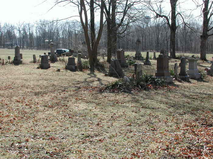
| Location | : | Carthage, Rush County, USA |
| Coordinate | : | 39.7717018, -85.5227966 |
| Description | : | This cemetery is also located in 2 different townships. Part of it is in Ripley Township and part of it is in Center Township. When it first started it was called Bell Cemetery, but by 1890 it was only called Barrett Cemetery. Henry County History 1822-1906, Vol1 and 2 by Hazzard, notes the name of the cemetery as Barrett Cemetery and this book was published in 1906. History of the Bell Cemetery: Semi-Centennial History of the Presbyterian Church, Knightstown, Ind.," a pamphlet produced for the membership in 1882. In it are a couple of paragraphs about the beginning of the church. It is written... Read More |
frequently asked questions (FAQ):
-
Where is Bell Cemetery?
Bell Cemetery is located at Carthage, Rush County ,Indiana ,USA.
-
Bell Cemetery cemetery's updated grave count on graveviews.com?
0 memorials
-
Where are the coordinates of the Bell Cemetery?
Latitude: 39.7717018
Longitude: -85.5227966
Nearby Cemetories:
1. Soldiers and Sailors Childrens Home Cemetery
Rush County, USA
Coordinate: 39.7688050, -85.5187900
2. Reddick Cemetery
Rush County, USA
Coordinate: 39.7576900, -85.4969300
3. Carthage Pike Cemetery
Carthage, Rush County, USA
Coordinate: 39.7581480, -85.5509690
4. Raysville Friends Cemetery
Henry County, USA
Coordinate: 39.7969704, -85.5048904
5. Raysville Christian Cemetery
Henry County, USA
Coordinate: 39.7975006, -85.5046234
6. Pioneer Baptist Cemetery
Knightstown, Henry County, USA
Coordinate: 39.8011665, -85.5210342
7. Carthage Cemetery
Carthage, Rush County, USA
Coordinate: 39.7538986, -85.5582962
8. Glen Cove Cemetery
Knightstown, Henry County, USA
Coordinate: 39.8045883, -85.5324707
9. Riverside Cemetery
Carthage, Rush County, USA
Coordinate: 39.7449989, -85.5766983
10. Carthage Friends Cemetery
Carthage, Rush County, USA
Coordinate: 39.7356950, -85.5741470
11. Fort Family Burial Grounds
Henry County, USA
Coordinate: 39.8219900, -85.5475300
12. Elm Grove Cemetery
Henry County, USA
Coordinate: 39.8240830, -85.5038330
13. Center Church Cemetery
Center Township, Rush County, USA
Coordinate: 39.7460022, -85.4559326
14. Dillon Cemetery
Rush County, USA
Coordinate: 39.7131000, -85.4862000
15. Dunreith Cemetery
Dunreith, Henry County, USA
Coordinate: 39.8014412, -85.4383774
16. Shiloh Cemetery
Mays, Rush County, USA
Coordinate: 39.7724991, -85.4289017
17. Six Mile Cemetery
Charlottesville, Hancock County, USA
Coordinate: 39.8149986, -85.6063995
18. Little Blue River Cemetery
Rush County, USA
Coordinate: 39.7070389, -85.4597244
19. Walnut Ridge Cemetery
Carthage, Rush County, USA
Coordinate: 39.7270164, -85.6130753
20. Pleasant View Cemetery
Hancock County, USA
Coordinate: 39.7569008, -85.6331024
21. David Family Burial Plot
Farmers, Rush County, USA
Coordinate: 39.6861190, -85.5062310
22. Hannegan Cemetery
Henderson, Rush County, USA
Coordinate: 39.6828918, -85.5211105
23. Franklin Cemetery
Carthage, Rush County, USA
Coordinate: 39.6999588, -85.5949402
24. Spiceland Friends Cemetery
Spiceland, Henry County, USA
Coordinate: 39.8392830, -85.4434204