
| Memorials | : | 0 |
| Location | : | Carthage, Rush County, USA |
| Coordinate | : | 39.7538986, -85.5582962 |
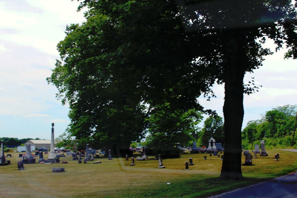
| Description | : | The cemetery is located on the south side of N. Carthage Pike about 0.4 miles north of its intersection with W County road 950 N. The U.S. Geological Survey (USGS) Geographic Names Information System (GNIS) feature ID for the cemetery is 432195 (Carthage Cemetery). |
frequently asked questions (FAQ):
-
Where is Carthage Cemetery?
Carthage Cemetery is located at N. Carthage Pike Carthage, Rush County ,Indiana , 46115USA.
-
Carthage Cemetery cemetery's updated grave count on graveviews.com?
0 memorials
-
Where are the coordinates of the Carthage Cemetery?
Latitude: 39.7538986
Longitude: -85.5582962
Nearby Cemetories:
1. Carthage Pike Cemetery
Carthage, Rush County, USA
Coordinate: 39.7581480, -85.5509690
2. Riverside Cemetery
Carthage, Rush County, USA
Coordinate: 39.7449989, -85.5766983
3. Carthage Friends Cemetery
Carthage, Rush County, USA
Coordinate: 39.7356950, -85.5741470
4. Bell Cemetery
Carthage, Rush County, USA
Coordinate: 39.7717018, -85.5227966
5. Soldiers and Sailors Childrens Home Cemetery
Rush County, USA
Coordinate: 39.7688050, -85.5187900
6. Reddick Cemetery
Rush County, USA
Coordinate: 39.7576900, -85.4969300
7. Walnut Ridge Cemetery
Carthage, Rush County, USA
Coordinate: 39.7270164, -85.6130753
8. Glen Cove Cemetery
Knightstown, Henry County, USA
Coordinate: 39.8045883, -85.5324707
9. Pioneer Baptist Cemetery
Knightstown, Henry County, USA
Coordinate: 39.8011665, -85.5210342
10. Pleasant View Cemetery
Hancock County, USA
Coordinate: 39.7569008, -85.6331024
11. Raysville Friends Cemetery
Henry County, USA
Coordinate: 39.7969704, -85.5048904
12. Raysville Christian Cemetery
Henry County, USA
Coordinate: 39.7975006, -85.5046234
13. Franklin Cemetery
Carthage, Rush County, USA
Coordinate: 39.6999588, -85.5949402
14. Fort Family Burial Grounds
Henry County, USA
Coordinate: 39.8219900, -85.5475300
15. Dillon Cemetery
Rush County, USA
Coordinate: 39.7131000, -85.4862000
16. Six Mile Cemetery
Charlottesville, Hancock County, USA
Coordinate: 39.8149986, -85.6063995
17. Gilboa Cemetery
Hancock County, USA
Coordinate: 39.7752991, -85.6524963
18. Hannegan Cemetery
Henderson, Rush County, USA
Coordinate: 39.6828918, -85.5211105
19. David Family Burial Plot
Farmers, Rush County, USA
Coordinate: 39.6861190, -85.5062310
20. Center Church Cemetery
Center Township, Rush County, USA
Coordinate: 39.7460022, -85.4559326
21. Elm Grove Cemetery
Henry County, USA
Coordinate: 39.8240830, -85.5038330
22. Ball Graveyard
Rush County, USA
Coordinate: 39.6730995, -85.5327988
23. Westland Friends Church Cemetery
Westland, Hancock County, USA
Coordinate: 39.7430801, -85.6717606
24. Little Blue River Cemetery
Rush County, USA
Coordinate: 39.7070389, -85.4597244