
| Memorials | : | 0 |
| Location | : | Carthage, Rush County, USA |
| Coordinate | : | 39.7356950, -85.5741470 |
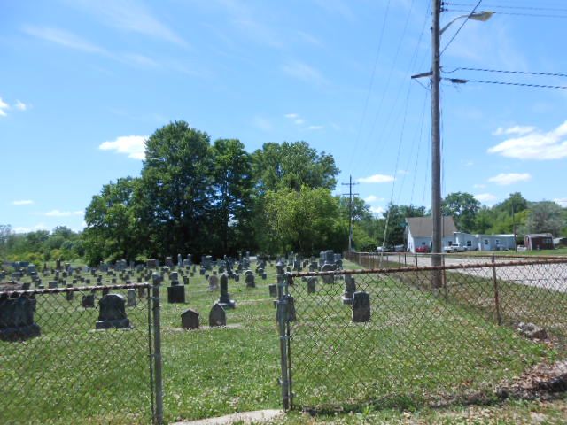
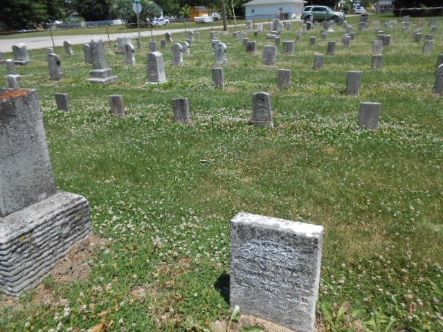
| Description | : | Carthage Monthly Meeting was set off from Walnut Ridge Monthly Meeting and first held Eighth Month 4, 1866. The meetinghouse is located at the south edge of the village of Carthage. The monthly meeting originally consisted of two preparatives, Carthage and Little Blue River. The latter was set off as a monthly meeting in 1884. When Carthage Meeting was established in 1839, some Friends thought that the meetinghouse should be near the school, which was southeast of the present town. John Clark, a Friend and one of the founders of Carthage, took aside the clerk of the committee that was... Read More |
frequently asked questions (FAQ):
-
Where is Carthage Friends Cemetery?
Carthage Friends Cemetery is located at Clark Street Carthage, Rush County ,Indiana , 46115USA.
-
Carthage Friends Cemetery cemetery's updated grave count on graveviews.com?
0 memorials
-
Where are the coordinates of the Carthage Friends Cemetery?
Latitude: 39.7356950
Longitude: -85.5741470
Nearby Cemetories:
1. Riverside Cemetery
Carthage, Rush County, USA
Coordinate: 39.7449989, -85.5766983
2. Carthage Cemetery
Carthage, Rush County, USA
Coordinate: 39.7538986, -85.5582962
3. Carthage Pike Cemetery
Carthage, Rush County, USA
Coordinate: 39.7581480, -85.5509690
4. Walnut Ridge Cemetery
Carthage, Rush County, USA
Coordinate: 39.7270164, -85.6130753
5. Franklin Cemetery
Carthage, Rush County, USA
Coordinate: 39.6999588, -85.5949402
6. Pleasant View Cemetery
Hancock County, USA
Coordinate: 39.7569008, -85.6331024
7. Bell Cemetery
Carthage, Rush County, USA
Coordinate: 39.7717018, -85.5227966
8. Soldiers and Sailors Childrens Home Cemetery
Rush County, USA
Coordinate: 39.7688050, -85.5187900
9. Reddick Cemetery
Rush County, USA
Coordinate: 39.7576900, -85.4969300
10. Hannegan Cemetery
Henderson, Rush County, USA
Coordinate: 39.6828918, -85.5211105
11. Haskett Cemetery
Blue River Township, Hancock County, USA
Coordinate: 39.7010994, -85.6521988
12. Ball Graveyard
Rush County, USA
Coordinate: 39.6730995, -85.5327988
13. Dillon Cemetery
Rush County, USA
Coordinate: 39.7131000, -85.4862000
14. David Family Burial Plot
Farmers, Rush County, USA
Coordinate: 39.6861190, -85.5062310
15. Gilboa Cemetery
Hancock County, USA
Coordinate: 39.7752991, -85.6524963
16. Westland Friends Church Cemetery
Westland, Hancock County, USA
Coordinate: 39.7430801, -85.6717606
17. Glen Cove Cemetery
Knightstown, Henry County, USA
Coordinate: 39.8045883, -85.5324707
18. Stanley Cemetery
Arlington, Rush County, USA
Coordinate: 39.6590080, -85.5723340
19. Pioneer Baptist Cemetery
Knightstown, Henry County, USA
Coordinate: 39.8011665, -85.5210342
20. Glendenning Cemetery
Henderson, Rush County, USA
Coordinate: 39.6624020, -85.5391410
21. Raysville Friends Cemetery
Henry County, USA
Coordinate: 39.7969704, -85.5048904
22. Raysville Christian Cemetery
Henry County, USA
Coordinate: 39.7975006, -85.5046234
23. Six Mile Cemetery
Charlottesville, Hancock County, USA
Coordinate: 39.8149986, -85.6063995
24. Fort Family Burial Grounds
Henry County, USA
Coordinate: 39.8219900, -85.5475300