
| Memorials | : | 32 |
| Location | : | Fergus, Wellington County, Canada |
| Coordinate | : | 43.7063522, -80.3686829 |
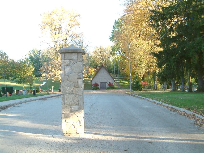
| Description | : | Belsyde Cemetery was originally the farmland of early Fergus pioneer and politician, Alexander David Ferrier. His farm, which he named "Belsyde" after his father's home in Scotland, became Belsyde Cemetery when the original burial ground, The Auld Kirk Yard, at St. Andrew's Presbyterian Church had outgrown its purpose. The first burial at Belsyde was James Samson, May 1863. A memorial stone, erected in Ferrier's honour at Belsyde Cemetery, reads as follows: "Erected by the town of Fergus, to the memory of the late A.D. Ferrier, born in Edinborough [sic] Scotland Nov. 13, 1813, died in Campbeltown Scotland Aug. 4, 1890, buried... Read More |
frequently asked questions (FAQ):
-
Where is Belsyde Cemetery?
Belsyde Cemetery is located at Thistle St. (off of Union St.) Fergus, Wellington County ,Ontario ,Canada.
-
Belsyde Cemetery cemetery's updated grave count on graveviews.com?
30 memorials
-
Where are the coordinates of the Belsyde Cemetery?
Latitude: 43.7063522
Longitude: -80.3686829
Nearby Cemetories:
1. Saint Andrews Auld Presbyterian Kirkyard
Fergus, Wellington County, Canada
Coordinate: 43.7042122, -80.3811722
2. Saint Joseph's Catholic Cemetery
Fergus, Wellington County, Canada
Coordinate: 43.7024918, -80.3827591
3. House of Industry & Refuge Cemetery
Fergus, Wellington County, Canada
Coordinate: 43.6905910, -80.3943440
4. Wellington County Cemetery
Elora, Wellington County, Canada
Coordinate: 43.6913500, -80.3954600
5. Saint John the Evangelist Anglican Cairn
Elora, Wellington County, Canada
Coordinate: 43.6756940, -80.4300500
6. Elora Cemetery
Elora, Wellington County, Canada
Coordinate: 43.6876259, -80.4413986
7. St. Mary's Roman Catholic Cemetery
Elora, Wellington County, Canada
Coordinate: 43.6868510, -80.4414870
8. Mount Pleasant Cemetery
Centre Wellington Township, Wellington County, Canada
Coordinate: 43.6436000, -80.3141000
9. Mount Carmel Cemetery
Belwood, Wellington County, Canada
Coordinate: 43.7967320, -80.3501690
10. McKee Cemetery
Craigsholme, Dufferin County, Canada
Coordinate: 43.7811600, -80.2775700
11. Johnson-Eramosa Union Cemetery
Eramosa Township, Wellington County, Canada
Coordinate: 43.6515600, -80.2516100
12. Bethel Mennonite Cemetery
Elora, Wellington County, Canada
Coordinate: 43.6720009, -80.5111160
13. Mimosa Union Cemetery
Mimosa, Wellington County, Canada
Coordinate: 43.7456690, -80.2202533
14. Maple View Mennonite Cemetery
Alma, Wellington County, Canada
Coordinate: 43.7482990, -80.5179980
15. McCormick Cemetery
Eramosa Township, Wellington County, Canada
Coordinate: 43.6347500, -80.2403300
16. Bloomsbury Methodist Cemetery
Centre Wellington Township, Wellington County, Canada
Coordinate: 43.7020810, -80.5405760
17. Calvary Conservative Mennonite Cemetery
Woolwich Township, Waterloo Regional Municipality, Canada
Coordinate: 43.6695709, -80.5437622
18. Sandhills Baptist Cemetery
Woolwich Township, Waterloo Regional Municipality, Canada
Coordinate: 43.6476440, -80.5368670
19. West Montrose Mennonite Meeting House Cemetery
West Montrose, Waterloo Regional Municipality, Canada
Coordinate: 43.5967293, -80.4791183
20. West Montrose United Church Cemetery
West Montrose, Waterloo Regional Municipality, Canada
Coordinate: 43.5900917, -80.4815063
21. Creek Bank Mennonite Cemetery
Creek Bank, Wellington County, Canada
Coordinate: 43.6863861, -80.5634460
22. Jesuit Cemetery
Guelph, Wellington County, Canada
Coordinate: 43.5719820, -80.2866080
23. The Grove Cemetery
East Garafraxa, Dufferin County, Canada
Coordinate: 43.7988100, -80.2092750
24. Price's Corners Cemetery
Prices Corner, Dufferin County, Canada
Coordinate: 43.8186570, -80.2351690