
| Memorials | : | 166 |
| Location | : | Beltingham, Northumberland Unitary Authority, England |
| Coordinate | : | 54.9690700, -2.3312200 |
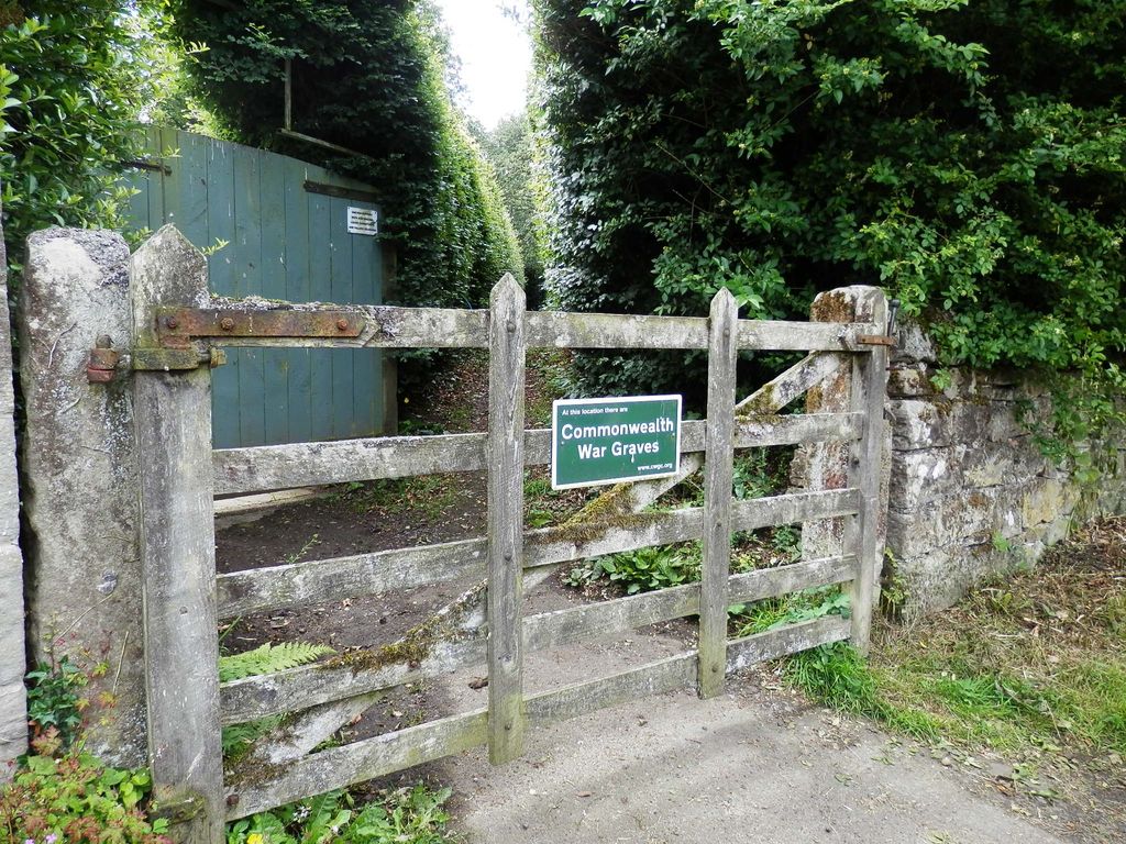
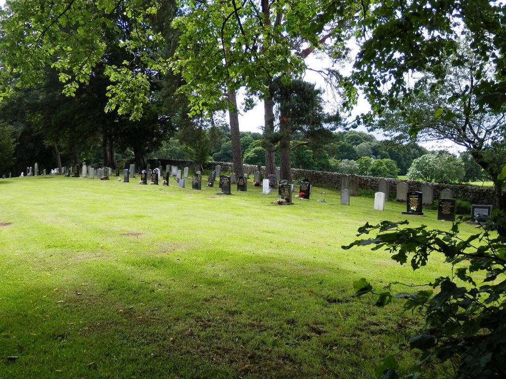
| Description | : | Beltingham is a small village on the River South Tyne in Northumberland, England. It is one mile (2 km) southeast of Bardon Mill and ten miles (16 km) to the west of Hexham. The small cemetery is in the centre of the village, across the road from St Cuthbert’s Church & Churchyard and to the south west of it. It is not signposted and the only indication that it is a burial ground is a Commonwealth War Graves Commission sign stating: “At this location there are Commonwealth War Graves.” |
frequently asked questions (FAQ):
-
Where is Beltingham Cemetery?
Beltingham Cemetery is located at Beltingham, Northumberland Unitary Authority ,Northumberland ,England.
-
Beltingham Cemetery cemetery's updated grave count on graveviews.com?
166 memorials
-
Where are the coordinates of the Beltingham Cemetery?
Latitude: 54.9690700
Longitude: -2.3312200
Nearby Cemetories:
1. St. Cuthbert's Churchyard
Beltingham, Northumberland Unitary Authority, England
Coordinate: 54.9694330, -2.3305080
2. All Hallows Churchyard
Henshaw, Northumberland Unitary Authority, England
Coordinate: 54.9731030, -2.3704408
3. St Cuthbert Churchyard
Haydon Bridge, Northumberland Unitary Authority, England
Coordinate: 54.9740620, -2.2473570
4. Haydon Bridge Churchyard Extension
Haydon Bridge, Northumberland Unitary Authority, England
Coordinate: 54.9766250, -2.2478820
5. Haydon Bridge Cemetery
Haydon Bridge, Northumberland Unitary Authority, England
Coordinate: 54.9694700, -2.2467715
6. Haydon Old Churchyard
Haydon Bridge, Northumberland Unitary Authority, England
Coordinate: 54.9818710, -2.2483010
7. Keenley Methodist Chapel Graveyard
Allendale, Northumberland Unitary Authority, England
Coordinate: 54.9053170, -2.3075580
8. Cowburn Primitive Methodist Chapel
Cowburn, Northumberland Unitary Authority, England
Coordinate: 55.0034880, -2.4323380
9. Holy Cross Churchyard
Haltwhistle, Northumberland Unitary Authority, England
Coordinate: 54.9699900, -2.4583480
10. Haltwhistle Cemetery
Haltwhistle, Northumberland Unitary Authority, England
Coordinate: 54.9652600, -2.4740100
11. Friends Meeting House Cemetery
Coanwood, Northumberland Unitary Authority, England
Coordinate: 54.9241920, -2.4540450
12. St. Cuthbert's Churchyard
Allendale, Northumberland Unitary Authority, England
Coordinate: 54.8978260, -2.2545020
13. Friends Meeting House
Allendale, Northumberland Unitary Authority, England
Coordinate: 54.8957750, -2.2598490
14. High House Methodist Chapel Graveyard
Allendale, Northumberland Unitary Authority, England
Coordinate: 54.8844090, -2.3285218
15. Allendale Old Cemetery
Allendale, Northumberland Unitary Authority, England
Coordinate: 54.8941650, -2.2612690
16. Allendale Woodland Cemetery
Allendale, Northumberland Unitary Authority, England
Coordinate: 54.8932624, -2.2618136
17. St Mary & St Patrick Churchyard
Lambley, Northumberland Unitary Authority, England
Coordinate: 54.9209060, -2.5122140
18. St Cuthbert's Churchyard
Greenhead, Northumberland Unitary Authority, England
Coordinate: 54.9813930, -2.5324120
19. St Andrew's Cemetery
Haydon Bridge, Northumberland Unitary Authority, England
Coordinate: 54.9788680, -2.1276850
20. Hexham Cemetery
Hexham, Northumberland Unitary Authority, England
Coordinate: 54.9788580, -2.1276740
21. Limestone Brae Burial Ground
Allendale, Northumberland Unitary Authority, England
Coordinate: 54.8441180, -2.3233520
22. Limestone Brae, Wesleyan Methodist Chapel
Allendale, Northumberland Unitary Authority, England
Coordinate: 54.8425890, -2.3207386
23. St John of Beverley Churchyard
Acomb, Northumberland Unitary Authority, England
Coordinate: 54.9859680, -2.1061560
24. St Mary Roman Catholic Churchyard
Hexham, Northumberland Unitary Authority, England
Coordinate: 54.9697070, -2.1040520