
| Memorials | : | 8 |
| Location | : | Hiawatha, Brown County, USA |
| Coordinate | : | 39.8194900, -95.5668300 |
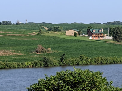
| Description | : | The Bemis Cemetery is located in Township 3, Range 16, Section 1 in Hiawatha Township, Brown County, Kansas. From the west edge of Hiawatha it is 1 ½ miles South of 220th Street on Kestrel Road and then ¼ mile west of Kestral Road in a field. Also known as the Poor Farm Cemetery, it sets about ¼ miles south and slightly east of the old Brown County Poor Farm. Now owned by the Aller family (2005), an occasional reference is made to the Aller Cemetery. An unknown number of tombstones have been vandalized, destroyed, buried or removed. The cemetery is... Read More |
frequently asked questions (FAQ):
-
Where is Bemis Cemetery?
Bemis Cemetery is located at Hiawatha, Brown County ,Kansas ,USA.
-
Bemis Cemetery cemetery's updated grave count on graveviews.com?
8 memorials
-
Where are the coordinates of the Bemis Cemetery?
Latitude: 39.8194900
Longitude: -95.5668300
Nearby Cemetories:
1. Mount Hope Cemetery
Hiawatha, Brown County, USA
Coordinate: 39.8497009, -95.5156021
2. Hiawatha Cemetery
Hiawatha, Brown County, USA
Coordinate: 39.8601799, -95.5265198
3. Niles Cemetery
Hiawatha, Brown County, USA
Coordinate: 39.8730900, -95.6126300
4. Claytonville Cemetery
Horton, Brown County, USA
Coordinate: 39.7766991, -95.5046997
5. Powhattan Cemetery
Powhattan, Brown County, USA
Coordinate: 39.7681007, -95.6288986
6. Pleasant Hill Cemetery
Fairview, Brown County, USA
Coordinate: 39.8411800, -95.6716400
7. Shelton Cemetery
Hamlin, Brown County, USA
Coordinate: 39.8852997, -95.6393967
8. Carson Cemetery
Hamlin, Brown County, USA
Coordinate: 39.8810200, -95.6483100
9. Saint Paul Lutheran Cemetery
Fairview, Brown County, USA
Coordinate: 39.8559700, -95.6779700
10. Lutheran Cemetery
Mercier, Brown County, USA
Coordinate: 39.7250500, -95.6000710
11. Immanuel Lutheran Cemetery
Fairview, Brown County, USA
Coordinate: 39.8559700, -95.6858500
12. Saint Peters Cemetery
Mercier, Brown County, USA
Coordinate: 39.7247009, -95.6016998
13. Old Fairview Cemetery
Fairview, Brown County, USA
Coordinate: 39.8550491, -95.6948700
14. Congregational Cemetery
Fairview, Brown County, USA
Coordinate: 39.8549995, -95.6949997
15. Oakland Cemetery
Padonia, Brown County, USA
Coordinate: 39.9273900, -95.5610900
16. Hamlin Cemetery
Hamlin, Brown County, USA
Coordinate: 39.9206009, -95.6292877
17. Grasshopper Burial Ground
Powhattan Township, Brown County, USA
Coordinate: 39.7578020, -95.6949820
18. Rose Hill Cemetery
Robinson, Brown County, USA
Coordinate: 39.8097000, -95.4139023
19. Sun Springs Cemetery
Morrill, Brown County, USA
Coordinate: 39.8993988, -95.6836014
20. Madison Cemetery
Robinson, Brown County, USA
Coordinate: 39.7717700, -95.4201700
21. Ununda Cemetery
Robinson, Brown County, USA
Coordinate: 39.8582993, -95.4143982
22. Carr Cemetery
Everest, Brown County, USA
Coordinate: 39.7254600, -95.4521600
23. Fairview City Cemetery
Fairview, Brown County, USA
Coordinate: 39.8464300, -95.7326900
24. Hart Cemetery
Reserve, Brown County, USA
Coordinate: 39.9519005, -95.5366974