| Memorials | : | 7 |
| Location | : | Hiawatha, Brown County, USA |
| Coordinate | : | 39.8730900, -95.6126300 |
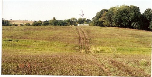
| Description | : | Niles Cemetery is a family cemetery on Walnut Creek Farm in Hiawatha, Kansas In March of 1865 a military detachment from Fort Leavenworth was on the military trail to Nebraska. They camped nearby at Camp Ames, on Walnut Creek. Several soldiers took sick and died, and permission was granted by land owner Edward H. Niles for the soldiers to be buried in his family cemetery. |
frequently asked questions (FAQ):
-
Where is Niles Cemetery?
Niles Cemetery is located at Hiawatha, Brown County ,Kansas ,USA.
-
Niles Cemetery cemetery's updated grave count on graveviews.com?
1 memorials
-
Where are the coordinates of the Niles Cemetery?
Latitude: 39.8730900
Longitude: -95.6126300
Nearby Cemetories:
1. Shelton Cemetery
Hamlin, Brown County, USA
Coordinate: 39.8852997, -95.6393967
2. Carson Cemetery
Hamlin, Brown County, USA
Coordinate: 39.8810200, -95.6483100
3. Hamlin Cemetery
Hamlin, Brown County, USA
Coordinate: 39.9206009, -95.6292877
4. Saint Paul Lutheran Cemetery
Fairview, Brown County, USA
Coordinate: 39.8559700, -95.6779700
5. Pleasant Hill Cemetery
Fairview, Brown County, USA
Coordinate: 39.8411800, -95.6716400
6. Immanuel Lutheran Cemetery
Fairview, Brown County, USA
Coordinate: 39.8559700, -95.6858500
7. Sun Springs Cemetery
Morrill, Brown County, USA
Coordinate: 39.8993988, -95.6836014
8. Bemis Cemetery
Hiawatha, Brown County, USA
Coordinate: 39.8194900, -95.5668300
9. Old Fairview Cemetery
Fairview, Brown County, USA
Coordinate: 39.8550491, -95.6948700
10. Congregational Cemetery
Fairview, Brown County, USA
Coordinate: 39.8549995, -95.6949997
11. Oakland Cemetery
Padonia, Brown County, USA
Coordinate: 39.9273900, -95.5610900
12. Hiawatha Cemetery
Hiawatha, Brown County, USA
Coordinate: 39.8601799, -95.5265198
13. Pleasant Hill Cemetery
Hamlin, Brown County, USA
Coordinate: 39.9430428, -95.6484299
14. Mount Hope Cemetery
Hiawatha, Brown County, USA
Coordinate: 39.8497009, -95.5156021
15. Morrill Cemetery
Morrill, Brown County, USA
Coordinate: 39.9351311, -95.6932831
16. Fairview City Cemetery
Fairview, Brown County, USA
Coordinate: 39.8464300, -95.7326900
17. Hart Cemetery
Reserve, Brown County, USA
Coordinate: 39.9519005, -95.5366974
18. Isely Cemetery
Fairview, Brown County, USA
Coordinate: 39.8844900, -95.7418200
19. Powhattan Cemetery
Powhattan, Brown County, USA
Coordinate: 39.7681007, -95.6288986
20. Cornelison Cemetery
Reserve, Brown County, USA
Coordinate: 39.9754105, -95.5485687
21. Tyler Cemetery
Fairview, Brown County, USA
Coordinate: 39.8119300, -95.7483200
22. Brethren Church Cemetery
Morrill, Brown County, USA
Coordinate: 39.9808693, -95.6940079
23. Stumbo Cemetery
Brown County, USA
Coordinate: 39.9977798, -95.6298828
24. Claytonville Cemetery
Horton, Brown County, USA
Coordinate: 39.7766991, -95.5046997

