| Memorials | : | 1 |
| Location | : | Kowaliga, Elmore County, USA |
| Coordinate | : | 32.7165900, -85.9714500 |
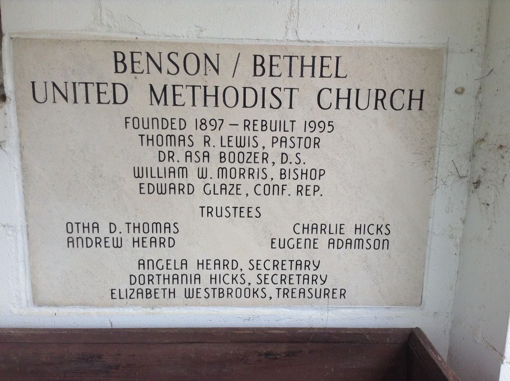
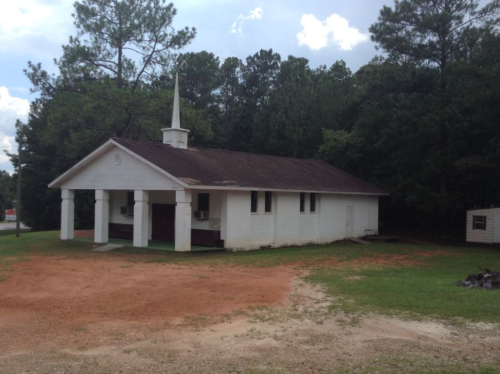
| Description | : | Bethel Methodist Episcopal Church was founded in 1897. According to the church deed, in 1920 church trustees purchased this property to use "as a church building site, and cemetery and for use by the Birmingham, Montgomery & Gulf Power Company for the re-interment of bodies removed from the cemeteries in the Cherokee Bluffs Reservoir." The power company moved graves from historically black Old Bethel Cemetery to Bethel M E Church as Lake Martin formed. According to Martin Dam Cemetery records located in the Alabama Power Archives at 600 North 18th Street in Birmingham, Alabama, only five Old Bethel graves... Read More |
frequently asked questions (FAQ):
-
Where is Benson-Bethel United Methodist Church Cemetery?
Benson-Bethel United Methodist Church Cemetery is located at 8535 Kowaliga Road Kowaliga, Elmore County ,Alabama ,USA.
-
Benson-Bethel United Methodist Church Cemetery cemetery's updated grave count on graveviews.com?
0 memorials
-
Where are the coordinates of the Benson-Bethel United Methodist Church Cemetery?
Latitude: 32.7165900
Longitude: -85.9714500
Nearby Cemetories:
1. Shiloh Missionary Baptist Church Cemetery
Kowaliga, Elmore County, USA
Coordinate: 32.7175800, -85.9680800
2. New Prospect Cemetery
Eclectic, Elmore County, USA
Coordinate: 32.7288100, -85.9826400
3. Darden Cemetery
Eclectic, Elmore County, USA
Coordinate: 32.7292100, -85.9834650
4. Prospect Cemetery
Eclectic, Elmore County, USA
Coordinate: 32.7378006, -85.9805984
5. Lovejoy Cemetery
Elmore County, USA
Coordinate: 32.7033005, -85.9400024
6. Watson Chapel Cemetery
Red Hill, Elmore County, USA
Coordinate: 32.6819000, -85.9760971
7. Old Harmony Church Cemetery
Elmore County, USA
Coordinate: 32.7346992, -86.0121994
8. Hornsby Cemetery at Red Hill
Tallassee, Elmore County, USA
Coordinate: 32.6854040, -85.9434510
9. Refuge Cemetery
Red Hill, Elmore County, USA
Coordinate: 32.6842995, -85.9439011
10. Watson Chapel Congregational Church Cemetery
Red Hill, Elmore County, USA
Coordinate: 32.6737170, -85.9842170
11. Mount Gilead Cemetery
Eclectic, Elmore County, USA
Coordinate: 32.7039986, -86.0243988
12. Westbrook Cemetery
Kowaliga, Elmore County, USA
Coordinate: 32.7645420, -85.9652710
13. Mount Hebron Church of Christ Cemetery
Jordan, Elmore County, USA
Coordinate: 32.6996670, -86.0273670
14. Warren-Kent Cemetery
Cotton, Elmore County, USA
Coordinate: 32.6871330, -86.0215670
15. Cotton Cemetery
Cotton, Elmore County, USA
Coordinate: 32.6843987, -86.0194016
16. County Line Cemetery
Kowaliga, Elmore County, USA
Coordinate: 32.7425995, -85.9175491
17. Mount Hebron East Baptist Church Cemetery
Falkner, Elmore County, USA
Coordinate: 32.6990471, -86.0305099
18. Warren Cemetery
Eclectic, Elmore County, USA
Coordinate: 32.6741486, -86.0087204
19. Thrash Cemetery
Elmore County, USA
Coordinate: 32.6800003, -86.0199966
20. Thrash Family Cemetery
Eclectic, Elmore County, USA
Coordinate: 32.6792330, -86.0232830
21. Mount Pleasant Baptist Church Cemetery
Tallapoosa County, USA
Coordinate: 32.7687200, -85.9401500
22. Taunton Cemetery
Red Hill, Elmore County, USA
Coordinate: 32.6511830, -85.9426330
23. Harmony Cemetery
Coosa County, USA
Coordinate: 32.7578011, -86.0449982
24. Hornsby Cemetery on Goldmine Road
Kent, Elmore County, USA
Coordinate: 32.6568100, -85.9119980


