
| Memorials | : | 0 |
| Location | : | Red Hill, Elmore County, USA |
| Coordinate | : | 32.6737170, -85.9842170 |
frequently asked questions (FAQ):
-
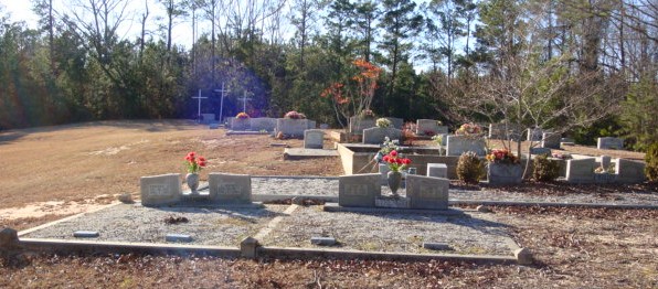
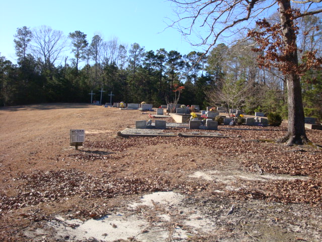
Where is Watson Chapel Congregational Church Cemetery?
Watson Chapel Congregational Church Cemetery is located at East Cotton Road Red Hill, Elmore County ,Alabama ,USA.
-
Watson Chapel Congregational Church Cemetery cemetery's updated grave count on graveviews.com?
0 memorials
-
Where are the coordinates of the Watson Chapel Congregational Church Cemetery?
Latitude: 32.6737170
Longitude: -85.9842170

Nearby Cemetories:
1. Watson Chapel Cemetery
Red Hill, Elmore County, USA
Coordinate: 32.6819000, -85.9760971
2. Warren Cemetery
Eclectic, Elmore County, USA
Coordinate: 32.6741486, -86.0087204
3. Thrash Cemetery
Elmore County, USA
Coordinate: 32.6800003, -86.0199966
4. Cotton Cemetery
Cotton, Elmore County, USA
Coordinate: 32.6843987, -86.0194016
5. Thrash Family Cemetery
Eclectic, Elmore County, USA
Coordinate: 32.6792330, -86.0232830
6. Warren-Kent Cemetery
Cotton, Elmore County, USA
Coordinate: 32.6871330, -86.0215670
7. Refuge Cemetery
Red Hill, Elmore County, USA
Coordinate: 32.6842995, -85.9439011
8. Hornsby Cemetery at Red Hill
Tallassee, Elmore County, USA
Coordinate: 32.6854040, -85.9434510
9. Taunton Cemetery
Red Hill, Elmore County, USA
Coordinate: 32.6511830, -85.9426330
10. Benson-Bethel United Methodist Church Cemetery
Kowaliga, Elmore County, USA
Coordinate: 32.7165900, -85.9714500
11. Mount Hebron Church of Christ Cemetery
Jordan, Elmore County, USA
Coordinate: 32.6996670, -86.0273670
12. Mount Gilead Cemetery
Eclectic, Elmore County, USA
Coordinate: 32.7039986, -86.0243988
13. Shiloh Missionary Baptist Church Cemetery
Kowaliga, Elmore County, USA
Coordinate: 32.7175800, -85.9680800
14. Mount Hebron East Baptist Church Cemetery
Falkner, Elmore County, USA
Coordinate: 32.6990471, -86.0305099
15. Pleasant Grove Cemetery
Eclectic, Elmore County, USA
Coordinate: 32.6395988, -86.0224991
16. Lovejoy Cemetery
Elmore County, USA
Coordinate: 32.7033005, -85.9400024
17. Chana Creek Primitive Baptist Church Cemetery
Kent, Elmore County, USA
Coordinate: 32.6197014, -85.9894028
18. New Prospect Cemetery
Eclectic, Elmore County, USA
Coordinate: 32.7288100, -85.9826400
19. Pleasant Hill Church Cemetery
Kent, Elmore County, USA
Coordinate: 32.6308330, -85.9431000
20. Darden Cemetery
Eclectic, Elmore County, USA
Coordinate: 32.7292100, -85.9834650
21. Providence Primitive Baptist Church Cemetery
Elmore County, USA
Coordinate: 32.6195984, -85.9621964
22. Bullard Cemetery
Eclectic, Elmore County, USA
Coordinate: 32.6469002, -86.0513992
23. Hornsby Cemetery on Goldmine Road
Kent, Elmore County, USA
Coordinate: 32.6568100, -85.9119980
24. Union United Methodist Church Cemetery
Eclectic, Elmore County, USA
Coordinate: 32.6598170, -86.0582830