
| Memorials | : | 0 |
| Location | : | Circleville, Pickaway County, USA |
| Coordinate | : | 39.6437700, -82.8643000 |
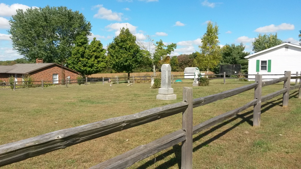
| Description | : | The cemetery is located on the northwest corner of the intersection of Ringgold Southern Road (Township Road 42) and Stout Road (Township Road 78). The cemetery is located in Washington Township, Pickaway County, Ohio, and is # 9639 (Bethany United Brethren Cemetery / Bethany Cemetery) in “Ohio Cemeteries 1803-2003”, compiled by the Ohio Genealogical Society. The U.S. Geological Survey (USGS) Geographic Names Information System (GNIS) feature ID for the cemetery is 1037887 (Bethany Cemetery / Bethany United Brethren Cemetery). |
frequently asked questions (FAQ):
-
Where is Bethany Cemetery?
Bethany Cemetery is located at Ringgold Southern Road Circleville, Pickaway County ,Ohio , 43113USA.
-
Bethany Cemetery cemetery's updated grave count on graveviews.com?
0 memorials
-
Where are the coordinates of the Bethany Cemetery?
Latitude: 39.6437700
Longitude: -82.8643000
Nearby Cemetories:
1. Zinser Cemetery
Circleville, Pickaway County, USA
Coordinate: 39.6513090, -82.8660930
2. Wagner Farm Cemetery
Walnut, Pickaway County, USA
Coordinate: 39.6511700, -82.8674000
3. Walter Leist Farm Cemetery
Circleville, Pickaway County, USA
Coordinate: 39.6384060, -82.8743330
4. Old Lutheran Cemetery
East Ringgold, Pickaway County, USA
Coordinate: 39.6657100, -82.8619800
5. John Graffis Farm Cemetery
Circleville, Pickaway County, USA
Coordinate: 39.6280070, -82.8891730
6. Stout Family Cemetery
Washington Township, Pickaway County, USA
Coordinate: 39.6241989, -82.8439026
7. Infirmary Cemetery
Pickaway County, USA
Coordinate: 39.6183014, -82.8675003
8. Griffith Cemetery
Washington Township, Pickaway County, USA
Coordinate: 39.6340523, -82.8991003
9. Ritter Cemetery
East Ringgold, Pickaway County, USA
Coordinate: 39.6741982, -82.8514023
10. Zion Cemetery
Circleville, Pickaway County, USA
Coordinate: 39.6119003, -82.8688965
11. McDonald Cemetery (Defunct)
Walnut Township, Pickaway County, USA
Coordinate: 39.6532470, -82.9054180
12. C F Brinker Farm Cemetery (Defunct)
Walnut Township, Pickaway County, USA
Coordinate: 39.6675060, -82.9038640
13. Dry Run Cemetery
Ashville, Pickaway County, USA
Coordinate: 39.6680984, -82.9036026
14. Dewey Seitz Farm Cemetery
Ashville, Pickaway County, USA
Coordinate: 39.6854160, -82.8695980
15. Reber Hill Cemetery
Ashville, Pickaway County, USA
Coordinate: 39.6836014, -82.8906021
16. Peters-Tallman Cemetery
East Ringgold, Pickaway County, USA
Coordinate: 39.6830030, -82.8358830
17. W C Morrison Farm Cemetery (Defunct)
Walnut Township, Pickaway County, USA
Coordinate: 39.6683030, -82.9159340
18. Columbus Mausoleum
Walnut Township, Pickaway County, USA
Coordinate: 39.6853350, -82.8926210
19. Pontius Chapel Cemetery
Pickaway County, USA
Coordinate: 39.6009000, -82.8932300
20. Heidelberg Reformed Church Cemetery
Stoutsville, Fairfield County, USA
Coordinate: 39.6047783, -82.8269348
21. Turkey Run Baptist Church Cemetery
Lancaster, Fairfield County, USA
Coordinate: 39.6817017, -82.8246994
22. Mace Cemetery
Amanda, Fairfield County, USA
Coordinate: 39.6474710, -82.7978680
23. Saint Pauls Evangelical Church Cemetery
Pickaway County, USA
Coordinate: 39.5925600, -82.8718400
24. Maple Hill Cemetery
Stoutsville, Fairfield County, USA
Coordinate: 39.6006012, -82.8227997