
| Memorials | : | 0 |
| Location | : | Chinook, Blaine County, USA |
| Coordinate | : | 48.7552000, -109.1345000 |
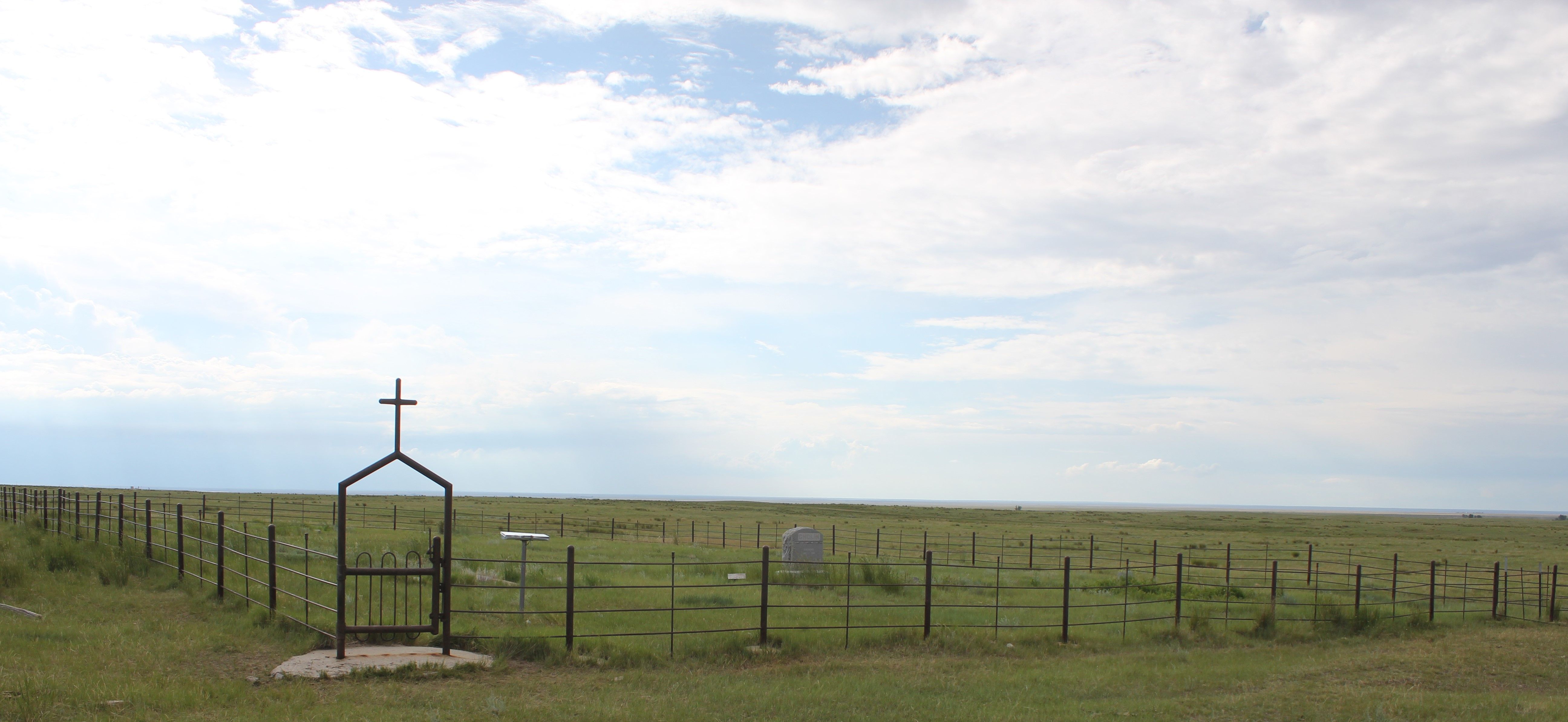
| Description | : | The Mennonites settled together in an area where they could build a church and worship together. In 1913 they began construction of the basement of the Bethel Bruderthaler Church on land belonging to John N. Wall. John N. Wall served as minister in the Minnesota Settlement, preaching at the Bethel Bruderthaler Church and other churches in the area. On June 26, 1918, John N. and Anna Wall deeded about five acres to the Bethel Bruderthaler Church, Inc. The five acres were located in the NE 1/4 Sec. 32, T35N, R20E, John N. Wall's homestead. The cemetery is... Read More |
frequently asked questions (FAQ):
-
Where is Bethel Bruderthaler Mennonite Church Cemetery?
Bethel Bruderthaler Mennonite Church Cemetery is located at Chinook, Blaine County ,Montana ,USA.
-
Bethel Bruderthaler Mennonite Church Cemetery cemetery's updated grave count on graveviews.com?
0 memorials
-
Where are the coordinates of the Bethel Bruderthaler Mennonite Church Cemetery?
Latitude: 48.7552000
Longitude: -109.1345000
Nearby Cemetories:
1. Hollandville Cemetery
Chinook, Blaine County, USA
Coordinate: 48.6960310, -109.1557200
2. Mennonite Brethren Cemetery
Chinook, Blaine County, USA
Coordinate: 48.8012560, -109.1980620
3. Kuper Memorial Cemetery
Chinook, Blaine County, USA
Coordinate: 48.6083100, -109.2531200
4. Saint Gabriel Cemetery
Chinook, Blaine County, USA
Coordinate: 48.6065200, -109.2531200
5. Zurich Cemetery
Zurich, Blaine County, USA
Coordinate: 48.5900000, -109.0459000
6. Prairie Chapel United Brethren Cemetery
Chinook, Blaine County, USA
Coordinate: 48.8860000, -109.3414000
7. Andrew S. Lohman Grave Site
Lohman, Blaine County, USA
Coordinate: 48.5903520, -109.4073350
8. East End Colony Cemetery
East End Colony, Hill County, USA
Coordinate: 48.7485000, -109.5474000
9. North Harlem Colony Cemetery
North Harlem Colony, Blaine County, USA
Coordinate: 48.5855560, -108.7558330
10. Silver Bow Cemetery
Hogeland, Blaine County, USA
Coordinate: 48.8870000, -108.7160000
11. Harlem Cemetery
Harlem, Blaine County, USA
Coordinate: 48.5444700, -108.7817200
12. Wing Cemetery
Hogeland, Blaine County, USA
Coordinate: 48.8125000, -108.5860000
13. Agency Cemetery
Fort Belknap Agency, Blaine County, USA
Coordinate: 48.4767000, -108.7702000
14. North Havre Lutheran Church Graveyard (Defunct)
Havre, Hill County, USA
Coordinate: 48.6538903, -109.6815870
15. Bear Paw Battlefield
Chinook, Blaine County, USA
Coordinate: 48.3780070, -109.2121290
16. Divide Cemetery
Divide, Maple Creek Census Division, Canada
Coordinate: 49.1455840, -109.0491690
17. Calvary Cemetery
Havre, Hill County, USA
Coordinate: 48.5457000, -109.6883000
18. Highland Cemetery
Havre, Hill County, USA
Coordinate: 48.5463982, -109.6900024
19. Mount Hope Cemetery
Havre, Hill County, USA
Coordinate: 48.5540000, -109.7050000
20. Hilldale Hutterite Colony Cemetery
Hilldale Colony, Hill County, USA
Coordinate: 48.7997000, -109.7872000
21. Sacred Heart Catholic Cemetery
Fort Belknap Agency, Blaine County, USA
Coordinate: 48.4489000, -108.6582000
22. Turner Colony Cemetery
Turner Colony, Blaine County, USA
Coordinate: 48.7595000, -108.4369000
23. Cleveland Cemetery
Cleveland, Blaine County, USA
Coordinate: 48.2714500, -109.1517000
24. Sunset Garden Park
Havre, Hill County, USA
Coordinate: 48.5531006, -109.8019028