
| Memorials | : | 0 |
| Location | : | Chinook, Blaine County, USA |
| Coordinate | : | 48.8860000, -109.3414000 |
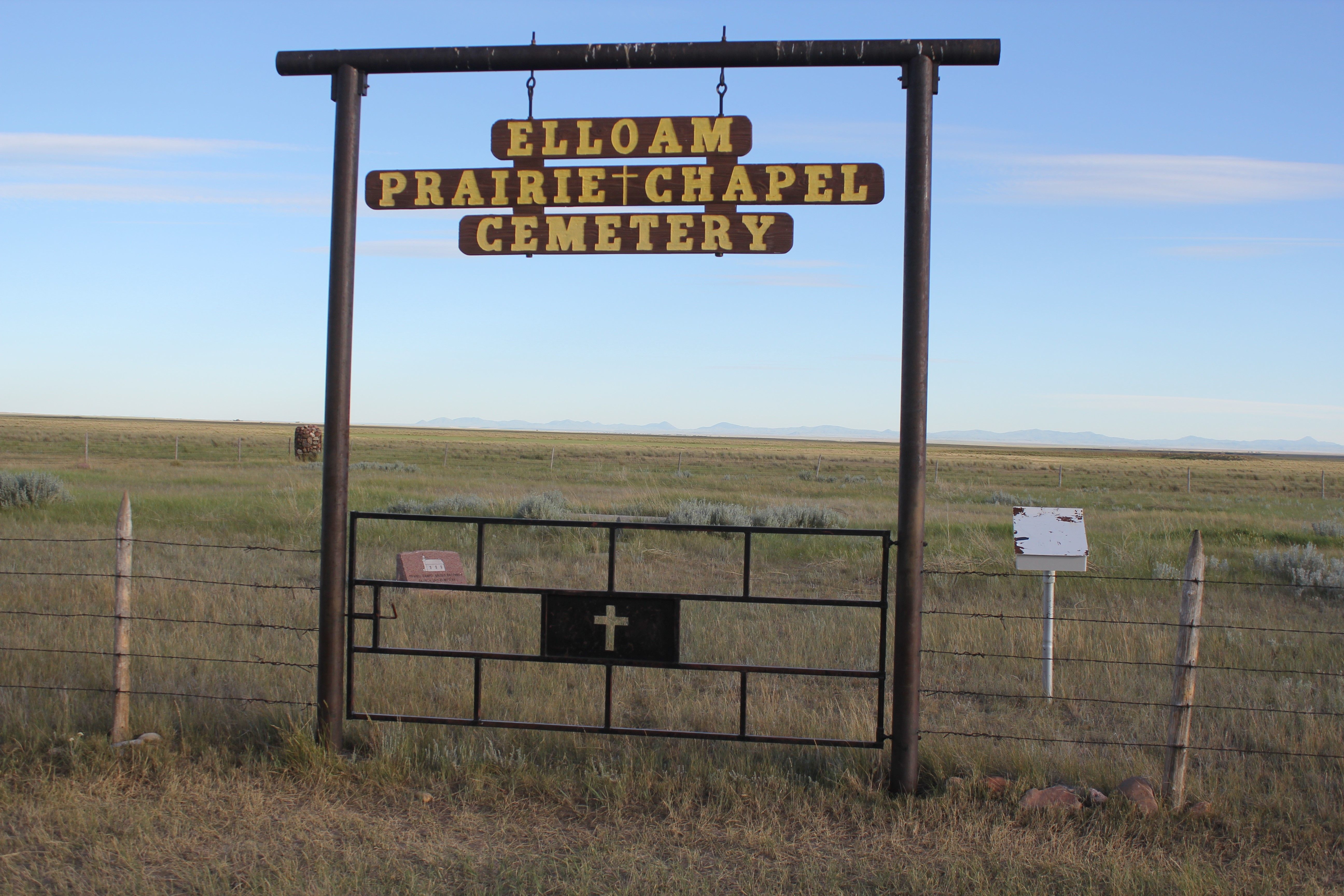
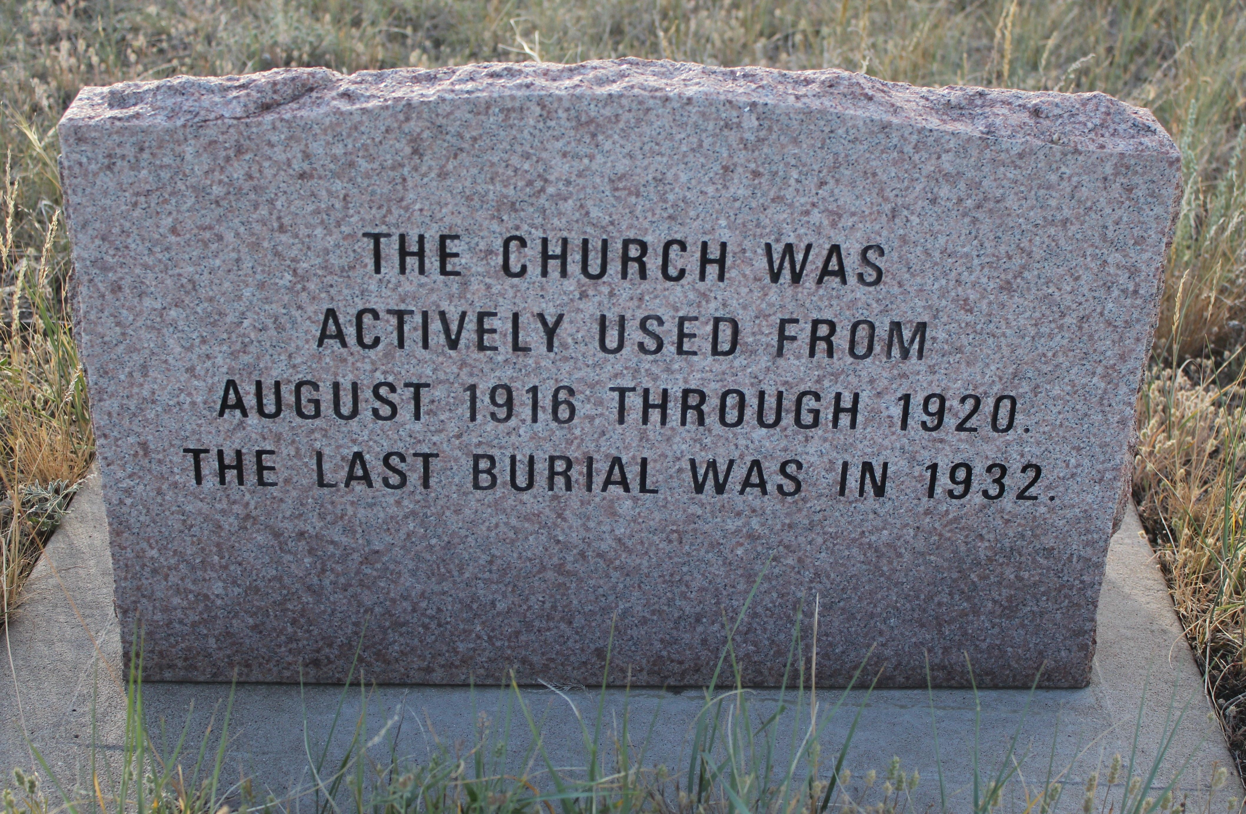
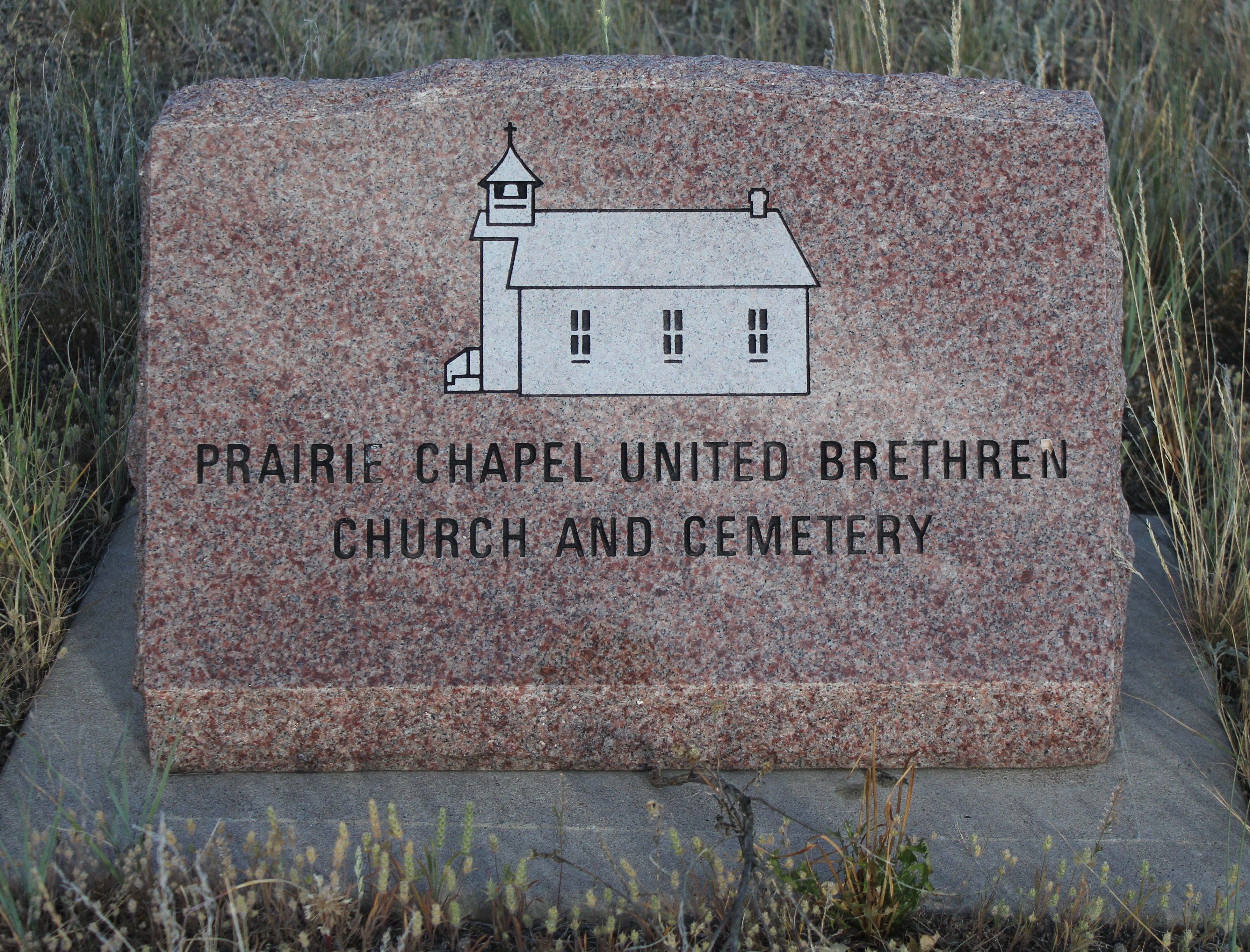
| Description | : | Homesteaders considered schools and a place of worship to be priorities once a shelter was established for their familes and animals. Four single women: Kate Kleener, Alice Chilton, Maud Phifer and Maud Hawkins settled on adjoining property around that area in the Elloam Community. Sunday school classes and services were held in the home of Miss Hawkins in Sec 22, T36N, R18E and a schoolhouse was on Miss Phifer's property, and later, a cemetery in Sec 14, T36N, R18E. Noted in the Chinook Opinion June 22, 1916: "The people in the neighborhood of the Phifer School have made arrangements to put... Read More |
frequently asked questions (FAQ):
-
Where is Prairie Chapel United Brethren Cemetery?
Prairie Chapel United Brethren Cemetery is located at Chinook, Blaine County ,Montana ,USA.
-
Prairie Chapel United Brethren Cemetery cemetery's updated grave count on graveviews.com?
0 memorials
-
Where are the coordinates of the Prairie Chapel United Brethren Cemetery?
Latitude: 48.8860000
Longitude: -109.3414000
Nearby Cemetories:
1. Mennonite Brethren Cemetery
Chinook, Blaine County, USA
Coordinate: 48.8012560, -109.1980620
2. Bethel Bruderthaler Mennonite Church Cemetery
Chinook, Blaine County, USA
Coordinate: 48.7552000, -109.1345000
3. East End Colony Cemetery
East End Colony, Hill County, USA
Coordinate: 48.7485000, -109.5474000
4. Hollandville Cemetery
Chinook, Blaine County, USA
Coordinate: 48.6960310, -109.1557200
5. Kuper Memorial Cemetery
Chinook, Blaine County, USA
Coordinate: 48.6083100, -109.2531200
6. Saint Gabriel Cemetery
Chinook, Blaine County, USA
Coordinate: 48.6065200, -109.2531200
7. Andrew S. Lohman Grave Site
Lohman, Blaine County, USA
Coordinate: 48.5903520, -109.4073350
8. Hilldale Hutterite Colony Cemetery
Hilldale Colony, Hill County, USA
Coordinate: 48.7997000, -109.7872000
9. Divide Cemetery
Divide, Maple Creek Census Division, Canada
Coordinate: 49.1455840, -109.0491690
10. North Havre Lutheran Church Graveyard (Defunct)
Havre, Hill County, USA
Coordinate: 48.6538903, -109.6815870
11. Zurich Cemetery
Zurich, Blaine County, USA
Coordinate: 48.5900000, -109.0459000
12. Grainbelt Cemetery
Hill County, USA
Coordinate: 48.6828003, -109.8657990
13. Mount Hope Cemetery
Havre, Hill County, USA
Coordinate: 48.5540000, -109.7050000
14. Calvary Cemetery
Havre, Hill County, USA
Coordinate: 48.5457000, -109.6883000
15. Highland Cemetery
Havre, Hill County, USA
Coordinate: 48.5463982, -109.6900024
16. Silver Bow Cemetery
Hogeland, Blaine County, USA
Coordinate: 48.8870000, -108.7160000
17. Saint Johns Catholic Cemetery
Havre, Hill County, USA
Coordinate: 48.7625008, -109.9638977
18. Consul Cemetery
Consul, Maple Creek Census Division, Canada
Coordinate: 49.3047000, -109.5247700
19. Sunset Garden Park
Havre, Hill County, USA
Coordinate: 48.5531006, -109.8019028
20. North Harlem Colony Cemetery
North Harlem Colony, Blaine County, USA
Coordinate: 48.5855560, -108.7558330
21. Robsart Cemetery
Robsart, Maple Creek Census Division, Canada
Coordinate: 49.3749800, -109.3027600
22. Wing Cemetery
Hogeland, Blaine County, USA
Coordinate: 48.8125000, -108.5860000
23. Harlem Cemetery
Harlem, Blaine County, USA
Coordinate: 48.5444700, -108.7817200
24. Bear Paw Battlefield
Chinook, Blaine County, USA
Coordinate: 48.3780070, -109.2121290