
| Memorials | : | 24 |
| Location | : | Moorefield, Wellington County, Canada |
| Coordinate | : | 43.7817530, -80.7380320 |
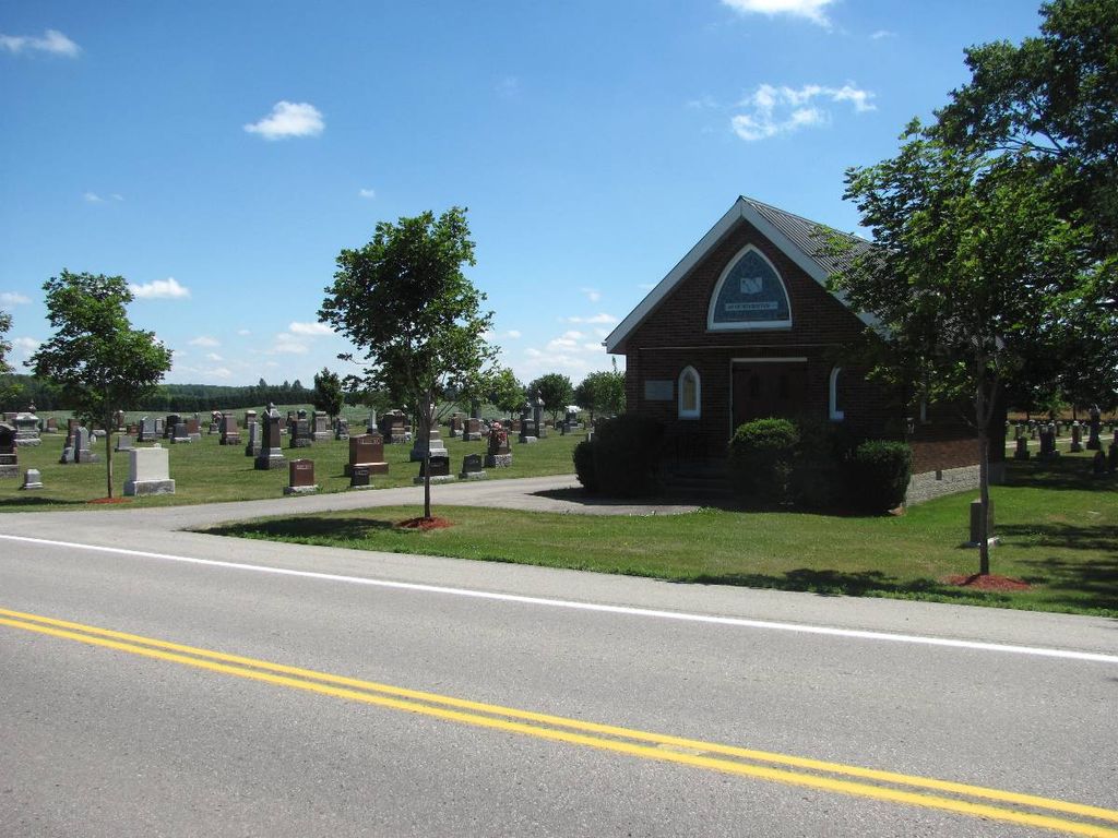
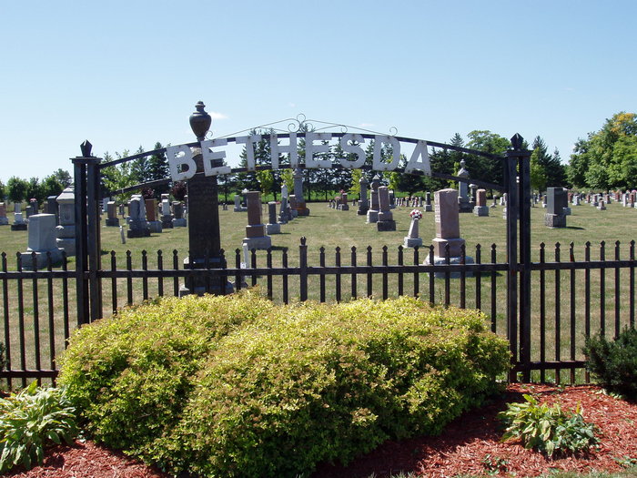
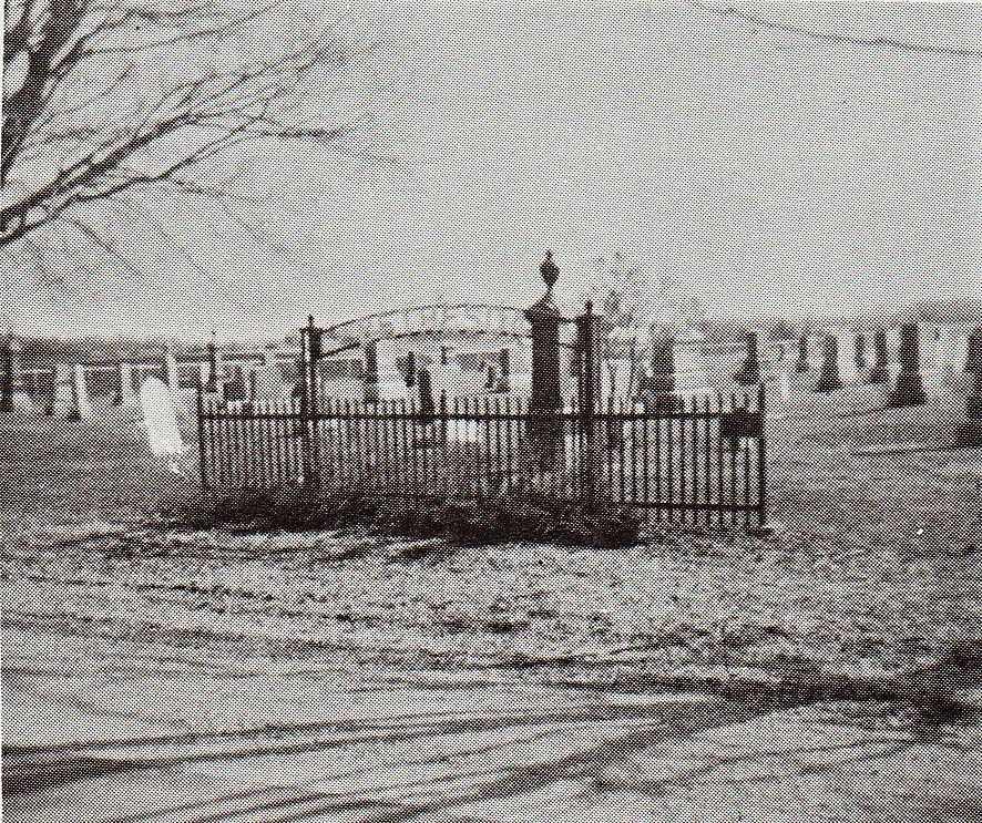
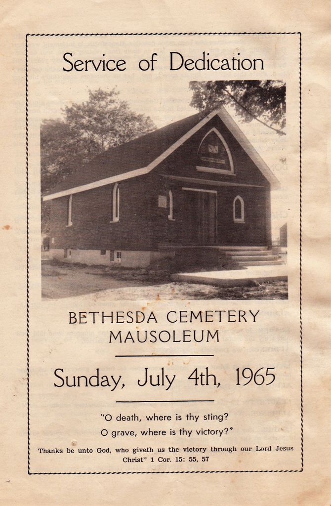
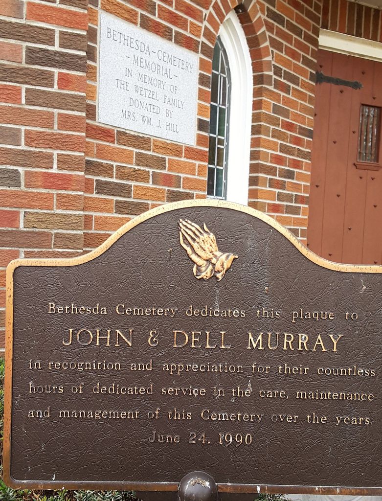
| Description | : | Quoting "HISTORY OF MARYBOROUGH TOWNSHIP 1851-1976 Volume 1 Page #64" "Sometime between the year 1852 when Mrs John Walker settled on the 10th concession of Maryborough township and the year 1866 a Methodist church was organized on the 10th concession. Since there was no church building to worship in, property for the church was donated by Mr. John Walker on July 2, 1866, according to the Deed: one acre of land more or less, which is a part of Lot 9, Con. 10 of Maryborough township, was deeded for the sum of Five Shillings (... Read More |
frequently asked questions (FAQ):
-
Where is Bethesda Community Cemetery?
Bethesda Community Cemetery is located at Moorefield, Wellington County ,Ontario ,Canada.
-
Bethesda Community Cemetery cemetery's updated grave count on graveviews.com?
22 memorials
-
Where are the coordinates of the Bethesda Community Cemetery?
Latitude: 43.7817530
Longitude: -80.7380320
Nearby Cemetories:
1. Saint John's Anglican Cemetery
Moorefield, Wellington County, Canada
Coordinate: 43.7569444, -80.7413889
2. Derryadd Cemetery
Rothsay, Wellington County, Canada
Coordinate: 43.8168200, -80.6848900
3. Saint James Anglican Pioneer Cemetery
Rothsay, Wellington County, Canada
Coordinate: 43.7451500, -80.6815333
4. Drayton Victoria Cemetery
Drayton, Wellington County, Canada
Coordinate: 43.7651972, -80.6629083
5. Saint James Lutheran Cemetery
Trecastle, Wellington County, Canada
Coordinate: 43.7883333, -80.8169444
6. Drayton Methodist Church and Cemetery
Drayton, Wellington County, Canada
Coordinate: 43.7525000, -80.6641670
7. Zion Methodist Cemetery
Wallace Township, Perth County, Canada
Coordinate: 43.7663210, -80.8331110
8. Zion United Church Cemetery
Drayton, Wellington County, Canada
Coordinate: 43.7973382, -80.6375023
9. Hollen Cemetery
Hollen, Wellington County, Canada
Coordinate: 43.7064000, -80.7227300
10. Zion Mennonite Cemetery
Mapleton Township, Wellington County, Canada
Coordinate: 43.7229600, -80.8063600
11. Berea Mennonite Cemetery
Bosworth, Wellington County, Canada
Coordinate: 43.7793980, -80.6300350
12. Sharron Cemetery
Lebanon, Wellington County, Canada
Coordinate: 43.7029400, -80.8151900
13. Spring Hill Methodist Cemetery
Peel Township, Wellington County, Canada
Coordinate: 43.6867500, -80.7110000
14. Palmerston Cemetery
Palmerston, Wellington County, Canada
Coordinate: 43.8316800, -80.8683000
15. Ebenezer Primitive Methodist Cemetery
Goldstone, Wellington County, Canada
Coordinate: 43.7291794, -80.6049728
16. Goshen Mennonite Meeting House Cemetery
Wellington County, Canada
Coordinate: 43.6905556, -80.6425018
17. Cross/Goshen Wesleyan Cemetery
Mapleton Township, Wellington County, Canada
Coordinate: 43.6868930, -80.6415130
18. Glen Allan Cemetery
Glen Allan, Wellington County, Canada
Coordinate: 43.6627769, -80.7105560
19. Old Anglican Cemetery
Glen Allan, Wellington County, Canada
Coordinate: 43.6599000, -80.7136000
20. Farewell Mennonite Cemetery
Farewell, Wellington County, Canada
Coordinate: 43.9053140, -80.7182690
21. Saint Anthony's Roman Catholic Cemetery
Peel Township, Wellington County, Canada
Coordinate: 43.7419800, -80.5709000
22. Zion United Church Cemetery
Wallace Township, Perth County, Canada
Coordinate: 43.8028790, -80.9231570
23. Greenfield Cemetery
Arthur, Wellington County, Canada
Coordinate: 43.8287070, -80.5598260
24. Olivet Mennonite Cemetery
Winfield, Wellington County, Canada
Coordinate: 43.6610413, -80.6478043