
| Memorials | : | 1 |
| Location | : | Mapleton Township, Wellington County, Canada |
| Coordinate | : | 43.7229600, -80.8063600 |
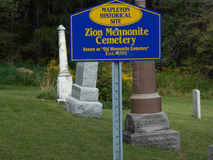
| Description | : | Lot 6, Concession 5, Maryborough Twp The Fourth Line Mennonite congregation constructed their first church building in the early 1880s on land owned by Amos Eby. Originally part of the Mennonite Church, the congregation soon joined the Mennonite Brethren in Christ movement. A larger church was built in 1923. When the building and the congregation moved to Palmerston in 1949, it became the United Missionary Church. The cemetery was maintained by volunteer neighbors for some time. In 1983 it was acquired by the Township of Maryborough. It is closed for burials. |
frequently asked questions (FAQ):
-
Where is Zion Mennonite Cemetery?
Zion Mennonite Cemetery is located at 8487 Concession Road 4 Mapleton Township, Wellington County ,Ontario ,Canada.
-
Zion Mennonite Cemetery cemetery's updated grave count on graveviews.com?
1 memorials
-
Where are the coordinates of the Zion Mennonite Cemetery?
Latitude: 43.7229600
Longitude: -80.8063600
Nearby Cemetories:
1. Sharron Cemetery
Lebanon, Wellington County, Canada
Coordinate: 43.7029400, -80.8151900
2. Zion Methodist Cemetery
Wallace Township, Perth County, Canada
Coordinate: 43.7663210, -80.8331110
3. Saint John's Anglican Cemetery
Moorefield, Wellington County, Canada
Coordinate: 43.7569444, -80.7413889
4. Hollen Cemetery
Hollen, Wellington County, Canada
Coordinate: 43.7064000, -80.7227300
5. Saint James Lutheran Cemetery
Trecastle, Wellington County, Canada
Coordinate: 43.7883333, -80.8169444
6. Brookside Cemetery
Carthage, Perth County, Canada
Coordinate: 43.6629066, -80.8494186
7. Bethesda Community Cemetery
Moorefield, Wellington County, Canada
Coordinate: 43.7817530, -80.7380320
8. Spring Hill Methodist Cemetery
Peel Township, Wellington County, Canada
Coordinate: 43.6867500, -80.7110000
9. Klearview Mennonite Cemetery
Carthage, Perth County, Canada
Coordinate: 43.6428150, -80.8364370
10. Saint Johns Lutheran Cemetery
Hesson, Perth County, Canada
Coordinate: 43.6395800, -80.7944900
11. Carthage Methodist Pioneer Memorial Cemetery
Carthage, Perth County, Canada
Coordinate: 43.6457200, -80.8619000
12. Saint Marys Roman Catholic Cemetery
Hesson, Perth County, Canada
Coordinate: 43.6363869, -80.7906265
13. Glen Allan Cemetery
Glen Allan, Wellington County, Canada
Coordinate: 43.6627769, -80.7105560
14. Old Anglican Cemetery
Glen Allan, Wellington County, Canada
Coordinate: 43.6599000, -80.7136000
15. Saint James Anglican Pioneer Cemetery
Rothsay, Wellington County, Canada
Coordinate: 43.7451500, -80.6815333
16. North Mornington Presbyterian Cemetery
Perth East Township, Perth County, Canada
Coordinate: 43.6480000, -80.8864200
17. Weaverland Mennonite Cemetery
Hesson, Perth County, Canada
Coordinate: 43.6258888, -80.7707977
18. Fairview Cemetery
Listowel, Perth County, Canada
Coordinate: 43.7375374, -80.9438934
19. Drayton Methodist Church and Cemetery
Drayton, Wellington County, Canada
Coordinate: 43.7525000, -80.6641670
20. Saint Paul's Lutheran Cemetery
Gowanstown, Perth County, Canada
Coordinate: 43.7808700, -80.9363010
21. Fair Haven Mennonite Cemetery
Fernbank, Perth County, Canada
Coordinate: 43.6124030, -80.8082200
22. Drayton Victoria Cemetery
Drayton, Wellington County, Canada
Coordinate: 43.7651972, -80.6629083
23. Zion United Church Cemetery
Wallace Township, Perth County, Canada
Coordinate: 43.8028790, -80.9231570
24. Palmerston Cemetery
Palmerston, Wellington County, Canada
Coordinate: 43.8316800, -80.8683000