
| Memorials | : | 1 |
| Location | : | Drayton, Wellington County, Canada |
| Coordinate | : | 43.7525000, -80.6641670 |
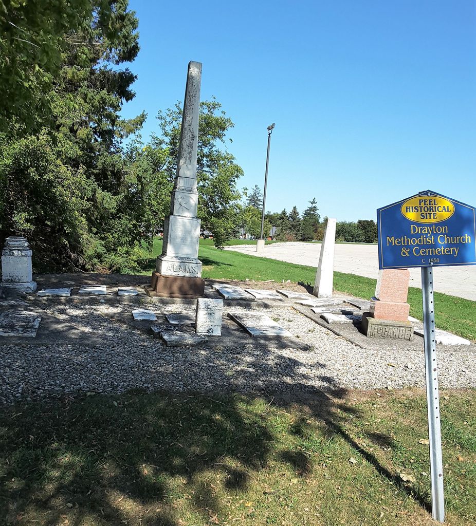
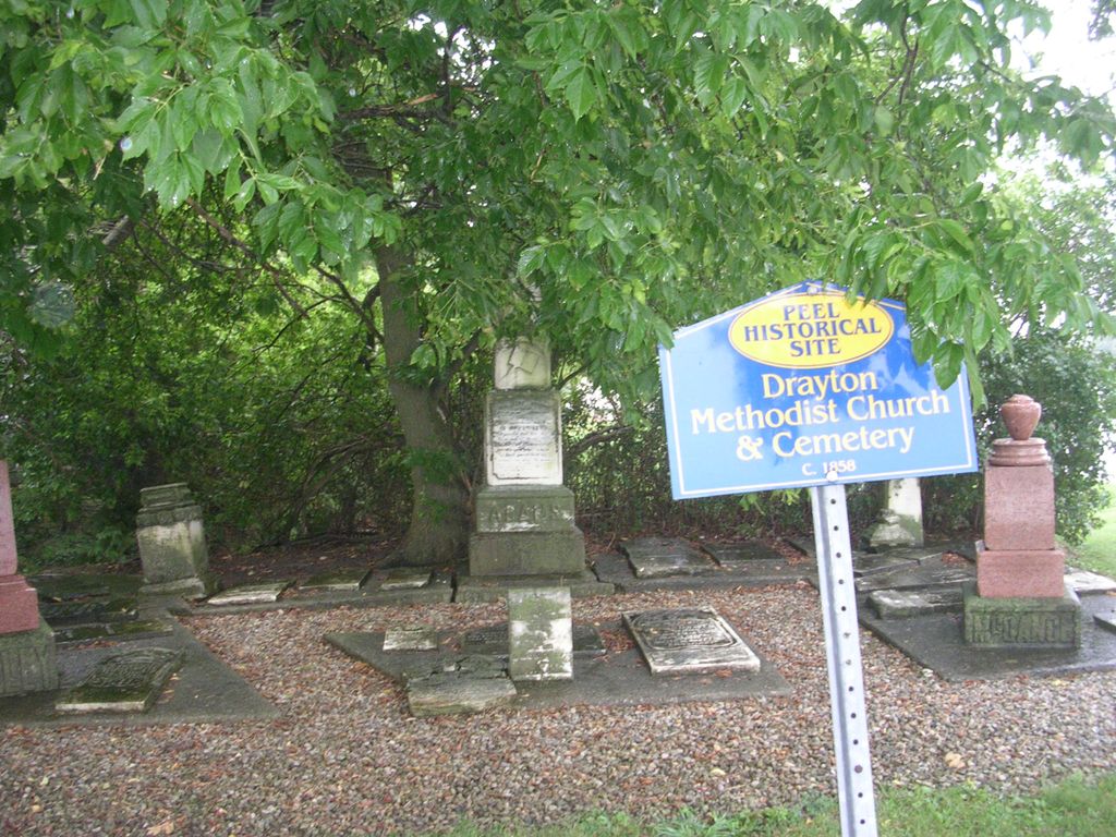
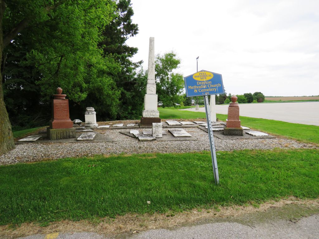
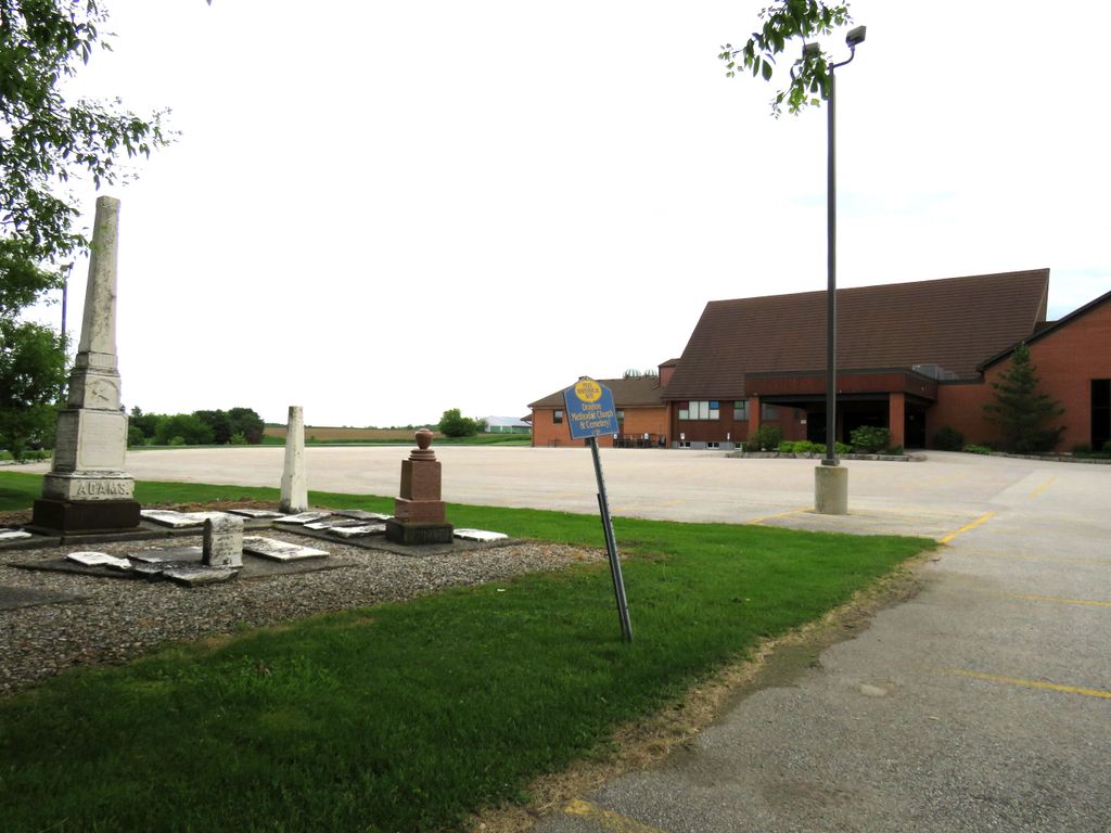
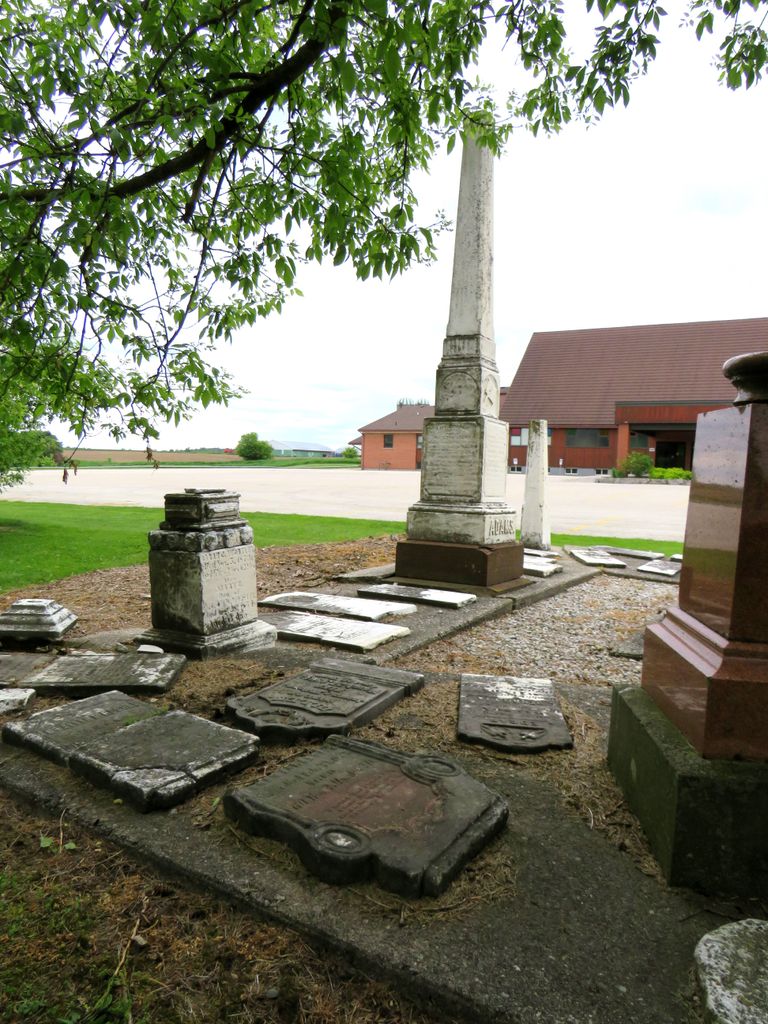
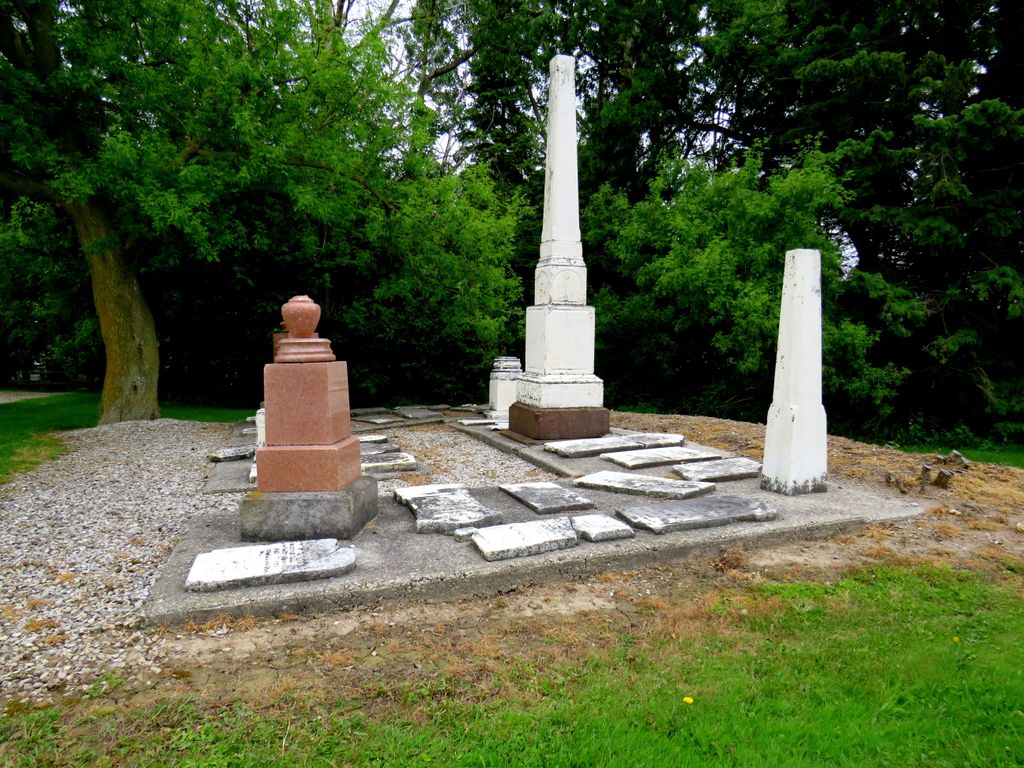
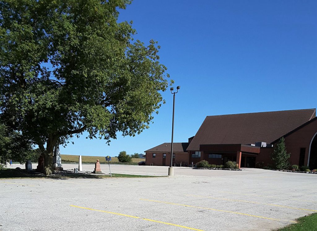
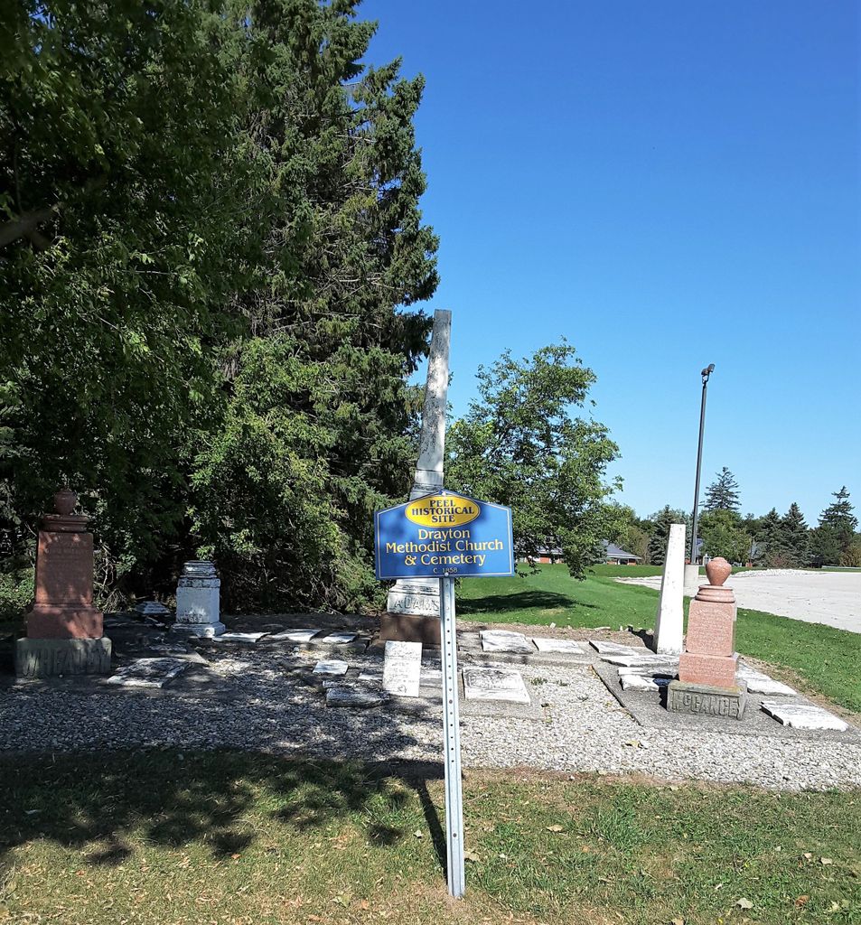
| Description | : | The first church in Drayton was the Methodist Church. It was established in 1847 by Rev Benjamin Jones, who married Mary, the step daughter of Rev. Ezra Adams. The worshipers met in homes or school houses. In 1856 Rev Ezra Adams took out a Crown Deed to Lot # 2 Concession 11 Peel Township, then known as the Queen's Bush. In 1860 the Drayton Wesleyan Methodist Church was built, and the opening happened in 1870. It was used until 1892, when a new brick church was built at the corner of Main... Read More |
frequently asked questions (FAQ):
-
Where is Drayton Methodist Church and Cemetery?
Drayton Methodist Church and Cemetery is located at 88 Main Street East Drayton, Wellington County ,Ontario , N0G 1P0Canada.
-
Drayton Methodist Church and Cemetery cemetery's updated grave count on graveviews.com?
1 memorials
-
Where are the coordinates of the Drayton Methodist Church and Cemetery?
Latitude: 43.7525000
Longitude: -80.6641670
Nearby Cemetories:
1. Drayton Victoria Cemetery
Drayton, Wellington County, Canada
Coordinate: 43.7651972, -80.6629083
2. Saint James Anglican Pioneer Cemetery
Rothsay, Wellington County, Canada
Coordinate: 43.7451500, -80.6815333
3. Berea Mennonite Cemetery
Bosworth, Wellington County, Canada
Coordinate: 43.7793980, -80.6300350
4. Ebenezer Primitive Methodist Cemetery
Goldstone, Wellington County, Canada
Coordinate: 43.7291794, -80.6049728
5. Zion United Church Cemetery
Drayton, Wellington County, Canada
Coordinate: 43.7973382, -80.6375023
6. Saint John's Anglican Cemetery
Moorefield, Wellington County, Canada
Coordinate: 43.7569444, -80.7413889
7. Bethesda Community Cemetery
Moorefield, Wellington County, Canada
Coordinate: 43.7817530, -80.7380320
8. Hollen Cemetery
Hollen, Wellington County, Canada
Coordinate: 43.7064000, -80.7227300
9. Goshen Mennonite Meeting House Cemetery
Wellington County, Canada
Coordinate: 43.6905556, -80.6425018
10. Derryadd Cemetery
Rothsay, Wellington County, Canada
Coordinate: 43.8168200, -80.6848900
11. Cross/Goshen Wesleyan Cemetery
Mapleton Township, Wellington County, Canada
Coordinate: 43.6868930, -80.6415130
12. Saint Anthony's Roman Catholic Cemetery
Peel Township, Wellington County, Canada
Coordinate: 43.7419800, -80.5709000
13. Spring Hill Methodist Cemetery
Peel Township, Wellington County, Canada
Coordinate: 43.6867500, -80.7110000
14. Olivet Mennonite Cemetery
Winfield, Wellington County, Canada
Coordinate: 43.6610413, -80.6478043
15. Glen Allan Cemetery
Glen Allan, Wellington County, Canada
Coordinate: 43.6627769, -80.7105560
16. Creek Bank Mennonite Cemetery
Creek Bank, Wellington County, Canada
Coordinate: 43.6863861, -80.5634460
17. Old Anglican Cemetery
Glen Allan, Wellington County, Canada
Coordinate: 43.6599000, -80.7136000
18. Bloomsbury Methodist Cemetery
Centre Wellington Township, Wellington County, Canada
Coordinate: 43.7020810, -80.5405760
19. Maple View Mennonite Cemetery
Alma, Wellington County, Canada
Coordinate: 43.7482990, -80.5179980
20. Zion Mennonite Cemetery
Mapleton Township, Wellington County, Canada
Coordinate: 43.7229600, -80.8063600
21. Greenfield Cemetery
Arthur, Wellington County, Canada
Coordinate: 43.8287070, -80.5598260
22. British Methodist Episcopal Cemetery
Wallenstein, Wellington County, Canada
Coordinate: 43.6476850, -80.6238770
23. Saint John the Evangelist Roman Catholic Cemetery
Arthur, Wellington County, Canada
Coordinate: 43.8293300, -80.5559700
24. Olivet Cemetery
Mapleton Township, Wellington County, Canada
Coordinate: 43.6478752, -80.6153249