
| Memorials | : | 0 |
| Location | : | Millville, Clayton County, USA |
| Coordinate | : | 42.7230500, -91.0925166 |
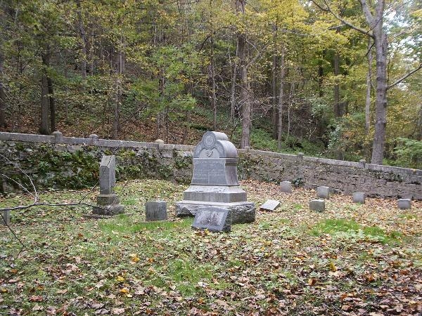
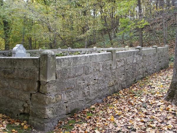
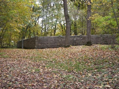
| Description | : | This very small cemetery is located just a couple miles from Millville, Iowa, on Noble Road. It appears there are 7 graves with the name Bierer and 3 graves with the name Geick. The stone work around the cemetery is very impressive for it's size. Earliest Burial: 01/01/1862 Latest Burial: 01/01/1986 N 42° 43.383 W 091° 05.551 15T E 656174 N 4731824 |
frequently asked questions (FAQ):
-
Where is Bierer Cemetery?
Bierer Cemetery is located at Millville, Clayton County ,Iowa ,USA.
-
Bierer Cemetery cemetery's updated grave count on graveviews.com?
0 memorials
-
Where are the coordinates of the Bierer Cemetery?
Latitude: 42.7230500
Longitude: -91.0925166

Nearby Cemetories:
1. Redman Cemetery
Millville, Clayton County, USA
Coordinate: 42.7166755, -91.0852901
2. Friedlein Cemetery
Millville, Clayton County, USA
Coordinate: 42.7080994, -91.1108017
3. Saint Johns Cemetery
Jefferson Township, Clayton County, USA
Coordinate: 42.7497000, -91.1133000
4. Goshen Cemetery
Millville, Clayton County, USA
Coordinate: 42.6905594, -91.0544434
5. Graham Cemetery
Millville, Clayton County, USA
Coordinate: 42.6833172, -91.1195685
6. Guttenberg Cemetery
Guttenberg, Clayton County, USA
Coordinate: 42.7691994, -91.1035995
7. Mount Olivet Cemetery
Guttenberg, Clayton County, USA
Coordinate: 42.7764840, -91.1083560
8. Saint Marys Cemetery
Guttenberg, Clayton County, USA
Coordinate: 42.7691994, -91.1352997
9. Bolsinger Cemetery
Mallory Township, Clayton County, USA
Coordinate: 42.6776340, -91.1424090
10. Bethel Cemetery
Osterdock, Clayton County, USA
Coordinate: 42.7041702, -91.1688919
11. Lewis Cemetery
Osterdock, Clayton County, USA
Coordinate: 42.7416000, -91.1834000
12. Noggle Cemetery
Clayton County, USA
Coordinate: 42.6666580, -91.1654100
13. Myer Cemetery
Luxemburg, Dubuque County, USA
Coordinate: 42.6455760, -91.0762740
14. Charlotte Cemetery
Glen Haven, Grant County, USA
Coordinate: 42.7933006, -91.0381012
15. Storck Cemetery
Guttenberg, Clayton County, USA
Coordinate: 42.7694335, -91.1834638
16. Saint Charles Catholic Church Cemetery
Cassville, Grant County, USA
Coordinate: 42.7144000, -90.9764000
17. Old Saint Marys Cemetery
Glen Haven, Grant County, USA
Coordinate: 42.8078100, -91.0675330
18. Saint Paula Cemetery
Osterdock, Clayton County, USA
Coordinate: 42.7635994, -91.1992035
19. Cassville Cemetery
Cassville, Grant County, USA
Coordinate: 42.7324982, -90.9713974
20. Ramsey Cemetery
North Andover, Grant County, USA
Coordinate: 42.7817001, -90.9972000
21. Saint Marys Settlement Cemetery
Cassville, Grant County, USA
Coordinate: 42.7538986, -90.9627991
22. Borcherding Cemetery
Jefferson Township, Clayton County, USA
Coordinate: 42.8182983, -91.1414032
23. Saint Michael Cemetery
Clayton County, USA
Coordinate: 42.8055992, -91.1802979
24. Brown Cemetery
Mallory Township, Clayton County, USA
Coordinate: 42.6530991, -91.2005997