| Memorials | : | 0 |
| Location | : | Wrightsville, Johnson County, USA |
| Coordinate | : | 32.6921080, -82.5140190 |
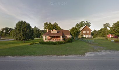
| Description | : | Located off the Kite road on the property of Clark Powell (formerly owned by P. Flanders). Go four miles on highway 57 east from Wrightsville. Turn left at the top of the hill and go 1/4 mile. The cemetery can be reached by going through a field gate on the right. Directions courtesy of James W. Allen. |
frequently asked questions (FAQ):
-
Where is Bill Meeks Cemetery?
Bill Meeks Cemetery is located at Kite Road Wrightsville, Johnson County ,Georgia ,USA.
-
Bill Meeks Cemetery cemetery's updated grave count on graveviews.com?
0 memorials
-
Where are the coordinates of the Bill Meeks Cemetery?
Latitude: 32.6921080
Longitude: -82.5140190
Nearby Cemetories:
1. Kite City Cemetery
Kite, Johnson County, USA
Coordinate: 32.6901980, -82.5087080
2. James Daniel Kersey Gravesite
Swainsboro, Emanuel County, USA
Coordinate: 32.6847030, -82.4957050
3. Wheeler Cemetery
Kite, Johnson County, USA
Coordinate: 32.6758003, -82.5017014
4. William's Chapel Baptist Church Cemetery
Kite, Johnson County, USA
Coordinate: 32.7071660, -82.4898040
5. Kersey Family Cemetery
Kite, Johnson County, USA
Coordinate: 32.6751621, -82.5417982
6. Fortner Cemetery
Kite, Johnson County, USA
Coordinate: 32.7069016, -82.5456009
7. Saint Paul Cemetery
Kite, Johnson County, USA
Coordinate: 32.6976400, -82.5577110
8. Stephens
Kite, Johnson County, USA
Coordinate: 32.6984800, -82.5578800
9. Gumlog Primitive Baptist Church Cemetery
Kite, Johnson County, USA
Coordinate: 32.7312711, -82.5162420
10. Anderson Cemetery
Kite, Johnson County, USA
Coordinate: 32.6775017, -82.5639038
11. Townsend Cemetery
Kite, Johnson County, USA
Coordinate: 32.6525002, -82.4875031
12. Minton Chapel Advent Christian Church Cemetery
Kite, Johnson County, USA
Coordinate: 32.7327220, -82.4790250
13. Cora Flanders Grave
Dellwood, Emanuel County, USA
Coordinate: 32.6986000, -82.4544900
14. Sumner-Flanders Cemetery
Swainsboro, Emanuel County, USA
Coordinate: 32.6649300, -82.4610200
15. Webb Grave
Swainsboro, Emanuel County, USA
Coordinate: 32.6843330, -82.4519260
16. Rehoboth Baptist Church Cemetery
Johnson County, USA
Coordinate: 32.6933190, -82.5769750
17. Oak Chapel Baptist Cemetery
Dellwood, Emanuel County, USA
Coordinate: 32.6869011, -82.4492035
18. Bethel United Methodist Church Cemetery
Swainsboro, Emanuel County, USA
Coordinate: 32.6665300, -82.4537400
19. Sardis Primitive Baptist Cemetery
Norristown Junction, Emanuel County, USA
Coordinate: 32.6306000, -82.5072021
20. Scott Cemetery
Swainsboro, Emanuel County, USA
Coordinate: 32.6960710, -82.4393780
21. Pollett Cemetery
Johnson County, USA
Coordinate: 32.7392006, -82.4610977
22. Moxley Cemetery
Swainsboro, Emanuel County, USA
Coordinate: 32.6638985, -82.4328003
23. Kersey- Ohooppee Cemetery
Dellwood, Emanuel County, USA
Coordinate: 32.6340000, -82.4540000
24. John W Harrison Cemetery
Wrightsville, Johnson County, USA
Coordinate: 32.7587340, -82.5658560

