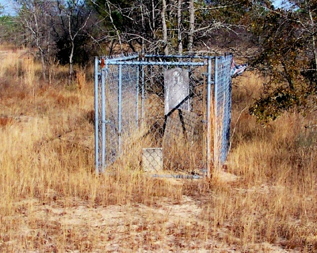
| Memorials | : | 0 |
| Location | : | Swainsboro, Emanuel County, USA |
| Coordinate | : | 32.6847030, -82.4957050 |
| Description | : | From Swainsboro, go northwest about 9 miles on GA Hwy 57 towards Kite, pass Cow Ford Bridge Road, and go another 2.6 miles; just before the Johnson County line, turn left onto dirt trail, go 0.1 miles, turn left onto dirt trail, and go 0.5 miles; just past brick home,turn right onto dirt trail, and go 0.2 miles; bear to the right, and go another 75 yds. to the grave. As of 2009, the grave is located on land belonging to Doc Claxton. |
frequently asked questions (FAQ):
-
Where is James Daniel Kersey Gravesite?
James Daniel Kersey Gravesite is located at Swainsboro, Emanuel County ,Georgia ,USA.
-
James Daniel Kersey Gravesite cemetery's updated grave count on graveviews.com?
0 memorials
-
Where are the coordinates of the James Daniel Kersey Gravesite?
Latitude: 32.6847030
Longitude: -82.4957050
Nearby Cemetories:
1. Wheeler Cemetery
Kite, Johnson County, USA
Coordinate: 32.6758003, -82.5017014
2. Kite City Cemetery
Kite, Johnson County, USA
Coordinate: 32.6901980, -82.5087080
3. Bill Meeks Cemetery
Wrightsville, Johnson County, USA
Coordinate: 32.6921080, -82.5140190
4. William's Chapel Baptist Church Cemetery
Kite, Johnson County, USA
Coordinate: 32.7071660, -82.4898040
5. Townsend Cemetery
Kite, Johnson County, USA
Coordinate: 32.6525002, -82.4875031
6. Sumner-Flanders Cemetery
Swainsboro, Emanuel County, USA
Coordinate: 32.6649300, -82.4610200
7. Webb Grave
Swainsboro, Emanuel County, USA
Coordinate: 32.6843330, -82.4519260
8. Cora Flanders Grave
Dellwood, Emanuel County, USA
Coordinate: 32.6986000, -82.4544900
9. Oak Chapel Baptist Cemetery
Dellwood, Emanuel County, USA
Coordinate: 32.6869011, -82.4492035
10. Bethel United Methodist Church Cemetery
Swainsboro, Emanuel County, USA
Coordinate: 32.6665300, -82.4537400
11. Kersey Family Cemetery
Kite, Johnson County, USA
Coordinate: 32.6751621, -82.5417982
12. Fortner Cemetery
Kite, Johnson County, USA
Coordinate: 32.7069016, -82.5456009
13. Scott Cemetery
Swainsboro, Emanuel County, USA
Coordinate: 32.6960710, -82.4393780
14. Gumlog Primitive Baptist Church Cemetery
Kite, Johnson County, USA
Coordinate: 32.7312711, -82.5162420
15. Minton Chapel Advent Christian Church Cemetery
Kite, Johnson County, USA
Coordinate: 32.7327220, -82.4790250
16. Saint Paul Cemetery
Kite, Johnson County, USA
Coordinate: 32.6976400, -82.5577110
17. Stephens
Kite, Johnson County, USA
Coordinate: 32.6984800, -82.5578800
18. Sardis Primitive Baptist Cemetery
Norristown Junction, Emanuel County, USA
Coordinate: 32.6306000, -82.5072021
19. Moxley Cemetery
Swainsboro, Emanuel County, USA
Coordinate: 32.6638985, -82.4328003
20. Anderson Cemetery
Kite, Johnson County, USA
Coordinate: 32.6775017, -82.5639038
21. Kersey- Ohooppee Cemetery
Dellwood, Emanuel County, USA
Coordinate: 32.6340000, -82.4540000
22. Pollett Cemetery
Johnson County, USA
Coordinate: 32.7392006, -82.4610977
23. Rehoboth Baptist Church Cemetery
Johnson County, USA
Coordinate: 32.6933190, -82.5769750
24. Lambs Cemetery
Norristown, Emanuel County, USA
Coordinate: 32.6152992, -82.4638977

