
| Memorials | : | 4 |
| Location | : | Curry County, USA |
| Coordinate | : | 34.4087510, -103.3365440 |
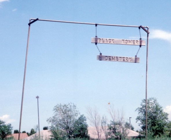
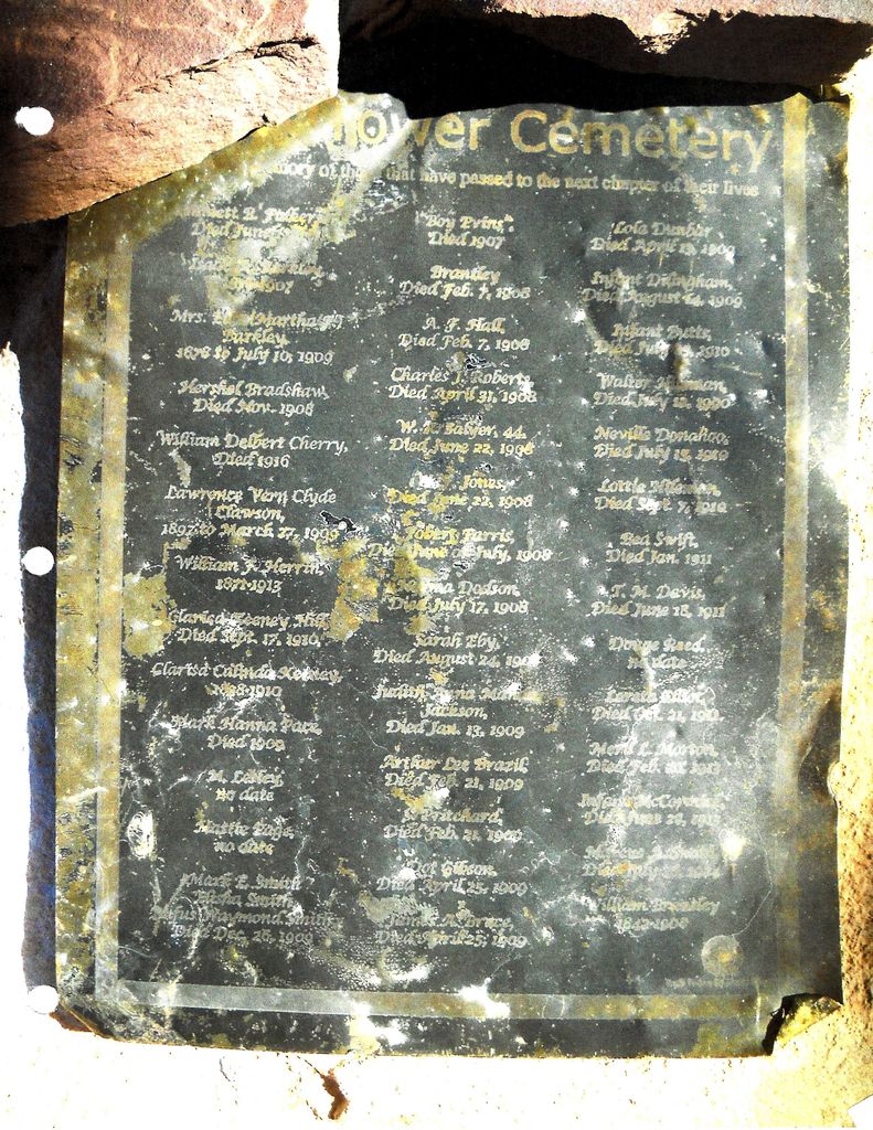
| Description | : | When the town of Blacktower, New Mexico faded away, the only thing left behind was the cemetery. The Blacktower Cemetery, located west of the Chavez West Housing edition near Cannon Air Force Base, near Clovis, New Mexico. Clovis Historian Harold Kilmer and members of the High Plains Historical Foundation has compiled a list of about 50 known burials at the cemetery, dating back to 1907. Don McAlavy, a member of the foundation, found most of the list of the known burials in the funeral records at Steed-Todd Funeral Home in Clovis. What makes Blacktower Cemetery unique is that research suggests... Read More |
frequently asked questions (FAQ):
-
Where is Black Tower Cemetery?
Black Tower Cemetery is located at Curry County ,New Mexico ,USA.
-
Black Tower Cemetery cemetery's updated grave count on graveviews.com?
4 memorials
-
Where are the coordinates of the Black Tower Cemetery?
Latitude: 34.4087510
Longitude: -103.3365440

Nearby Cemetories:
1. Mission Garden of Memories Cemetery
Clovis, Curry County, USA
Coordinate: 34.4049263, -103.2436752
2. Reid Cemetery
Ranchvale, Curry County, USA
Coordinate: 34.4937440, -103.3188840
3. Lawn Haven Memorial Gardens Cemetery
Clovis, Curry County, USA
Coordinate: 34.4333000, -103.1856003
4. Bobo Qualls Cemetery
Ranchvale, Curry County, USA
Coordinate: 34.5211670, -103.4501290
5. Texico Cemetery
Texico, Curry County, USA
Coordinate: 34.3758011, -103.0849991
6. Portales Cemetery
Portales, Roosevelt County, USA
Coordinate: 34.1860500, -103.3199200
7. Memorial Cemetery
Melrose, Curry County, USA
Coordinate: 34.4307251, -103.6171112
8. Bethel Cemetery
Roosevelt County, USA
Coordinate: 34.2146988, -103.4961014
9. Pleasant Hill Cemetery
Pleasant Hill, Curry County, USA
Coordinate: 34.5349998, -103.0733032
10. North Cemetery
Melrose, Curry County, USA
Coordinate: 34.4496994, -103.6410980
11. Rest Lawn Memorial Cemetery
Portales, Roosevelt County, USA
Coordinate: 34.1342010, -103.3347015
12. Floyd Cemetery
Floyd, Roosevelt County, USA
Coordinate: 34.2141991, -103.5800018
13. Roach Cemetery
Curry County, USA
Coordinate: 34.6618996, -103.4828033
14. Eiland Cemetery
Roosevelt County, USA
Coordinate: 34.1169014, -103.1949997
15. Field Cemetery
Field, Curry County, USA
Coordinate: 34.6618996, -103.5738983
16. West Camp Cemetery
Bailey County, USA
Coordinate: 34.2811012, -102.9757996
17. Arch Cemetery
Roosevelt County, USA
Coordinate: 34.1133003, -103.1418991
18. Upton Cemetery
Upton, Roosevelt County, USA
Coordinate: 34.1553001, -103.6524963
19. Stockton Cemetery
Forrest, Quay County, USA
Coordinate: 34.7649000, -103.4962000
20. Yeakley Cemetery
Weber City, Curry County, USA
Coordinate: 34.6775017, -103.6881027
21. Beevers Cemetery
Forrest, Quay County, USA
Coordinate: 34.7714005, -103.5658035
22. Hollene Cemetery
Hollene, Curry County, USA
Coordinate: 34.7774950, -103.0994210
23. Grady City Cemetery
Grady, Curry County, USA
Coordinate: 34.8260000, -103.3105000
24. Mount Zion Cemetery
Dora, Roosevelt County, USA
Coordinate: 33.9824982, -103.3268967