
| Memorials | : | 567 |
| Location | : | Clovis, Curry County, USA |
| Phone | : | (575) 763-3814 |
| Coordinate | : | 34.4049263, -103.2436752 |
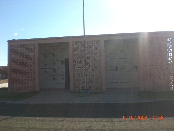
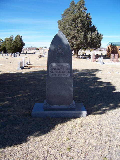
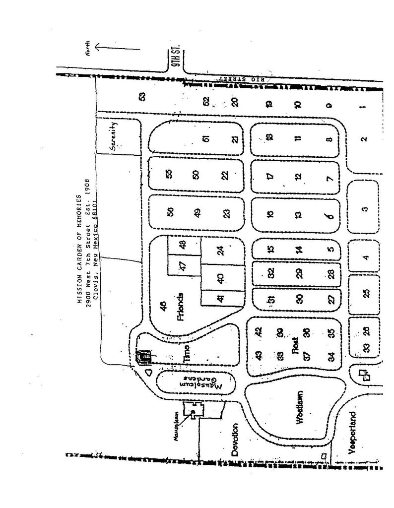
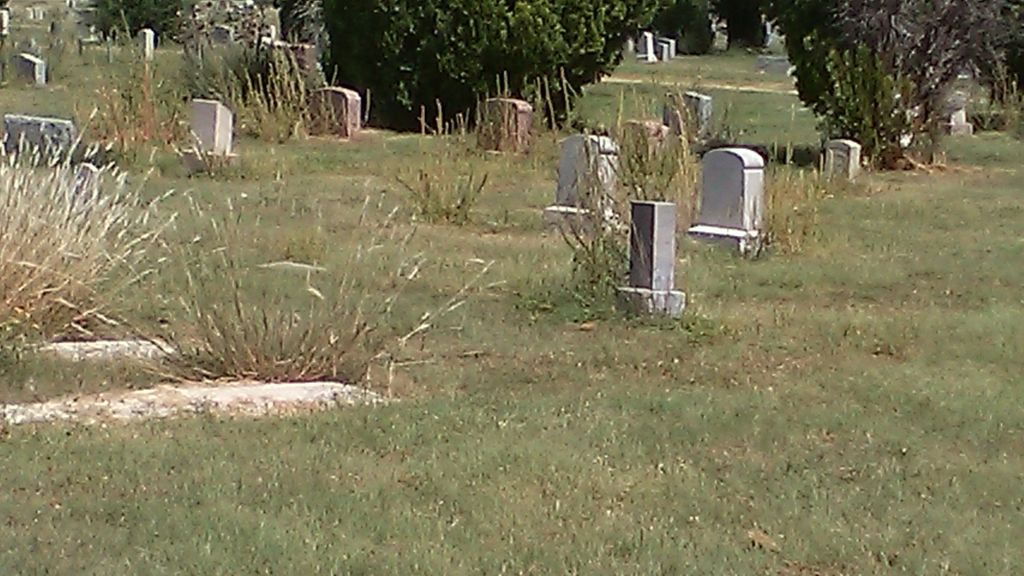
| Description | : | This cemetery was originally called "Clovis Cemetery" because it was the only one for a long time (a lot of the older folks still call it that). Most folks around here just refer to it as "Mission Gardens". It was established in 1908 on West 7th Street, Clovis, New Mexico on the north side of the road. There are several famous people laid to rest here, including New Mexico Governor Andrew W Hockenhull. He served as Assistant DA for Curry County 1912 - 1916 and City Attorney for 6 years after that. In 1930 he... Read More |
frequently asked questions (FAQ):
-
Where is Mission Garden of Memories Cemetery?
Mission Garden of Memories Cemetery is located at 2900 West 7th Street Clovis, Curry County ,New Mexico , 88101USA.
-
Mission Garden of Memories Cemetery cemetery's updated grave count on graveviews.com?
528 memorials
-
Where are the coordinates of the Mission Garden of Memories Cemetery?
Latitude: 34.4049263
Longitude: -103.2436752

Nearby Cemetories:
1. Lawn Haven Memorial Gardens Cemetery
Clovis, Curry County, USA
Coordinate: 34.4333000, -103.1856003
2. Black Tower Cemetery
Curry County, USA
Coordinate: 34.4087510, -103.3365440
3. Reid Cemetery
Ranchvale, Curry County, USA
Coordinate: 34.4937440, -103.3188840
4. Texico Cemetery
Texico, Curry County, USA
Coordinate: 34.3758011, -103.0849991
5. Pleasant Hill Cemetery
Pleasant Hill, Curry County, USA
Coordinate: 34.5349998, -103.0733032
6. Bobo Qualls Cemetery
Ranchvale, Curry County, USA
Coordinate: 34.5211670, -103.4501290
7. Portales Cemetery
Portales, Roosevelt County, USA
Coordinate: 34.1860500, -103.3199200
8. West Camp Cemetery
Bailey County, USA
Coordinate: 34.2811012, -102.9757996
9. Rest Lawn Memorial Cemetery
Portales, Roosevelt County, USA
Coordinate: 34.1342010, -103.3347015
10. Bethel Cemetery
Roosevelt County, USA
Coordinate: 34.2146988, -103.4961014
11. Eiland Cemetery
Roosevelt County, USA
Coordinate: 34.1169014, -103.1949997
12. Arch Cemetery
Roosevelt County, USA
Coordinate: 34.1133003, -103.1418991
13. Memorial Cemetery
Melrose, Curry County, USA
Coordinate: 34.4307251, -103.6171112
14. Roach Cemetery
Curry County, USA
Coordinate: 34.6618996, -103.4828033
15. North Cemetery
Melrose, Curry County, USA
Coordinate: 34.4496994, -103.6410980
16. Floyd Cemetery
Floyd, Roosevelt County, USA
Coordinate: 34.2141991, -103.5800018
17. Field Cemetery
Field, Curry County, USA
Coordinate: 34.6618996, -103.5738983
18. Hollene Cemetery
Hollene, Curry County, USA
Coordinate: 34.7774950, -103.0994210
19. Muleshoe Memorial Park Cemetery
Muleshoe, Bailey County, USA
Coordinate: 34.2634100, -102.7851800
20. Bailey County Cemetery
Muleshoe, Bailey County, USA
Coordinate: 34.2859600, -102.7661950
21. Stockton Cemetery
Forrest, Quay County, USA
Coordinate: 34.7649000, -103.4962000
22. Upton Cemetery
Upton, Roosevelt County, USA
Coordinate: 34.1553001, -103.6524963
23. Grady City Cemetery
Grady, Curry County, USA
Coordinate: 34.8260000, -103.3105000
24. Mount Zion Cemetery
Dora, Roosevelt County, USA
Coordinate: 33.9824982, -103.3268967