
| Memorials | : | 5 |
| Location | : | Texico, Curry County, USA |
| Coordinate | : | 34.3758011, -103.0849991 |
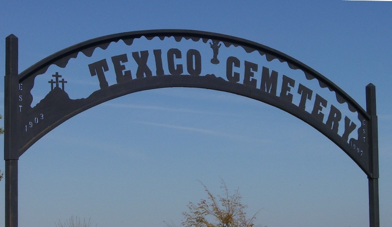
| Description | : | The original section of the Cemetery was purchased from G. M Hockenhull and Edna Hockenhull on April 12, 1929. It consists of three and one half acres of land. On November 27, 1991 an additional three acres was purchased to the east from Nita Nell Wilson. Although the original deed is dated 1929 there are 132 burials prior to that date. The earliest headstone is B. F. Jenkins, January 21, 1903. At the present time, there is a Cemetery Association Board consisting of five members, that oversees the upkeep and general operation... Read More |
frequently asked questions (FAQ):
-
Where is Texico Cemetery?
Texico Cemetery is located at 374 CR8 Texico, Curry County ,New Mexico ,USA.
-
Texico Cemetery cemetery's updated grave count on graveviews.com?
5 memorials
-
Where are the coordinates of the Texico Cemetery?
Latitude: 34.3758011
Longitude: -103.0849991
Nearby Cemetories:
1. Lawn Haven Memorial Gardens Cemetery
Clovis, Curry County, USA
Coordinate: 34.4333000, -103.1856003
2. West Camp Cemetery
Bailey County, USA
Coordinate: 34.2811012, -102.9757996
3. Mission Garden of Memories Cemetery
Clovis, Curry County, USA
Coordinate: 34.4049263, -103.2436752
4. Pleasant Hill Cemetery
Pleasant Hill, Curry County, USA
Coordinate: 34.5349998, -103.0733032
5. Black Tower Cemetery
Curry County, USA
Coordinate: 34.4087510, -103.3365440
6. Reid Cemetery
Ranchvale, Curry County, USA
Coordinate: 34.4937440, -103.3188840
7. Arch Cemetery
Roosevelt County, USA
Coordinate: 34.1133003, -103.1418991
8. Portales Cemetery
Portales, Roosevelt County, USA
Coordinate: 34.1860500, -103.3199200
9. Muleshoe Memorial Park Cemetery
Muleshoe, Bailey County, USA
Coordinate: 34.2634100, -102.7851800
10. Eiland Cemetery
Roosevelt County, USA
Coordinate: 34.1169014, -103.1949997
11. Bailey County Cemetery
Muleshoe, Bailey County, USA
Coordinate: 34.2859600, -102.7661950
12. Rest Lawn Memorial Cemetery
Portales, Roosevelt County, USA
Coordinate: 34.1342010, -103.3347015
13. Bobo Qualls Cemetery
Ranchvale, Curry County, USA
Coordinate: 34.5211670, -103.4501290
14. Bethel Cemetery
Roosevelt County, USA
Coordinate: 34.2146988, -103.4961014
15. Hollene Cemetery
Hollene, Curry County, USA
Coordinate: 34.7774950, -103.0994210
16. Baileyboro Cemetery
Bailey County, USA
Coordinate: 34.0264460, -102.8292020
17. Inez Cemetery
Inez, Roosevelt County, USA
Coordinate: 33.9667015, -103.1433029
18. Roach Cemetery
Curry County, USA
Coordinate: 34.6618996, -103.4828033
19. Floyd Cemetery
Floyd, Roosevelt County, USA
Coordinate: 34.2141991, -103.5800018
20. Mount Zion Cemetery
Dora, Roosevelt County, USA
Coordinate: 33.9824982, -103.3268967
21. Memorial Cemetery
Melrose, Curry County, USA
Coordinate: 34.4307251, -103.6171112
22. Longs Cemetery
Portales, Roosevelt County, USA
Coordinate: 33.9239006, -103.2110977
23. North Cemetery
Melrose, Curry County, USA
Coordinate: 34.4496994, -103.6410980
24. Roebuck Cemetery
Roosevelt County, USA
Coordinate: 33.9091440, -103.0740910