
| Memorials | : | 0 |
| Location | : | Ranburne, Cleburne County, USA |
| Coordinate | : | 33.4967900, -85.5024200 |
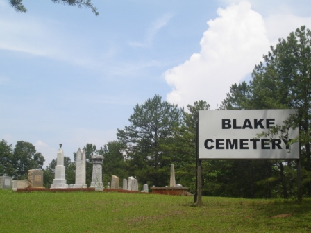
| Description | : | Located off county road #10. The Blake Cemetery is a family cemetery. It is located on land owned by Thomas Blake who settle the area in the 1830's. The cemetery is still owned by family members. |
frequently asked questions (FAQ):
-
Where is Blake Cemetery?
Blake Cemetery is located at off county road #10 Ranburne, Cleburne County ,Alabama , 36273USA.
-
Blake Cemetery cemetery's updated grave count on graveviews.com?
0 memorials
-
Where are the coordinates of the Blake Cemetery?
Latitude: 33.4967900
Longitude: -85.5024200
Nearby Cemetories:
1. Oak Grove A.M.E. Cemetery
Newell, Randolph County, USA
Coordinate: 33.4747120, -85.5006910
2. Cool Springs United Methodist Church Cemetery
Randolph County, USA
Coordinate: 33.4904660, -85.4691480
3. Pinetucky Baptist Cemetery
Micaville, Cleburne County, USA
Coordinate: 33.4963989, -85.5428009
4. Heaven Bound Cemetery
Heflin, Cleburne County, USA
Coordinate: 33.4966670, -85.5438890
5. Jordan Chapel Methodist Church Cemetery
Newell, Randolph County, USA
Coordinate: 33.4576118, -85.4974540
6. Morrison's Chapel United Methodist Cemetery
Randolph County, USA
Coordinate: 33.4720110, -85.5394250
7. Vise Grove Baptist Church Cemetery
Heflin, Cleburne County, USA
Coordinate: 33.5239980, -85.5399020
8. Howle Family Cemetery
Cleburne County, USA
Coordinate: 33.5453987, -85.5084000
9. Rock Springs Church Cemetery
Ranburne, Cleburne County, USA
Coordinate: 33.4942017, -85.4360962
10. Smyrna Missionary Cemetery
Randolph County, USA
Coordinate: 33.4607000, -85.4477000
11. Hurricane Methodist Cemetery
Cleburne County, USA
Coordinate: 33.5656013, -85.4886017
12. Oak Hill Missionary Baptist Church Cemetery
Heflin, Cleburne County, USA
Coordinate: 33.5318380, -85.5768970
13. Rice Cemetery
Randolph County, USA
Coordinate: 33.4612000, -85.4273100
14. Mountain View Baptist Church Cemetery
Ranburne, Cleburne County, USA
Coordinate: 33.5339410, -85.4279840
15. Potter’s House Church Cemetery
Randolph County, USA
Coordinate: 33.4590498, -85.4251876
16. Beason Grove Cemetery
Cleburne County, USA
Coordinate: 33.5602989, -85.5528030
17. McLeod Family Cemetery
Randolph County, USA
Coordinate: 33.4598700, -85.4200700
18. Union Baptist Church Cemetery
Newell, Randolph County, USA
Coordinate: 33.4193300, -85.4880900
19. Greens Chapel Church Cemetery
Heflin, Cleburne County, USA
Coordinate: 33.5593987, -85.5643997
20. Antioch Baptist Church Cemetery
Newell, Randolph County, USA
Coordinate: 33.4325430, -85.4383240
21. Corinth Baptist Church Cemetery
Randolph County, USA
Coordinate: 33.4565800, -85.5922510
22. Hepsabah Cemetery
Hollis Crossroads, Cleburne County, USA
Coordinate: 33.5008011, -85.6078033
23. Valley Grove Primitive Baptist Church Cemetery
Foster Crossroad, Randolph County, USA
Coordinate: 33.4184036, -85.5511703
24. Wise Chapel Cemetery
Trickem, Cleburne County, USA
Coordinate: 33.5691986, -85.4403000