
| Memorials | : | 1 |
| Location | : | Heflin, Cleburne County, USA |
| Coordinate | : | 33.5593987, -85.5643997 |
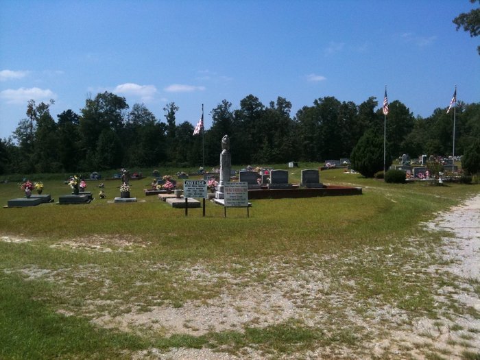
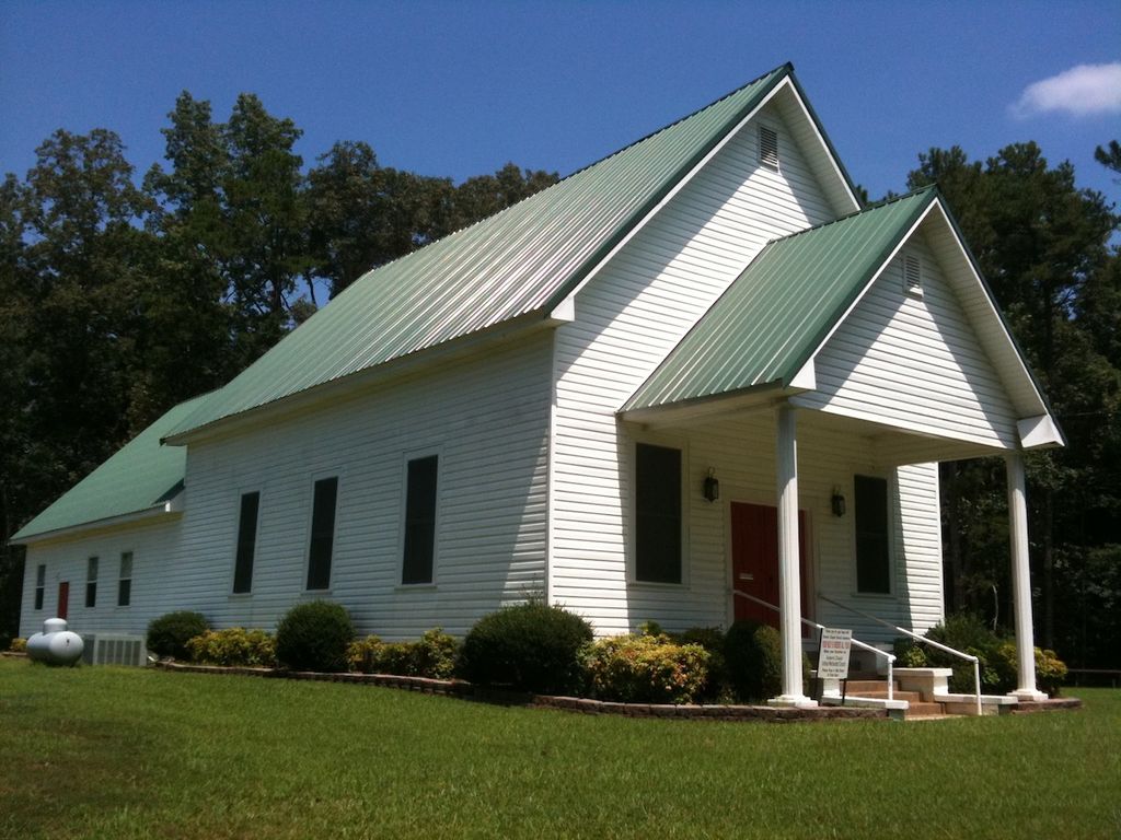
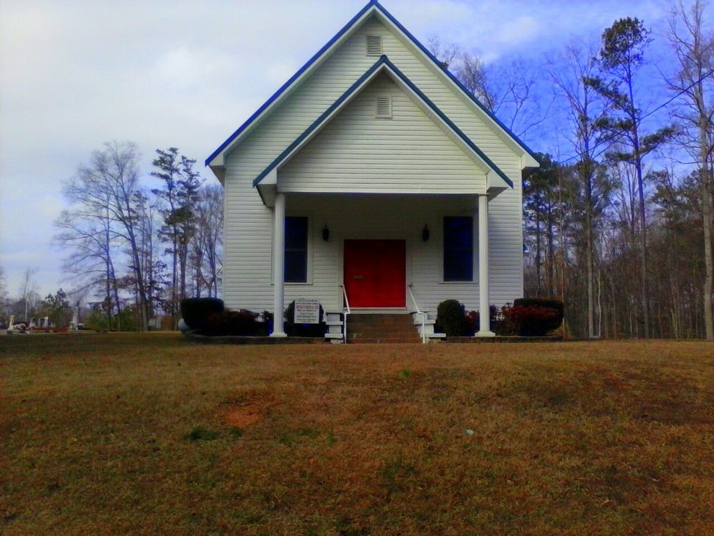
| Description | : | Township 17 Range 10 Section 11. Directions for visiting the cemetery are from Downtown Heflin via Alabama Highway 9, go 1.5 miles, turn left on Cleburne County Road 19 for 4.25 miles, then turn right on Cleburne County Road 36 for approximately 500 yards. The cemetery would be adjacent to Green's Chapel Church. All roads are marked with signs. |
frequently asked questions (FAQ):
-
Where is Greens Chapel Church Cemetery?
Greens Chapel Church Cemetery is located at Cleburne County Road 36 Heflin, Cleburne County ,Alabama , 36264USA.
-
Greens Chapel Church Cemetery cemetery's updated grave count on graveviews.com?
1 memorials
-
Where are the coordinates of the Greens Chapel Church Cemetery?
Latitude: 33.5593987
Longitude: -85.5643997


Nearby Cemetories:
1. Beason Grove Cemetery
Cleburne County, USA
Coordinate: 33.5602989, -85.5528030
2. Greens Graveyard
Cleburne County, USA
Coordinate: 33.5603981, -85.5841980
3. Cedar Creek Cemetery
Heflin, Cleburne County, USA
Coordinate: 33.5752983, -85.5785980
4. Oak Hill Missionary Baptist Church Cemetery
Heflin, Cleburne County, USA
Coordinate: 33.5318380, -85.5768970
5. Pleasant Hill Baptist Church Cemetery
Heflin, Cleburne County, USA
Coordinate: 33.5555992, -85.6117020
6. Vise Grove Baptist Church Cemetery
Heflin, Cleburne County, USA
Coordinate: 33.5239980, -85.5399020
7. Howle Family Cemetery
Cleburne County, USA
Coordinate: 33.5453987, -85.5084000
8. Mountain Grove Baptist Church Cemetery
Heflin, Cleburne County, USA
Coordinate: 33.5615190, -85.6254730
9. Evans Cemetery
Cleburne County, USA
Coordinate: 33.6194000, -85.5582962
10. Hurricane Methodist Cemetery
Cleburne County, USA
Coordinate: 33.5656013, -85.4886017
11. New Harmony Cemetery
Heflin, Cleburne County, USA
Coordinate: 33.6180992, -85.5958023
12. Heaven Bound Cemetery
Heflin, Cleburne County, USA
Coordinate: 33.4966670, -85.5438890
13. Pinetucky Baptist Cemetery
Micaville, Cleburne County, USA
Coordinate: 33.4963989, -85.5428009
14. Hepsabah Cemetery
Hollis Crossroads, Cleburne County, USA
Coordinate: 33.5008011, -85.6078033
15. Chulafinnee Baptist Church Cemetery
Chulafinnee, Cleburne County, USA
Coordinate: 33.5441380, -85.6465090
16. Bethlehem Primitive Baptist Church Cemetery
Heflin, Cleburne County, USA
Coordinate: 33.5766983, -85.6466980
17. Chulafinnee Methodist Church Cemetery
Chulafinnee, Cleburne County, USA
Coordinate: 33.5405006, -85.6503983
18. Blake Cemetery
Ranburne, Cleburne County, USA
Coordinate: 33.4967900, -85.5024200
19. Old Liberty Church Cemetery
Cleburne County, USA
Coordinate: 33.6310997, -85.5177994
20. Verdon Chapel Cemetery
Heflin, Cleburne County, USA
Coordinate: 33.5819016, -85.4702988
21. Liberty Hill Methodist Church Cemetery
Chulafinnee, Cleburne County, USA
Coordinate: 33.5681000, -85.6650009
22. Heflin Cemetery
Heflin, Cleburne County, USA
Coordinate: 33.6460991, -85.5836029
23. Calvary Baptist Church Cemetery
Heflin, Cleburne County, USA
Coordinate: 33.6432991, -85.6006012
24. Morrison's Chapel United Methodist Cemetery
Randolph County, USA
Coordinate: 33.4720110, -85.5394250