
| Memorials | : | 75 |
| Location | : | Strafford, Strafford County, USA |
| Coordinate | : | 43.3248620, -71.1756510 |
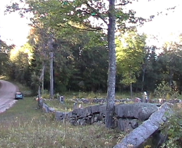
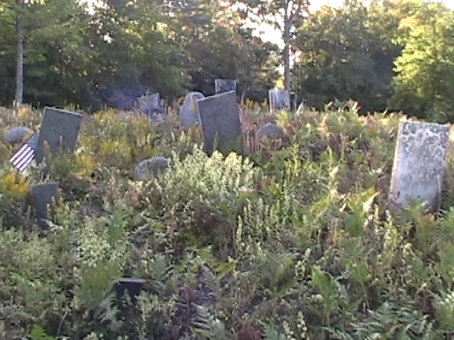
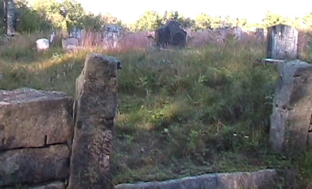
| Description | : | Located on the North side of Barn Door Gap Road aka Second Crown Point Road, .12 mile east of intersection with Wingate Road. Wingate Road intersects with Rte 126 aka Parker Mountain Road, also with Vail Road, near the Strafford and South Barnstead town line. The original family yard was 84'by 64', bounded by a built-up wall on the road side with a gate near the front center. There are stonewalls on the east and north sides with a slab wall retaining the banking. The original Holmes family graveyard is on the upper level, the new section... Read More |
frequently asked questions (FAQ):
-
Where is Blue Hills Cemetery?
Blue Hills Cemetery is located at Barndoor Gap Rd Strafford, Strafford County ,New Hampshire , 03884USA.
-
Blue Hills Cemetery cemetery's updated grave count on graveviews.com?
3 memorials
-
Where are the coordinates of the Blue Hills Cemetery?
Latitude: 43.3248620
Longitude: -71.1756510
Nearby Cemetories:
1. Holmes Family Cemetery
Strafford, Strafford County, USA
Coordinate: 43.3271200, -71.1798900
2. Babb-Foss Graveyard
Strafford, Strafford County, USA
Coordinate: 43.3251200, -71.1842100
3. Lougee Cemetery
Strafford, Strafford County, USA
Coordinate: 43.3137810, -71.1678460
4. Drew Cemetery
Strafford, Strafford County, USA
Coordinate: 43.3214620, -71.1575460
5. Perkins Family Farm Cemetery
Strafford, Strafford County, USA
Coordinate: 43.3125100, -71.1839100
6. Foss Cemetery
Strafford, Strafford County, USA
Coordinate: 43.3293770, -71.1537690
7. Otis-Drew Cemetery
Strafford, Strafford County, USA
Coordinate: 43.3183330, -71.1527780
8. Jones Cemetery
Strafford, Strafford County, USA
Coordinate: 43.3065600, -71.1782800
9. Foss Family Cemetery
Strafford, Strafford County, USA
Coordinate: 43.3065520, -71.1852050
10. Jones Cemetery
Strafford, Strafford County, USA
Coordinate: 43.3029300, -71.1783000
11. James Clark Burial Site
Barnstead, Belknap County, USA
Coordinate: 43.3433760, -71.1928650
12. Hayes Cemetery
Strafford, Strafford County, USA
Coordinate: 43.3167250, -71.1456770
13. Drew Hill Cemetery
Barnstead, Belknap County, USA
Coordinate: 43.3492600, -71.1717700
14. Hall - Gray Cemetery
Barnstead, Belknap County, USA
Coordinate: 43.3486110, -71.1666670
15. Welch Cemetery
Barnstead, Belknap County, USA
Coordinate: 43.3200000, -71.2088890
16. Lougee - Foss Cemetery
Strafford, Strafford County, USA
Coordinate: 43.2994510, -71.1731030
17. Pitman Family Cemetery
Barnstead, Belknap County, USA
Coordinate: 43.3436860, -71.1995490
18. Trickey Cemetery
Barnstead, Belknap County, USA
Coordinate: 43.3470280, -71.1936810
19. Enoch Howard Burial Site
Barnstead, Belknap County, USA
Coordinate: 43.3481820, -71.1934230
20. Welch Cemetery
Barnstead, Belknap County, USA
Coordinate: 43.3161110, -71.2105560
21. Hall-Sanders Cemetery
Strafford, Strafford County, USA
Coordinate: 43.3134920, -71.1412000
22. Berry Cemetery
Strafford, Strafford County, USA
Coordinate: 43.3341670, -71.1383330
23. Swain Cemetery
Strafford, Strafford County, USA
Coordinate: 43.3020000, -71.2052000
24. Berry Cemetery
Barnstead, Belknap County, USA
Coordinate: 43.3561710, -71.1661510