
| Memorials | : | 17 |
| Location | : | Barnstead, Belknap County, USA |
| Coordinate | : | 43.3486110, -71.1666670 |
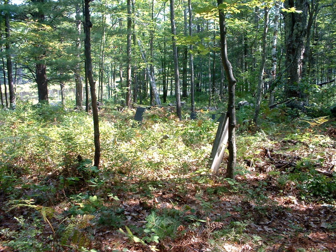
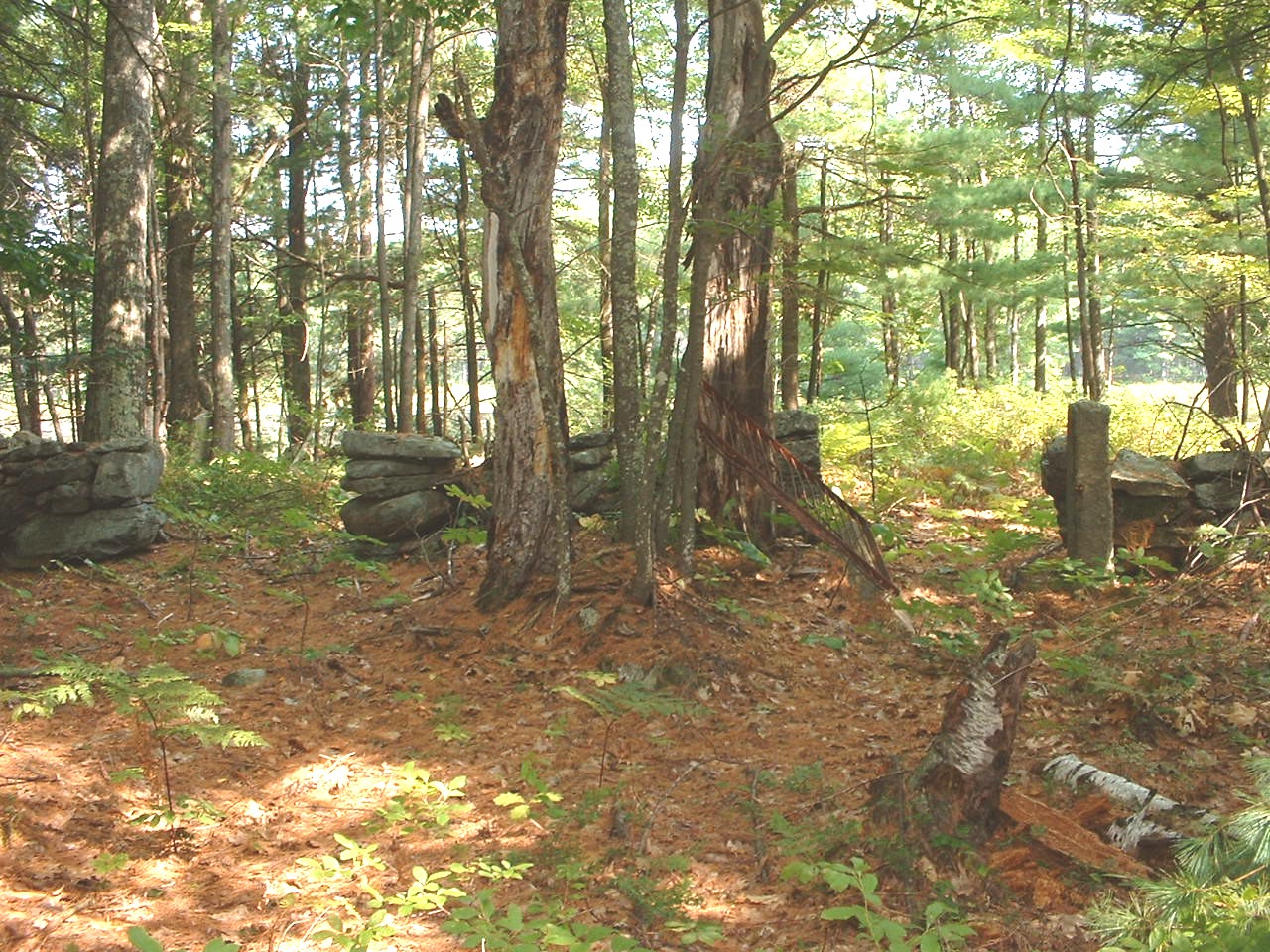
| Description | : | This is the Solomon Hall Site. Half the cemetery is shared with the Joseph Gray family. Half the cemetery lies in Barnstead (Hall) and half lies in Strafford (Gray). This cemetery is becoming quite overgrown and needs some TLC. NHOGA: B01-015 Hall, Doc Cob Road, USGS Parker Mountain Quadrangle, E32439, N480160, Zone 19 (43° 20' 55"N, 71° 10' 0"W), The Solomon Hall site on the Strafford town line, Source: Stuart Merrill 1994 NHOGA: S17-1G1 Gray, No. Straf. Road, USGS Parker Mountain Quadrangle, E32438, N480161, Zone 19 (43° 20' 56"N, 71° 10' 1"W), This is on the Barnstead Boundary. Hall markers over the line., Source: Stiles, Corrine... Read More |
frequently asked questions (FAQ):
-
Where is Hall - Gray Cemetery?
Hall - Gray Cemetery is located at Doc Cobb Road - 1st Crown Point Barnstead, Belknap County ,New Hampshire ,USA.
-
Hall - Gray Cemetery cemetery's updated grave count on graveviews.com?
17 memorials
-
Where are the coordinates of the Hall - Gray Cemetery?
Latitude: 43.3486110
Longitude: -71.1666670


Nearby Cemetories:
1. Drew Hill Cemetery
Barnstead, Belknap County, USA
Coordinate: 43.3492600, -71.1717700
2. Berry Cemetery
Barnstead, Belknap County, USA
Coordinate: 43.3561710, -71.1661510
3. Garland Cemetery
Barnstead, Belknap County, USA
Coordinate: 43.3587410, -71.1770670
4. Garland Cemetery
Barnstead, Belknap County, USA
Coordinate: 43.3593220, -71.1875440
5. Enoch Howard Burial Site
Barnstead, Belknap County, USA
Coordinate: 43.3481820, -71.1934230
6. Trickey Cemetery
Barnstead, Belknap County, USA
Coordinate: 43.3470280, -71.1936810
7. James Clark Burial Site
Barnstead, Belknap County, USA
Coordinate: 43.3433760, -71.1928650
8. Locke Cemetery
Alton, Belknap County, USA
Coordinate: 43.3656000, -71.1820000
9. Spongburg-Nordquist Cemetery
Dexter Corner, Strafford County, USA
Coordinate: 43.3686280, -71.1592840
10. Foss Cemetery
Strafford, Strafford County, USA
Coordinate: 43.3293770, -71.1537690
11. Hixon-Ayers Cemetery
Barnstead, Belknap County, USA
Coordinate: 43.3650080, -71.1876350
12. Holmes Family Cemetery
Strafford, Strafford County, USA
Coordinate: 43.3271200, -71.1798900
13. Pitman Family Cemetery
Barnstead, Belknap County, USA
Coordinate: 43.3436860, -71.1995490
14. Blue Hills Cemetery
Strafford, Strafford County, USA
Coordinate: 43.3248620, -71.1756510
15. McNeal Cemetery
Alton, Belknap County, USA
Coordinate: 43.3700000, -71.1847220
16. Berry Cemetery
Strafford, Strafford County, USA
Coordinate: 43.3341670, -71.1383330
17. Daniel Durgin Cemetery
New Durham, Strafford County, USA
Coordinate: 43.3733000, -71.1558000
18. Furber Cemetery
Alton, Belknap County, USA
Coordinate: 43.3752780, -71.1683330
19. Babb-Foss Graveyard
Strafford, Strafford County, USA
Coordinate: 43.3251200, -71.1842100
20. Mills Cemetery
Strafford, Strafford County, USA
Coordinate: 43.3355560, -71.1336110
21. Drew Cemetery
Strafford, Strafford County, USA
Coordinate: 43.3214620, -71.1575460
22. Otis Cemetery
Farmington, Strafford County, USA
Coordinate: 43.3547220, -71.1261110
23. Jethro Nutter Cemetery
Barnstead, Belknap County, USA
Coordinate: 43.3550900, -71.2076700
24. Deland Cemetery
Alton, Belknap County, USA
Coordinate: 43.3788800, -71.1766900