
| Memorials | : | 0 |
| Location | : | Boley, Okfuskee County, USA |
| Coordinate | : | 35.4793460, -96.4994780 |
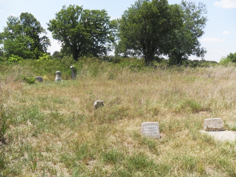
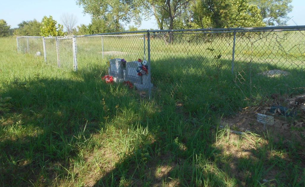
| Description | : | Boley Cemetery is an African American cemetery located in the town of Boley Oklahoma. Boley's downtown business district is listed in the National Register of Historic Places and has been designated a National Historic Landmark by the National Park Service. Boley cemetery has unique markers and graves of early town settlers. There are many unmarked graves, some grave still have the temporary funeral home markers and some markers are faded by weather that are unreadable. Direction to Boley Cemetery: From Boley, go West on HW 62 approx 0.5 miles to NS366, then go South on NS366 approx 0.75... Read More |
frequently asked questions (FAQ):
-
Where is Boley Cemetery?
Boley Cemetery is located at Boley, Okfuskee County ,Oklahoma , 78429USA.
-
Boley Cemetery cemetery's updated grave count on graveviews.com?
0 memorials
-
Where are the coordinates of the Boley Cemetery?
Latitude: 35.4793460
Longitude: -96.4994780
Nearby Cemetories:
1. East Lawn Cemetery
Boley, Okfuskee County, USA
Coordinate: 35.4786800, -96.4948200
2. Rusk Cemetery
Boley, Okfuskee County, USA
Coordinate: 35.4498590, -96.4981130
3. Boley Mennonite Church Cemetery
Boley, Okfuskee County, USA
Coordinate: 35.4760890, -96.4593400
4. West Cemetery
Boley, Okfuskee County, USA
Coordinate: 35.4794006, -96.4496994
5. North Saint Emanual Springs Cemetery
Boley, Okfuskee County, USA
Coordinate: 35.4794400, -96.4416700
6. East Saint Emanuel Baptist Church Cemetery
Boley, Okfuskee County, USA
Coordinate: 35.4795100, -96.4282300
7. Oakdale Cemetery
Paden, Okfuskee County, USA
Coordinate: 35.5161018, -96.5599976
8. Frank Family Farm Cemetery
Seminole County, USA
Coordinate: 35.4207060, -96.4547250
9. Chilesville Cemetery
Boley, Okfuskee County, USA
Coordinate: 35.5513992, -96.4957962
10. Valley Grove Cemetery
Okfuskee County, USA
Coordinate: 35.5228004, -96.4233017
11. Schoolton Cemetery
Cromwell, Seminole County, USA
Coordinate: 35.4065410, -96.4659690
12. McCulah Cemetery
Paden, Okfuskee County, USA
Coordinate: 35.4362370, -96.5812990
13. Ben Johnson Old Home Cemetery
Schoolton, Seminole County, USA
Coordinate: 35.3909630, -96.4646870
14. Castle Cemetery
Castle, Okfuskee County, USA
Coordinate: 35.4603004, -96.3874969
15. Sand Creek Cemetery
Seminole County, USA
Coordinate: 35.3911018, -96.4413986
16. Chisholm Cemetery
Paden, Okfuskee County, USA
Coordinate: 35.4635360, -96.3714690
17. Ebenezer Cemetery
Castle, Okfuskee County, USA
Coordinate: 35.4940109, -96.3706131
18. Giles Cemetery
Pottawatomie County, USA
Coordinate: 35.4342003, -96.6303024
19. Holahta Cemetery
Okfuskee County, USA
Coordinate: 35.4316200, -96.3679100
20. Lambdin Cemetery
Prague, Lincoln County, USA
Coordinate: 35.4991989, -96.6477966
21. Hicks Family Cemetery
Mason, Okfuskee County, USA
Coordinate: 35.5238800, -96.3585700
22. Prairie Springs Cemetery
Okemah, Okfuskee County, USA
Coordinate: 35.4354973, -96.3562775
23. Prague Cemetery
Prague, Lincoln County, USA
Coordinate: 35.4897003, -96.6549988
24. Buckeye Cemetery
Castle, Okfuskee County, USA
Coordinate: 35.4855995, -96.3431015