
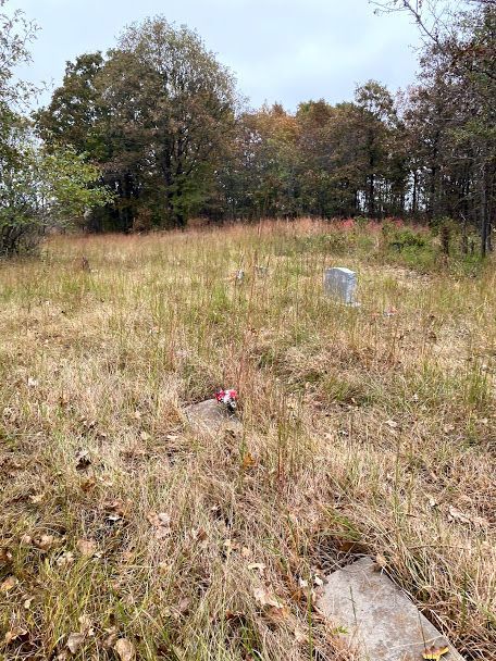
| Memorials | : | 0 |
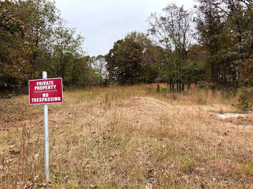
| Location | : | Boley, Okfuskee County, USA |
| Coordinate | : | 35.4795100, -96.4282300 |
| Description | : | Located 3.5 miles east of Boley on SH 62 then .5 mile south, then 1/4 mile west til you see it on the north side of road |
frequently asked questions (FAQ):
-
Where is East Saint Emanuel Baptist Church Cemetery?
East Saint Emanuel Baptist Church Cemetery is located at Boley, Okfuskee County ,Oklahoma ,USA.
-
East Saint Emanuel Baptist Church Cemetery cemetery's updated grave count on graveviews.com?
0 memorials
-
Where are the coordinates of the East Saint Emanuel Baptist Church Cemetery?
Latitude: 35.4795100
Longitude: -96.4282300
Nearby Cemetories:
1. North Saint Emanual Springs Cemetery
Boley, Okfuskee County, USA
Coordinate: 35.4794400, -96.4416700
2. West Cemetery
Boley, Okfuskee County, USA
Coordinate: 35.4794006, -96.4496994
3. Boley Mennonite Church Cemetery
Boley, Okfuskee County, USA
Coordinate: 35.4760890, -96.4593400
4. Castle Cemetery
Castle, Okfuskee County, USA
Coordinate: 35.4603004, -96.3874969
5. Valley Grove Cemetery
Okfuskee County, USA
Coordinate: 35.5228004, -96.4233017
6. Chisholm Cemetery
Paden, Okfuskee County, USA
Coordinate: 35.4635360, -96.3714690
7. Ebenezer Cemetery
Castle, Okfuskee County, USA
Coordinate: 35.4940109, -96.3706131
8. East Lawn Cemetery
Boley, Okfuskee County, USA
Coordinate: 35.4786800, -96.4948200
9. Boley Cemetery
Boley, Okfuskee County, USA
Coordinate: 35.4793460, -96.4994780
10. Frank Family Farm Cemetery
Seminole County, USA
Coordinate: 35.4207060, -96.4547250
11. Rusk Cemetery
Boley, Okfuskee County, USA
Coordinate: 35.4498590, -96.4981130
12. Holahta Cemetery
Okfuskee County, USA
Coordinate: 35.4316200, -96.3679100
13. Buckeye Cemetery
Castle, Okfuskee County, USA
Coordinate: 35.4855995, -96.3431015
14. Hicks Family Cemetery
Mason, Okfuskee County, USA
Coordinate: 35.5238800, -96.3585700
15. Prairie Springs Cemetery
Okemah, Okfuskee County, USA
Coordinate: 35.4354973, -96.3562775
16. Douglas family Cemetery
Mason, Okfuskee County, USA
Coordinate: 35.5230900, -96.3520200
17. Schoolton Cemetery
Cromwell, Seminole County, USA
Coordinate: 35.4065410, -96.4659690
18. Harjo Family Cemetery
Okemah, Okfuskee County, USA
Coordinate: 35.4429300, -96.3392500
19. Greenleaf Cemetery
Okemah, Okfuskee County, USA
Coordinate: 35.4174400, -96.3546400
20. Sand Creek Cemetery
Seminole County, USA
Coordinate: 35.3911018, -96.4413986
21. Chilesville Cemetery
Boley, Okfuskee County, USA
Coordinate: 35.5513992, -96.4957962
22. Ben Johnson Old Home Cemetery
Schoolton, Seminole County, USA
Coordinate: 35.3909630, -96.4646870
23. Morse Cemetery
Okemah, Okfuskee County, USA
Coordinate: 35.5158005, -96.3031006
24. Highland Cemetery
Okemah, Okfuskee County, USA
Coordinate: 35.4441986, -96.2985992