
| Memorials | : | 0 |
| Location | : | Bradford-on-Avon, Wiltshire Unitary Authority, England |
| Coordinate | : | 51.3468700, -2.2336400 |
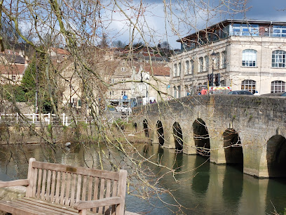
| Description | : | Bradford-on-Avon Cemetery, Holt Road, Bradford-Upon-Avon. Nearly 8,000 burial records, from 21st August 1856 to 7th April 1915, are available as computerised index data only. Burial records, from 21st April 1915 to 5th January 2010, are available as burial register scans in various formats with between 8 and 20 entries per scanned page. |
frequently asked questions (FAQ):
-
Where is Bradford on Avon Cemetery?
Bradford on Avon Cemetery is located at Holt Road Bradford-on-Avon, Wiltshire Unitary Authority ,Wiltshire ,England.
-
Bradford on Avon Cemetery cemetery's updated grave count on graveviews.com?
0 memorials
-
Where are the coordinates of the Bradford on Avon Cemetery?
Latitude: 51.3468700
Longitude: -2.2336400
Nearby Cemetories:
1. Holt Cemetery
Bradford-on-Avon, Wiltshire Unitary Authority, England
Coordinate: 51.3468710, -2.2352160
2. Christ Church Churchyard
Bradford-on-Avon, Wiltshire Unitary Authority, England
Coordinate: 51.3507000, -2.2493360
3. Holy Trinity Churchyard
Bradford-on-Avon, Wiltshire Unitary Authority, England
Coordinate: 51.3465927, -2.2538147
4. Broughton Gifford Cemetery
Broughton Gifford, Wiltshire Unitary Authority, England
Coordinate: 51.3665806, -2.1760188
5. Saint Peters Churchyard
Freshford, Bath and North East Somerset Unitary Authority, England
Coordinate: 51.3400570, -2.3033340
6. Farleigh Hungerford Castle
Farleigh Hungerford, Mendip District, England
Coordinate: 51.3173500, -2.2869590
7. St Leonard Churchyard
Farleigh Hungerford, Mendip District, England
Coordinate: 51.3155390, -2.2884820
8. Freshford Cemetery
Freshford, Bath and North East Somerset Unitary Authority, England
Coordinate: 51.3379620, -2.3082970
9. St. Michael's Churchyard
Atworth, Wiltshire Unitary Authority, England
Coordinate: 51.3910250, -2.2037350
10. Atworth Independent Churchyard
Atworth, Wiltshire Unitary Authority, England
Coordinate: 51.3926890, -2.1991210
11. Claverton Cemetery
Bath, Bath and North East Somerset Unitary Authority, England
Coordinate: 51.3758190, -2.3060720
12. St. Mary's Churchyard
Claverton, Bath and North East Somerset Unitary Authority, England
Coordinate: 51.3757560, -2.3061500
13. All Saints Churchyard
Tellisford, Mendip District, England
Coordinate: 51.2997270, -2.2877180
14. St. Michael's Churchyard
Monkton Combe, Bath and North East Somerset Unitary Authority, England
Coordinate: 51.3559540, -2.3285700
15. St. John the Baptist Churchyard
Hinton Charterhouse, Bath and North East Somerset Unitary Authority, England
Coordinate: 51.3233330, -2.3219440
16. Midford Burial Ground
Bath, Bath and North East Somerset Unitary Authority, England
Coordinate: 51.3394360, -2.3391424
17. Christ Church Churchyard
Rode, Mendip District, England
Coordinate: 51.2861620, -2.2790890
18. St Swithun Churchyard
Bathford, Bath and North East Somerset Unitary Authority, England
Coordinate: 51.3981960, -2.3060840
19. St. Philip’s and St. James’
Corsham, Wiltshire Unitary Authority, England
Coordinate: 51.4125733, -2.2017900
20. Box Cemetery
Box, Wiltshire Unitary Authority, England
Coordinate: 51.4142265, -2.2597129
21. St. Thomas A. Becket Churchyard
Box, Wiltshire Unitary Authority, England
Coordinate: 51.4151440, -2.2550730
22. Union Chapel
Combe Down, Bath and North East Somerset Unitary Authority, England
Coordinate: 51.3594751, -2.3443662
23. Prior Park College
Bath, Bath and North East Somerset Unitary Authority, England
Coordinate: 51.3645990, -2.3442400
24. St Lawrence Churchyard
Rode, Mendip District, England
Coordinate: 51.2792750, -2.2765370