
| Memorials | : | 16 |
| Location | : | Benton County, USA |
| Coordinate | : | 36.1018982, -94.5346985 |
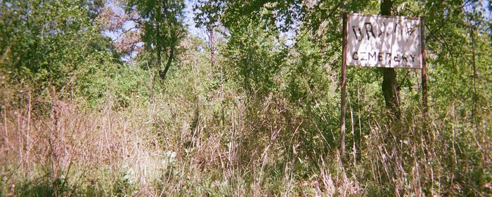
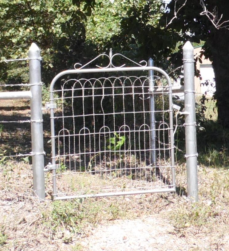
| Description | : | Brady Cemetery is located in Benton County on the Benton/Washington County line on Washington County Road 801 about 1/10 of a mile west of Arkansas Highway 59. The GPS location is N36°06.074' W094°32.071' at about 1000' elevation. The cemetery is directly behind the sign and is in as sad a condition as the sign. Several years ago, a teenage neighbor boy tried to clean up the sign by using electrician's tape to redo the lettering. Benton county authorities sent out a crew of prisoner's about 2005 to clear brush but left no provisions for continued care. Several... Read More |
frequently asked questions (FAQ):
-
Where is Brady Cemetery?
Brady Cemetery is located at Benton County ,Arkansas ,USA.
-
Brady Cemetery cemetery's updated grave count on graveviews.com?
16 memorials
-
Where are the coordinates of the Brady Cemetery?
Latitude: 36.1018982
Longitude: -94.5346985


Nearby Cemetories:
1. Mott Cemetery
Norwood, Benton County, USA
Coordinate: 36.1183900, -94.5118000
2. Jack Bean Cemetery
Baron, Adair County, USA
Coordinate: 36.1143797, -94.5689632
3. Harrell Cemetery
Cincinnati, Washington County, USA
Coordinate: 36.0736820, -94.5065660
4. Watts Cemetery
Watts, Adair County, USA
Coordinate: 36.1133003, -94.5774994
5. Norwood Cemetery
Washington County, USA
Coordinate: 36.1006012, -94.4741974
6. Caleb Davis Cemetery
Siloam Springs, Benton County, USA
Coordinate: 36.1260440, -94.4775465
7. Norwood Family Cemetery
Norwood, Benton County, USA
Coordinate: 36.1133200, -94.4633300
8. Bell Cemetery
Adair County, USA
Coordinate: 36.1567001, -94.5653000
9. Peden Cemetery
Cincinnati, Washington County, USA
Coordinate: 36.0405940, -94.5273010
10. Sixkiller Cemetery
Ballard, Adair County, USA
Coordinate: 36.0753950, -94.6126270
11. Parris Cemetery
Adair County, USA
Coordinate: 36.0327460, -94.5473640
12. West Pool Cemetery
Cincinnati, Washington County, USA
Coordinate: 36.0281920, -94.5171500
13. Rogers Family Cemetery
Westville, Adair County, USA
Coordinate: 36.0468520, -94.5995490
14. Old Union Cemetery
Cincinnati, Washington County, USA
Coordinate: 36.0297012, -94.5046997
15. Baptist Mission Cemetery
Westville, Adair County, USA
Coordinate: 36.0354620, -94.5835950
16. George Cemetery
Siloam Springs, Benton County, USA
Coordinate: 36.1852722, -94.5149078
17. Hastie Cemetery
Siloam Springs, Benton County, USA
Coordinate: 36.1853600, -94.5145230
18. Woodall Cemetery
Adair County, USA
Coordinate: 36.0230890, -94.5774360
19. Lacie Cemetery
Westville, Adair County, USA
Coordinate: 36.0336660, -94.6007720
20. Old Baptist Cemetery
Siloam Springs, Benton County, USA
Coordinate: 36.1885840, -94.5382110
21. Gunter Cemetery
Siloam Springs, Benton County, USA
Coordinate: 36.1889000, -94.5366974
22. Hico Cemetery
Siloam Springs, Benton County, USA
Coordinate: 36.1888810, -94.5377340
23. Oak Hill Cemetery
Siloam Springs, Benton County, USA
Coordinate: 36.1871986, -94.5599976
24. Grace Episcopal Columbarium
Siloam Springs, Benton County, USA
Coordinate: 36.1902670, -94.5409020