
| Memorials | : | 1 |
| Location | : | Adair County, USA |
| Coordinate | : | 36.0230890, -94.5774360 |
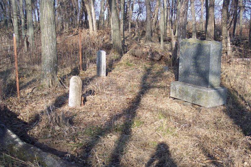
| Description | : | This cemetery was established around the year 1840 soon after the Cherokees arrived in present-day Oklahoma on the Trail of Tears. It is situated in Section 19, Township 18N, Range 26E in Adair County, Oklahoma, approximately 2.5 miles north of Westville. The last burial occurred in 1921 upon the death of Millard A. Wagnon. The funeral procession approached the cemetery from the north using Old Highway 17, and then it proceeded up the A.C. Williams family driveway to the cemetery. In 1937, interviewers Hummingbird and Bigby visited the cemetery as part of the Works Progress Administration's Indian-Pioneer History Project for... Read More |
frequently asked questions (FAQ):
-
Where is Woodall Cemetery?
Woodall Cemetery is located at Adair County ,Oklahoma ,USA.
-
Woodall Cemetery cemetery's updated grave count on graveviews.com?
1 memorials
-
Where are the coordinates of the Woodall Cemetery?
Latitude: 36.0230890
Longitude: -94.5774360
Nearby Cemetories:
1. Baptist Mission Cemetery
Westville, Adair County, USA
Coordinate: 36.0354620, -94.5835950
2. Westville Cemetery
Westville, Adair County, USA
Coordinate: 36.0088997, -94.5753021
3. Lacie Cemetery
Westville, Adair County, USA
Coordinate: 36.0336660, -94.6007720
4. Phillips Cemetery
Westville, Adair County, USA
Coordinate: 36.0024986, -94.5580978
5. Parris Cemetery
Adair County, USA
Coordinate: 36.0327460, -94.5473640
6. Rogers Family Cemetery
Westville, Adair County, USA
Coordinate: 36.0468520, -94.5995490
7. Foreman Cemetery
Westville, Adair County, USA
Coordinate: 35.9928017, -94.5830994
8. Peden Cemetery
Cincinnati, Washington County, USA
Coordinate: 36.0405940, -94.5273010
9. Crittenden Cemetery
Westville, Adair County, USA
Coordinate: 35.9919014, -94.5330963
10. West Pool Cemetery
Cincinnati, Washington County, USA
Coordinate: 36.0281920, -94.5171500
11. Fodder Cemetery
Westville, Adair County, USA
Coordinate: 35.9826580, -94.6159720
12. Corntassel Cemetery
Westville, Adair County, USA
Coordinate: 35.9815250, -94.6213310
13. Old Union Cemetery
Cincinnati, Washington County, USA
Coordinate: 36.0297012, -94.5046997
14. Sixkiller Cemetery
Ballard, Adair County, USA
Coordinate: 36.0753950, -94.6126270
15. Old Green Cemetery
Westville, Adair County, USA
Coordinate: 35.9770000, -94.6260000
16. Gibson Cemetery
Summers, Washington County, USA
Coordinate: 36.0160770, -94.5001330
17. Alberty Cemetery
Westville, Adair County, USA
Coordinate: 35.9653015, -94.5441971
18. Ketcher Cemetery
Westville, Adair County, USA
Coordinate: 35.9911003, -94.6549988
19. Hutch Cemetery
Cincinnati, Washington County, USA
Coordinate: 36.0163640, -94.4879260
20. Harrell Cemetery
Cincinnati, Washington County, USA
Coordinate: 36.0736820, -94.5065660
21. West Cemetery
Summers, Washington County, USA
Coordinate: 35.9671200, -94.5108700
22. Ganderville Cemetery
Summers, Washington County, USA
Coordinate: 35.9692001, -94.4997025
23. Beaty Cemetery #2
Lincoln, Washington County, USA
Coordinate: 36.0217960, -94.4720420
24. Brady Cemetery
Benton County, USA
Coordinate: 36.1018982, -94.5346985