| Memorials | : | 0 |
| Location | : | Westville, Adair County, USA |
| Coordinate | : | 36.0336660, -94.6007720 |
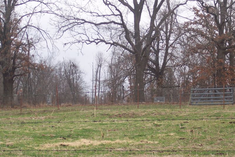
| Description | : | This cemetery was established in 1879 upon the death of Ellen Sixkiller, the wife of Taylor Sixkiller. It is situated in Section 13, Range 25E, Township 18N in Adair County, Oklahoma approximately 2.5 miles north of Westville. In 1969, historians James W. Tyner and Alice Tyner Timmons surveyed the cemetery and noted that approximately thirty-six graves existed, many marked with only sandstones. Since that time cattle have damaged and overturned headstones. Today, approximately twenty graves are marked. There is no road to the cemetery as it is located on private property. However, the owner allows visitors if permission... Read More |
frequently asked questions (FAQ):
-
Where is Lacie Cemetery?
Lacie Cemetery is located at Westville, Adair County ,Oklahoma ,USA.
-
Lacie Cemetery cemetery's updated grave count on graveviews.com?
0 memorials
-
Where are the coordinates of the Lacie Cemetery?
Latitude: 36.0336660
Longitude: -94.6007720
Nearby Cemetories:
1. Rogers Family Cemetery
Westville, Adair County, USA
Coordinate: 36.0468520, -94.5995490
2. Baptist Mission Cemetery
Westville, Adair County, USA
Coordinate: 36.0354620, -94.5835950
3. Woodall Cemetery
Adair County, USA
Coordinate: 36.0230890, -94.5774360
4. Westville Cemetery
Westville, Adair County, USA
Coordinate: 36.0088997, -94.5753021
5. Sixkiller Cemetery
Ballard, Adair County, USA
Coordinate: 36.0753950, -94.6126270
6. Parris Cemetery
Adair County, USA
Coordinate: 36.0327460, -94.5473640
7. Foreman Cemetery
Westville, Adair County, USA
Coordinate: 35.9928017, -94.5830994
8. Phillips Cemetery
Westville, Adair County, USA
Coordinate: 36.0024986, -94.5580978
9. Fodder Cemetery
Westville, Adair County, USA
Coordinate: 35.9826580, -94.6159720
10. Corntassel Cemetery
Westville, Adair County, USA
Coordinate: 35.9815250, -94.6213310
11. Peden Cemetery
Cincinnati, Washington County, USA
Coordinate: 36.0405940, -94.5273010
12. Old Green Cemetery
Westville, Adair County, USA
Coordinate: 35.9770000, -94.6260000
13. Ketcher Cemetery
Westville, Adair County, USA
Coordinate: 35.9911003, -94.6549988
14. West Pool Cemetery
Cincinnati, Washington County, USA
Coordinate: 36.0281920, -94.5171500
15. Crittenden Cemetery
Westville, Adair County, USA
Coordinate: 35.9919014, -94.5330963
16. New Hope Cemetery
Chance, Adair County, USA
Coordinate: 36.0699670, -94.6771930
17. Old Union Cemetery
Cincinnati, Washington County, USA
Coordinate: 36.0297012, -94.5046997
18. Watts Cemetery
Watts, Adair County, USA
Coordinate: 36.1133003, -94.5774994
19. Alberty Cemetery
Westville, Adair County, USA
Coordinate: 35.9653015, -94.5441971
20. Gibson Cemetery
Summers, Washington County, USA
Coordinate: 36.0160770, -94.5001330
21. Jack Bean Cemetery
Baron, Adair County, USA
Coordinate: 36.1143797, -94.5689632
22. Harrell Cemetery
Cincinnati, Washington County, USA
Coordinate: 36.0736820, -94.5065660
23. Brady Cemetery
Benton County, USA
Coordinate: 36.1018982, -94.5346985
24. Hutch Cemetery
Cincinnati, Washington County, USA
Coordinate: 36.0163640, -94.4879260

