
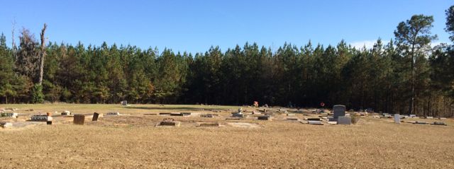
| Memorials | : | 1 |
| Location | : | Mathews, Montgomery County, USA |
| Coordinate | : | 32.1655900, -86.0595300 |
| Description | : | Matthews is mostly listed as Mathews. |
frequently asked questions (FAQ):
-
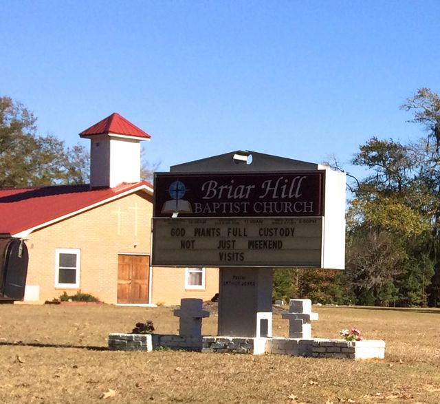
Where is Briar Hill Baptist Church Cemetery?
Briar Hill Baptist Church Cemetery is located at 3779 U.S. 82 Mathews, Montgomery County ,Alabama , 36052USA.
-
Briar Hill Baptist Church Cemetery cemetery's updated grave count on graveviews.com?
1 memorials
-
Where are the coordinates of the Briar Hill Baptist Church Cemetery?
Latitude: 32.1655900
Longitude: -86.0595300
Nearby Cemetories:
1. Elizabeth Missionary Baptist Church Cemetery
Mathews, Montgomery County, USA
Coordinate: 32.1464630, -86.1001640
2. Panhandle Cemetery
Montgomery County, USA
Coordinate: 32.2075005, -86.0492020
3. Barnett Cemetery
Mathews, Montgomery County, USA
Coordinate: 32.2106018, -86.0511017
4. Sand Creek Cemetery
Montgomery County, USA
Coordinate: 32.1122500, -86.0656180
5. Carter Hill Cemetery
Montgomery, Montgomery County, USA
Coordinate: 32.1926350, -86.1151910
6. Orange Cemetery
Montgomery County, USA
Coordinate: 32.1944008, -86.0017014
7. Old Hopewell Church Cemetery
Fitzpatrick, Bullock County, USA
Coordinate: 32.1703410, -85.9787040
8. New Providence Missionary Baptist Church Cemetery
Ramer, Montgomery County, USA
Coordinate: 32.1482400, -86.1394000
9. Pilgrim Missionary Baptist Church Cemetery
Ramer, Montgomery County, USA
Coordinate: 32.1127500, -86.1342000
10. Meriwether Cemetery
Montgomery County, USA
Coordinate: 32.2430992, -86.0136032
11. Norman Urquhart Cemetery
Ramer, Montgomery County, USA
Coordinate: 32.1003350, -86.1275550
12. Warrior Hill Baptist Church Cemetery
Pine Level, Montgomery County, USA
Coordinate: 32.0778660, -86.0624530
13. Panther Creek Baptist Church Cemetery
Fitzpatrick, Bullock County, USA
Coordinate: 32.2175980, -85.9754520
14. Bethany Cemetery
Lowndes County, USA
Coordinate: 32.1721992, -86.1652985
15. Spring Hill Baptist Church Cemetery
Montgomery County, USA
Coordinate: 32.0787810, -86.0869330
16. Pine Level United Methodist Church Cemetery
Pine Level, Montgomery County, USA
Coordinate: 32.0706558, -86.0571442
17. Gilmer Cemetery
Montgomery County, USA
Coordinate: 32.2627983, -86.0693970
18. Harrdt Cemetery
Montgomery County, USA
Coordinate: 32.2627983, -86.0406036
19. Mount Zion Baptist Cemetery
Ramer, Montgomery County, USA
Coordinate: 32.1702110, -86.1757950
20. Frazer-McLeod Cemetery
Pine Level, Montgomery County, USA
Coordinate: 32.0714560, -86.0959480
21. Pine Level Baptist Church Cemetery
Pine Level, Montgomery County, USA
Coordinate: 32.0663757, -86.0613251
22. Mount Zion AME Church Cemetery
Pine Level, Montgomery County, USA
Coordinate: 32.0660460, -86.0543472
23. Mount Zion Road Cemetery
Ramer, Montgomery County, USA
Coordinate: 32.1704880, -86.1773560
24. Bethesda Cemetery
Montgomery County, USA
Coordinate: 32.0792007, -85.9991989