
| Memorials | : | 0 |
| Location | : | Gays Mills, Crawford County, USA |
| Coordinate | : | 43.3117600, -90.8431100 |
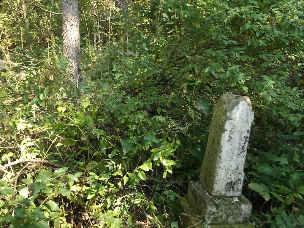
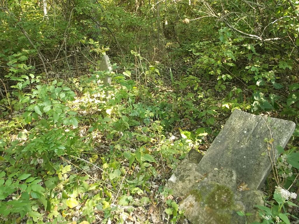
| Description | : | This cemetery is some what remote being off Hwy 131 just outside of Gays Mills out in the woods. It is of the family members of Lyman and Mary Brown and grandchildren who is said to have died one by one from some unknown disease. The stones that remain are in rough shape and hard to read |
frequently asked questions (FAQ):
-
Where is Brown Family Cemetery?
Brown Family Cemetery is located at Gays Mills, Crawford County ,Wisconsin ,USA.
-
Brown Family Cemetery cemetery's updated grave count on graveviews.com?
0 memorials
-
Where are the coordinates of the Brown Family Cemetery?
Latitude: 43.3117600
Longitude: -90.8431100
Nearby Cemetories:
1. Gays Mills Cemetery
Gays Mills, Crawford County, USA
Coordinate: 43.3244019, -90.8392029
2. Bell Center Cemetery
Bell Center, Crawford County, USA
Coordinate: 43.2851000, -90.8271330
3. Crow Creek Cemetery
Prairie du Chien, Crawford County, USA
Coordinate: 43.2744200, -90.8162400
4. McAuley-Halls-Branch Pioneer Cemetery
Mount Sterling, Crawford County, USA
Coordinate: 43.3173800, -90.9168430
5. Coleman-Whiteaker Cemetery
Bell Center, Crawford County, USA
Coordinate: 43.2919998, -90.7740021
6. Mount Sterling Lutheran Cemetery
Mount Sterling, Crawford County, USA
Coordinate: 43.3174000, -90.9259830
7. Haney Valley Cemetery
Petersburg, Crawford County, USA
Coordinate: 43.2461014, -90.8681030
8. Yankeetown Cemetery
Soldiers Grove, Crawford County, USA
Coordinate: 43.3751340, -90.8010520
9. Evergreen Cemetery
Seneca, Crawford County, USA
Coordinate: 43.2966995, -90.9411011
10. Mount Pleasant Cemetery
Mount Zion, Crawford County, USA
Coordinate: 43.2523500, -90.7845170
11. Mook Cemetery
Rolling Ground, Crawford County, USA
Coordinate: 43.3278000, -90.7400000
12. Utica Lutheran Church Cemetery
Mount Sterling, Crawford County, USA
Coordinate: 43.3506000, -90.9381830
13. Montgomeryville Cemetery
Montgomeryville, Crawford County, USA
Coordinate: 43.3567830, -90.7451000
14. Haney Ridge Cemetery
Barnum, Crawford County, USA
Coordinate: 43.2343830, -90.7907330
15. Barnum Cemetery
Barnum, Crawford County, USA
Coordinate: 43.2226670, -90.8343670
16. Saint Phillips Catholic Cemetery
Rolling Ground, Crawford County, USA
Coordinate: 43.3280400, -90.7195700
17. Forest Hill Cemetery
Soldiers Grove, Crawford County, USA
Coordinate: 43.3923830, -90.7821000
18. Towerville Cemetery
Towerville, Crawford County, USA
Coordinate: 43.4035350, -90.8878540
19. Union Hill Cemetery
Mount Zion, Crawford County, USA
Coordinate: 43.2557210, -90.7309770
20. Tell Cemetery
Towerville, Crawford County, USA
Coordinate: 43.4113700, -90.8374800
21. Graves Cemetery
Barnum, Crawford County, USA
Coordinate: 43.2200012, -90.7893982
22. Eitsert Cemetery
Fairview, Crawford County, USA
Coordinate: 43.3602982, -90.9638977
23. Saint Patricks Catholic Cemetery
Seneca, Crawford County, USA
Coordinate: 43.2603000, -90.9632000
24. South Kickapoo Cemetery
Soldiers Grove, Crawford County, USA
Coordinate: 43.4166170, -90.8375170