
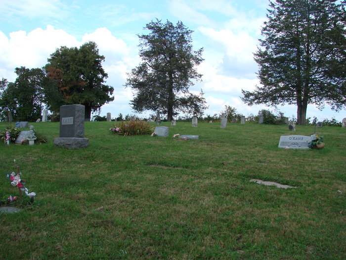
| Memorials | : | 6 |
| Location | : | Mount Zion, Crawford County, USA |
| Coordinate | : | 43.2523500, -90.7845170 |
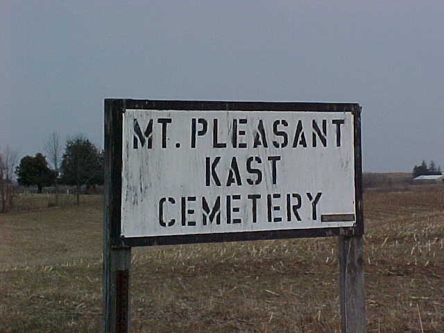
| Description | : | The Kast Cemetery is recorded as starting on deed date of April 12,1869 and recorded on Nov;15,1870.The land was bought from Elizabeth Dowling.It included the payment of $15.00 for the North West Quarter of the South West Quarter South West 18,in Town 9,Range 3 commencing.Chauncy Kast was recorded as trustee of the Mt.Pleasant Cemetery discribed as being in the one and a half acres in the South West corner,there of used for cemetery purposes in Section 18,Township 9,Range 3. Thus,the origanal and proper name for the Kast Cemetery is the Mt.Pleasant Cemetery. Elizabeth Dowling bought her farm from Randolf Elliot... Read More |
frequently asked questions (FAQ):
-
Where is Mount Pleasant Cemetery?
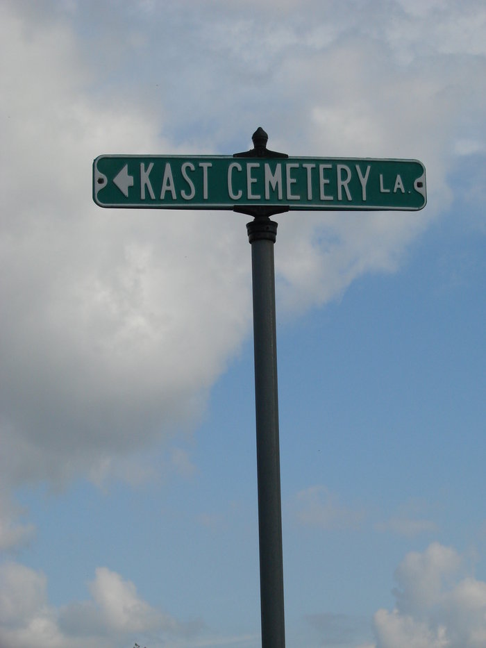
Mount Pleasant Cemetery is located at Kast Cemetery Road Mount Zion, Crawford County ,Wisconsin ,USA.
-
Mount Pleasant Cemetery cemetery's updated grave count on graveviews.com?
4 memorials
-
Where are the coordinates of the Mount Pleasant Cemetery?
Latitude: 43.2523500
Longitude: -90.7845170
Nearby Cemetories:
1. Haney Ridge Cemetery
Barnum, Crawford County, USA
Coordinate: 43.2343830, -90.7907330
2. Crow Creek Cemetery
Prairie du Chien, Crawford County, USA
Coordinate: 43.2744200, -90.8162400
3. Graves Cemetery
Barnum, Crawford County, USA
Coordinate: 43.2200012, -90.7893982
4. Union Hill Cemetery
Mount Zion, Crawford County, USA
Coordinate: 43.2557210, -90.7309770
5. Coleman-Whiteaker Cemetery
Bell Center, Crawford County, USA
Coordinate: 43.2919998, -90.7740021
6. Bell Center Cemetery
Bell Center, Crawford County, USA
Coordinate: 43.2851000, -90.8271330
7. Barnum Cemetery
Barnum, Crawford County, USA
Coordinate: 43.2226670, -90.8343670
8. Haney Valley Cemetery
Petersburg, Crawford County, USA
Coordinate: 43.2461014, -90.8681030
9. Pioneer Wood Cook Reynolds Cemetery
Steuben, Crawford County, USA
Coordinate: 43.1876280, -90.7852540
10. Saint Patricks Cemetery
Mount Zion, Crawford County, USA
Coordinate: 43.2397003, -90.6956024
11. Brown Family Cemetery
Gays Mills, Crawford County, USA
Coordinate: 43.3117600, -90.8431100
12. Union Steele Green Cemetery
Harmony Hill, Crawford County, USA
Coordinate: 43.1986008, -90.7164001
13. Posey Cemetery
Steuben, Crawford County, USA
Coordinate: 43.1810989, -90.8283005
14. Mook Cemetery
Rolling Ground, Crawford County, USA
Coordinate: 43.3278000, -90.7400000
15. Gays Mills Cemetery
Gays Mills, Crawford County, USA
Coordinate: 43.3244019, -90.8392029
16. Saint Phillips Catholic Cemetery
Rolling Ground, Crawford County, USA
Coordinate: 43.3280400, -90.7195700
17. Pleasant Mound Cemetery
Easter Rock, Crawford County, USA
Coordinate: 43.1632996, -90.7630997
18. West Fork Cemetery
Excelsior, Richland County, USA
Coordinate: 43.2630997, -90.6500015
19. Chitwood Cemetery
Westport, Richland County, USA
Coordinate: 43.2245120, -90.6509830
20. Wayne #1 Cemetery
Marietta, Crawford County, USA
Coordinate: 43.1699982, -90.7035980
21. Cisco Dremsa Farm Cemetery
Boscobel, Grant County, USA
Coordinate: 43.1695260, -90.7017966
22. Wayne #2 Cemetery
Boydtown, Crawford County, USA
Coordinate: 43.1490800, -90.8201200
23. Main Family Cemetery
Easter Rock, Crawford County, USA
Coordinate: 43.1445700, -90.7782400
24. Montgomeryville Cemetery
Montgomeryville, Crawford County, USA
Coordinate: 43.3567830, -90.7451000