
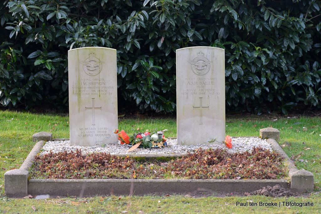
| Memorials | : | 0 |
| Location | : | Brummen, Brummen Municipality, Netherlands |
| Coordinate | : | 52.0986100, 6.1521500 |
| Description | : | The town of Brummen is situated to the south-east of Apeldoorn on the N48. From the motorway A12, which runs between Utrecht and Oberhausen, turn off at the junction Velperbroek onto the motorway A48 in the direction of Zutphen. Follow the A48 to the end and turn left onto the N317. At the next junction turn right onto the N48 in the direction of Zutphen. On reaching the town of Brummen turn left into Arnhemsestraat in the direction of the town centre. Follow the main road into Zutphensestraat and at the fork bear left into Voorsterweg. The cemetery is along... Read More |
frequently asked questions (FAQ):
-
Where is Brummen General Cemetery?
Brummen General Cemetery is located at Brummen, Brummen Municipality ,Gelderland ,Netherlands.
-
Brummen General Cemetery cemetery's updated grave count on graveviews.com?
0 memorials
-
Where are the coordinates of the Brummen General Cemetery?
Latitude: 52.0986100
Longitude: 6.1521500
Nearby Cemetories:
1. Hall General Cemetery
Hall, Brummen Municipality, Netherlands
Coordinate: 52.1068100, 6.0926700
2. Steenderen General Cemetery
Steenderen, Bronckhorst Municipality, Netherlands
Coordinate: 52.0642600, 6.1848700
3. Joodse Begraafplaats
Zutphen Municipality, Netherlands
Coordinate: 52.1294720, 6.2053340
4. Baak Roman Catholic Cemetery
Baak, Bronckhorst Municipality, Netherlands
Coordinate: 52.0792600, 6.2253100
5. Dieren Imboslaan Cemetery
Dieren, Rheden Municipality, Netherlands
Coordinate: 52.0599300, 6.0975500
6. Olburgen Roman Catholic Cemetery
Olburgen, Bronckhorst Municipality, Netherlands
Coordinate: 52.0440100, 6.1235300
7. Zutphen General Cemetery
Zutphen, Zutphen Municipality, Netherlands
Coordinate: 52.1436300, 6.2132400
8. Oude Algemene Begraafplaats
Dieren, Rheden Municipality, Netherlands
Coordinate: 52.0485900, 6.0967600
9. Sint-Willibrorduskerkhof
Wichmond, Bronckhorst Municipality, Netherlands
Coordinate: 52.0931500, 6.2545600
10. Warnsveld Cemetery
Warnsveld, Zutphen Municipality, Netherlands
Coordinate: 52.1350600, 6.2543600
11. Loenen Rooms-Katholieke Begraafplaats
Loenen, Apeldoorn Municipality, Netherlands
Coordinate: 52.1215700, 6.0216900
12. Doesburg Begraafplaats
Doesburg, Doesburg Municipality, Netherlands
Coordinate: 52.0152462, 6.1396174
13. Landgoed Groenouwe Mausoleum
Loenen, Apeldoorn Municipality, Netherlands
Coordinate: 52.0965000, 6.0120300
14. Nationaal Ereveld Loenen
Loenen, Apeldoorn Municipality, Netherlands
Coordinate: 52.1147600, 6.0000200
15. Nationale Veteranenbegraafplaats Loenen
Loenen, Apeldoorn Municipality, Netherlands
Coordinate: 52.1138024, 5.9935134
16. Gorssel General Cemetery
Gorssel, Lochem Municipality, Netherlands
Coordinate: 52.1922700, 6.2033700
17. Voorst General Cemetery
Voorst, Voorst Municipality, Netherlands
Coordinate: 52.2041100, 6.1364900
18. Vorden General Cemetery
Vorden, Bronckhorst Municipality, Netherlands
Coordinate: 52.1110620, 6.3307630
19. Hengelo Gelderland General Cemetery
Hengelo, Bronckhorst Municipality, Netherlands
Coordinate: 52.0497300, 6.3137100
20. Hummelo-en-Keppel General Cemetery
Hummelo, Bronckhorst Municipality, Netherlands
Coordinate: 52.0024000, 6.2432600
21. Almen Cemetery
Almen, Lochem Municipality, Netherlands
Coordinate: 52.1738500, 6.2861500
22. NH Begraafplaats De Pinkel
Rheden, Rheden Municipality, Netherlands
Coordinate: 52.0087450, 6.0354830
23. Joodse Begraafplaats
Vorden, Bronckhorst Municipality, Netherlands
Coordinate: 52.1141700, 6.3546100
24. Rheden Heiderust General Cemetery
Rheden, Rheden Municipality, Netherlands
Coordinate: 52.0083600, 6.0077900