
| Memorials | : | 0 |
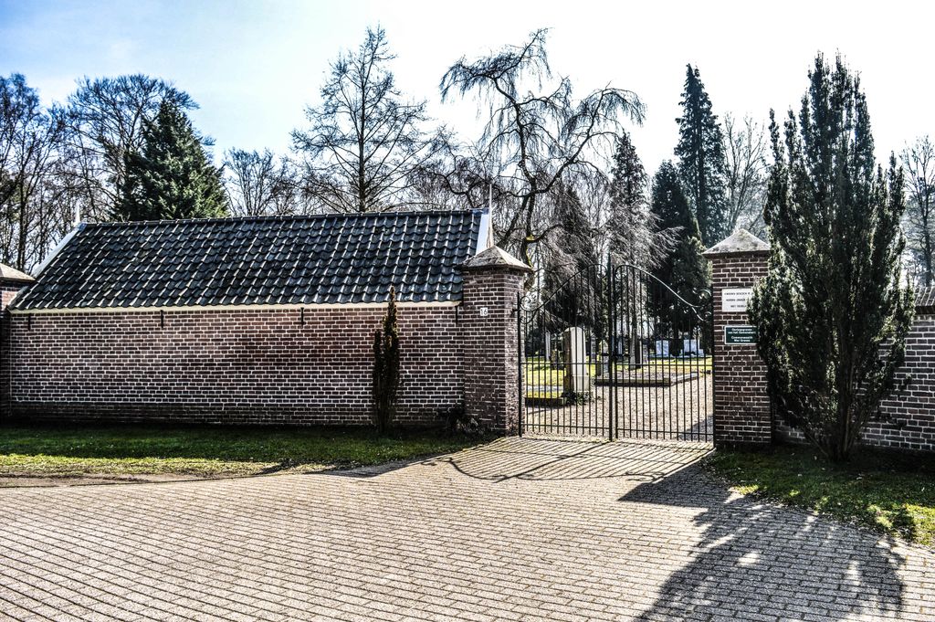
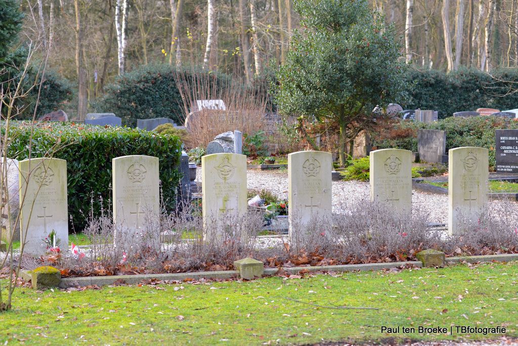
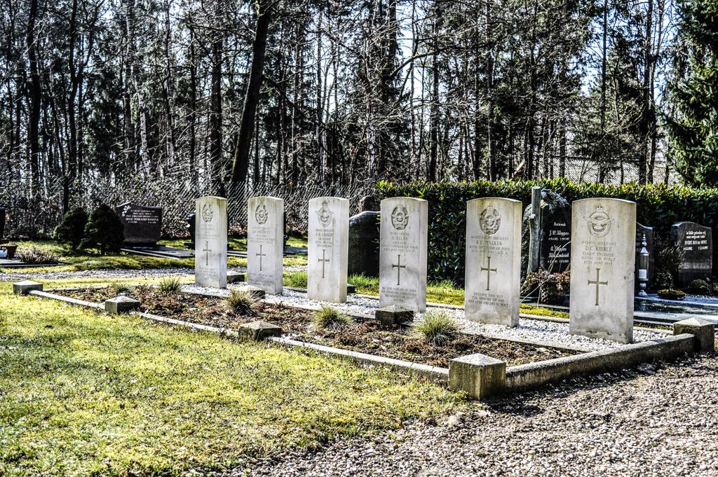
| Location | : | Hall, Brummen Municipality, Netherlands |
| Coordinate | : | 52.1068100, 6.0926700 |
| Description | : | Hall is a small village administered by Brummen, about 5 kilometres north-west of Brummen, which is a convenient centre. The cemetery lies about 1 kilometre south-west of Hal village church, on the road to Eerbeek. |
frequently asked questions (FAQ):
-
Where is Hall General Cemetery?
Hall General Cemetery is located at Hall, Brummen Municipality ,Gelderland ,Netherlands.
-
Hall General Cemetery cemetery's updated grave count on graveviews.com?
0 memorials
-
Where are the coordinates of the Hall General Cemetery?
Latitude: 52.1068100
Longitude: 6.0926700
Nearby Cemetories:
1. Brummen General Cemetery
Brummen, Brummen Municipality, Netherlands
Coordinate: 52.0986100, 6.1521500
2. Loenen Rooms-Katholieke Begraafplaats
Loenen, Apeldoorn Municipality, Netherlands
Coordinate: 52.1215700, 6.0216900
3. Dieren Imboslaan Cemetery
Dieren, Rheden Municipality, Netherlands
Coordinate: 52.0599300, 6.0975500
4. Landgoed Groenouwe Mausoleum
Loenen, Apeldoorn Municipality, Netherlands
Coordinate: 52.0965000, 6.0120300
5. Nationaal Ereveld Loenen
Loenen, Apeldoorn Municipality, Netherlands
Coordinate: 52.1147600, 6.0000200
6. Oude Algemene Begraafplaats
Dieren, Rheden Municipality, Netherlands
Coordinate: 52.0485900, 6.0967600
7. Nationale Veteranenbegraafplaats Loenen
Loenen, Apeldoorn Municipality, Netherlands
Coordinate: 52.1138024, 5.9935134
8. Olburgen Roman Catholic Cemetery
Olburgen, Bronckhorst Municipality, Netherlands
Coordinate: 52.0440100, 6.1235300
9. Steenderen General Cemetery
Steenderen, Bronckhorst Municipality, Netherlands
Coordinate: 52.0642600, 6.1848700
10. Joodse Begraafplaats
Zutphen Municipality, Netherlands
Coordinate: 52.1294720, 6.2053340
11. Zutphen General Cemetery
Zutphen, Zutphen Municipality, Netherlands
Coordinate: 52.1436300, 6.2132400
12. Baak Roman Catholic Cemetery
Baak, Bronckhorst Municipality, Netherlands
Coordinate: 52.0792600, 6.2253100
13. Begraafplaats Beekbergen
Beekbergen, Apeldoorn Municipality, Netherlands
Coordinate: 52.1531400, 5.9644400
14. Doesburg Begraafplaats
Doesburg, Doesburg Municipality, Netherlands
Coordinate: 52.0152462, 6.1396174
15. Sint-Willibrorduskerkhof
Wichmond, Bronckhorst Municipality, Netherlands
Coordinate: 52.0931500, 6.2545600
16. Voorst General Cemetery
Voorst, Voorst Municipality, Netherlands
Coordinate: 52.2041100, 6.1364900
17. Warnsveld Cemetery
Warnsveld, Zutphen Municipality, Netherlands
Coordinate: 52.1350600, 6.2543600
18. NH Begraafplaats De Pinkel
Rheden, Rheden Municipality, Netherlands
Coordinate: 52.0087450, 6.0354830
19. Gorssel General Cemetery
Gorssel, Lochem Municipality, Netherlands
Coordinate: 52.1922700, 6.2033700
20. Rheden Heiderust General Cemetery
Rheden, Rheden Municipality, Netherlands
Coordinate: 52.0083600, 6.0077900
21. Apeldoorn Joodse Begraafplaats
Apeldoorn, Apeldoorn Municipality, Netherlands
Coordinate: 52.1970310, 5.9617940
22. Rozendaal Communal Cemetery
Rozendaal, Rozendaal Municipality, Netherlands
Coordinate: 52.0131400, 5.9683700
23. Begraafplaats Heidehof
Ugchelen, Apeldoorn Municipality, Netherlands
Coordinate: 52.1777800, 5.9326800
24. Apeldoorn Arnhemseweg Catholic Cemetery
Apeldoorn, Apeldoorn Municipality, Netherlands
Coordinate: 52.2062100, 5.9624700