
| Memorials | : | 0 |
| Location | : | Olburgen, Bronckhorst Municipality, Netherlands |
| Coordinate | : | 52.0440100, 6.1235300 |
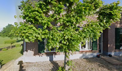
| Description | : | Not to be confused with Steenderen General Cemetery, which is a different cemetery. Olburgen is a village 6 kilometres south-west of Steenderen, lying 1 kilometre east of Dieren on the main Arnhem-Zutphen road. The Roman Catholic cemetery is very small and adjoins the church in the centre of the village. |
frequently asked questions (FAQ):
-
Where is Olburgen Roman Catholic Cemetery?
Olburgen Roman Catholic Cemetery is located at Olburgen, Bronckhorst Municipality ,Gelderland ,Netherlands.
-
Olburgen Roman Catholic Cemetery cemetery's updated grave count on graveviews.com?
0 memorials
-
Where are the coordinates of the Olburgen Roman Catholic Cemetery?
Latitude: 52.0440100
Longitude: 6.1235300
Nearby Cemetories:
1. Oude Algemene Begraafplaats
Dieren, Rheden Municipality, Netherlands
Coordinate: 52.0485900, 6.0967600
2. Dieren Imboslaan Cemetery
Dieren, Rheden Municipality, Netherlands
Coordinate: 52.0599300, 6.0975500
3. Doesburg Begraafplaats
Doesburg, Doesburg Municipality, Netherlands
Coordinate: 52.0152462, 6.1396174
4. Steenderen General Cemetery
Steenderen, Bronckhorst Municipality, Netherlands
Coordinate: 52.0642600, 6.1848700
5. Brummen General Cemetery
Brummen, Brummen Municipality, Netherlands
Coordinate: 52.0986100, 6.1521500
6. NH Begraafplaats De Pinkel
Rheden, Rheden Municipality, Netherlands
Coordinate: 52.0087450, 6.0354830
7. Hall General Cemetery
Hall, Brummen Municipality, Netherlands
Coordinate: 52.1068100, 6.0926700
8. Baak Roman Catholic Cemetery
Baak, Bronckhorst Municipality, Netherlands
Coordinate: 52.0792600, 6.2253100
9. Rheden Heiderust General Cemetery
Rheden, Rheden Municipality, Netherlands
Coordinate: 52.0083600, 6.0077900
10. Hummelo-en-Keppel General Cemetery
Hummelo, Bronckhorst Municipality, Netherlands
Coordinate: 52.0024000, 6.2432600
11. Landgoed Groenouwe Mausoleum
Loenen, Apeldoorn Municipality, Netherlands
Coordinate: 52.0965000, 6.0120300
12. Sint-Willibrorduskerkhof
Wichmond, Bronckhorst Municipality, Netherlands
Coordinate: 52.0931500, 6.2545600
13. Joodse Begraafplaats
Zutphen Municipality, Netherlands
Coordinate: 52.1294720, 6.2053340
14. Loenen Rooms-Katholieke Begraafplaats
Loenen, Apeldoorn Municipality, Netherlands
Coordinate: 52.1215700, 6.0216900
15. Rozendaal Communal Cemetery
Rozendaal, Rozendaal Municipality, Netherlands
Coordinate: 52.0131400, 5.9683700
16. Velp Old Protestant Cemetery
Velp, Rheden Municipality, Netherlands
Coordinate: 51.9927300, 5.9816100
17. Nationaal Ereveld Loenen
Loenen, Apeldoorn Municipality, Netherlands
Coordinate: 52.1147600, 6.0000200
18. Nationale Veteranenbegraafplaats Loenen
Loenen, Apeldoorn Municipality, Netherlands
Coordinate: 52.1138024, 5.9935134
19. Didam Protestant Cemetery
Didam, Montferland Municipality, Netherlands
Coordinate: 51.9360100, 6.1345300
20. Roman Catholic Cemetery
Duiven, Duiven Municipality, Netherlands
Coordinate: 51.9495185, 6.0238638
21. Algemene Begraafplaats 't Heijlige Lant
Duiven, Duiven Municipality, Netherlands
Coordinate: 51.9452663, 6.0353131
22. Zutphen General Cemetery
Zutphen, Zutphen Municipality, Netherlands
Coordinate: 52.1436300, 6.2132400
23. Joodse Begraafplaats
Zevenaar Municipality, Netherlands
Coordinate: 51.9310110, 6.0825120
24. Hengelo Gelderland General Cemetery
Hengelo, Bronckhorst Municipality, Netherlands
Coordinate: 52.0497300, 6.3137100