| Memorials | : | 1 |
| Location | : | Channel, Estrie Region, Canada |
| Coordinate | : | 45.2127800, -72.2341700 |
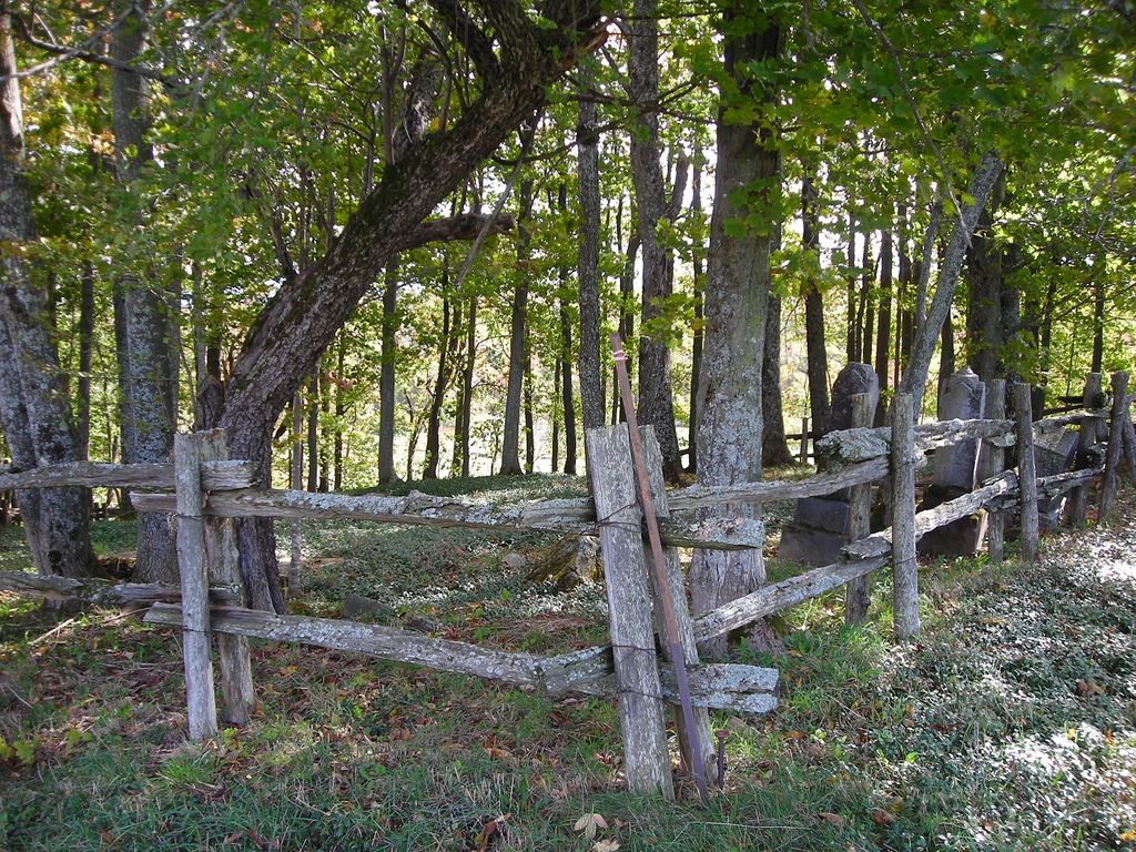
| Description | : | This cemetery is situated on a plot of land on the farm that was once settled by Christopher Bryant 1st. As in older days, many were buried on home farms. In later years, the plot was enlarged to include some Browns and Bowens, who married into the Bryant family. For many years, the cemetery remained unknown and unkept, until a few members of the more current Bryant families decided to restore and maintain it. It is nestled among a wooded area in an open field. It was surrounded by a rail fence. Most of the stones were broken and in bad... Read More |
frequently asked questions (FAQ):
-
Where is Bryant Cemetery?
Bryant Cemetery is located at Shuttleworth Road,Austin Channel, Estrie Region ,Quebec ,Canada.
-
Bryant Cemetery cemetery's updated grave count on graveviews.com?
1 memorials
-
Where are the coordinates of the Bryant Cemetery?
Latitude: 45.2127800
Longitude: -72.2341700
Nearby Cemetories:
1. Oliver Corner Cemetery
Oliver Corner, Estrie Region, Canada
Coordinate: 45.2036160, -72.1927880
2. East Bolton Cemetery
Bolton-Est, Estrie Region, Canada
Coordinate: 45.1944500, -72.2809800
3. Cimetière catholique d'Austin
Austin, Estrie Region, Canada
Coordinate: 45.1840000, -72.2735300
4. Ives Cemetery
Georgeville, Estrie Region, Canada
Coordinate: 45.1732900, -72.2231800
5. Cimetière Saint-Benoît du Lac
Saint-Benoît-du-Lac, Estrie Region, Canada
Coordinate: 45.1676110, -72.2721660
6. Bullock Cemetery
Georgeville, Estrie Region, Canada
Coordinate: 45.1433600, -72.2497700
7. Glenbrook Cemetery
Knowlton Landing, Estrie Region, Canada
Coordinate: 45.1643380, -72.3069160
8. Knowlton Maplehurst Farm Cemetery
Knowlton Landing, Estrie Region, Canada
Coordinate: 45.1506647, -72.2954754
9. Bolton Centre Cemetery
Bolton Centre, Estrie Region, Canada
Coordinate: 45.2013400, -72.3585100
10. Pine Hill Cemetery
Magog, Estrie Region, Canada
Coordinate: 45.2779970, -72.1475710
11. Cimetière Saint-Patrice
Magog, Estrie Region, Canada
Coordinate: 45.2795820, -72.1460800
12. Stickney Cemetery
Fitch Bay, Estrie Region, Canada
Coordinate: 45.1414430, -72.1528920
13. MacPherson Cemetery
Georgeville, Estrie Region, Canada
Coordinate: 45.1183900, -72.2520300
14. Cimetière Saint-Édouard
Eastman, Estrie Region, Canada
Coordinate: 45.2956100, -72.3056490
15. Cimetière de Saint-Ephrem
Fitch Bay, Estrie Region, Canada
Coordinate: 45.1204900, -72.1784500
16. Fitch Bay Cemetery
Fitch Bay, Estrie Region, Canada
Coordinate: 45.1178100, -72.1844000
17. Cherry River Cemetery
Orford, Estrie Region, Canada
Coordinate: 45.3094500, -72.1702800
18. Bissell Cemetery
Amy Corners, Estrie Region, Canada
Coordinate: 45.1056610, -72.1604400
19. Brown's Hill Cemetery
Ayer's Cliff, Estrie Region, Canada
Coordinate: 45.1480900, -72.0897100
20. Silver Valley Cemetery
Eastman, Estrie Region, Canada
Coordinate: 45.3203910, -72.3128540
21. McConnell Cemetery
Ayer's Cliff, Estrie Region, Canada
Coordinate: 45.1968570, -72.0575140
22. Bodwell Cemetery
Applegrove, Estrie Region, Canada
Coordinate: 45.0906810, -72.1911140
23. Apple Grove Cemetery
Applegrove, Estrie Region, Canada
Coordinate: 45.0815100, -72.1985800
24. Ayer's Cliff Cemetery
Ayer's Cliff, Estrie Region, Canada
Coordinate: 45.1702300, -72.0423600

