
| Memorials | : | 37 |
| Location | : | London Borough of Islington, England |
| Coordinate | : | 51.5236015, -0.0888900 |
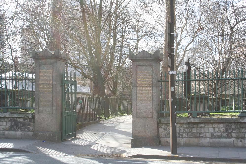
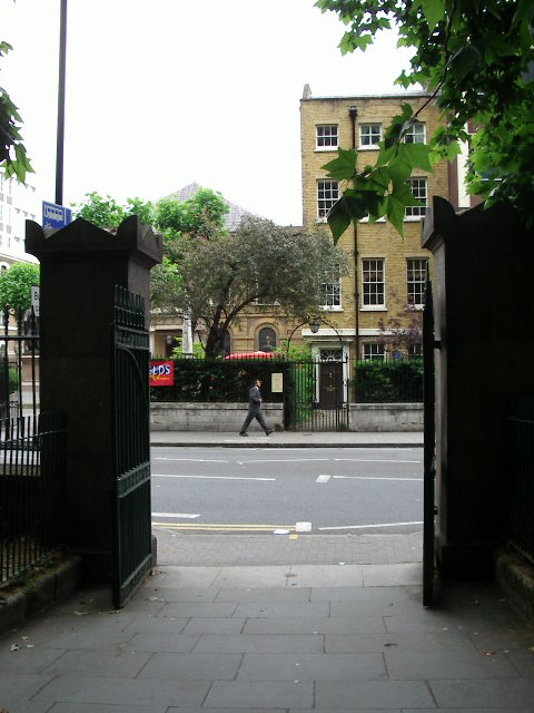
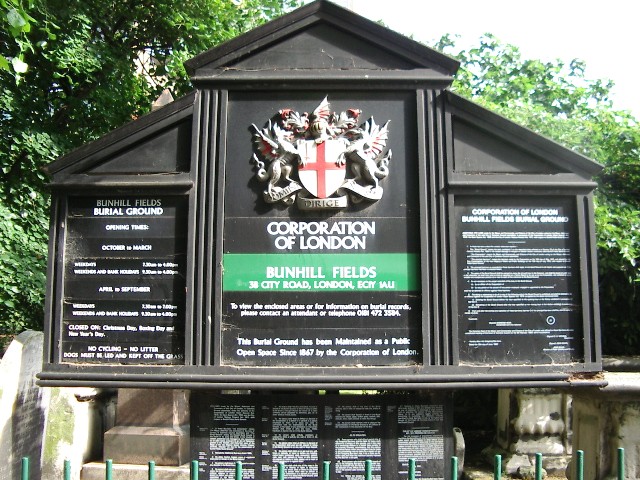
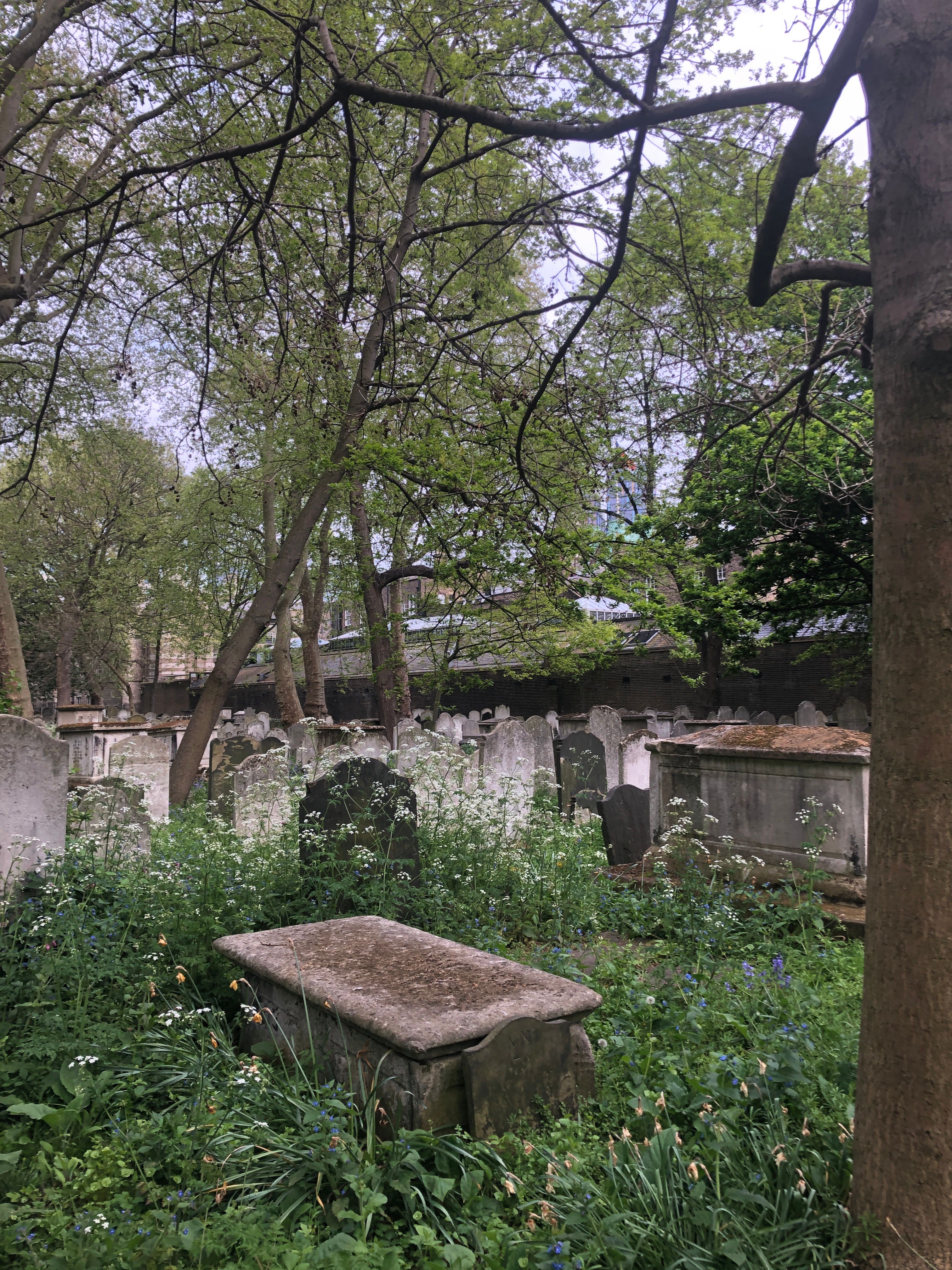
| Description | : | In 1665 the City of London Corporation decided to use some of the fen or moor fields as a common burial ground for the interment of bodies of inhabitants who had died of the plague and could not be accommodated in the churchyards.The burial ground attracted mainly dissenters from the Established Church who were of a Protestant persuasion, partly owing to their much larger numbers in the locality than other faiths who did not conform to the Church of England's ways, such as Catholics or Jewish citizens. Nonetheless, the burial ground was open for interment to anyone who could afford... Read More |
frequently asked questions (FAQ):
-
Where is Bunhill Fields Burial Ground?
Bunhill Fields Burial Ground is located at 38 City Road London Borough of Islington ,Greater London , EC1Y 1AUEngland.
-
Bunhill Fields Burial Ground cemetery's updated grave count on graveviews.com?
37 memorials
-
Where are the coordinates of the Bunhill Fields Burial Ground?
Latitude: 51.5236015
Longitude: -0.0888900


Nearby Cemetories:
1. Wesleys Chapel
London Borough of Islington, England
Coordinate: 51.5237140, -0.0865760
2. Quaker Gardens
London, City of London, England
Coordinate: 51.5239250, -0.0911890
3. Bunhill Fields Quaker Burying Ground
Islington, London Borough of Islington, England
Coordinate: 51.5239250, -0.0911890
4. St Luke Churchyard
St Luke's, London Borough of Islington, England
Coordinate: 51.5251312, -0.0941940
5. Old Church of St. Mary Moorfields (Defunct)
London, City of London, England
Coordinate: 51.5187890, -0.0857140
6. St. Giles Cripplegate Churchyard
London, City of London, England
Coordinate: 51.5187100, -0.0939510
7. St Mary's Moorfields Churchyard
London, City of London, England
Coordinate: 51.5177280, -0.0858980
8. Holywell Priory
Shoreditch, London Borough of Hackney, England
Coordinate: 51.5238050, -0.0785300
9. Plague Grave At Seward Street And Mount Mills
Clerkenwell, London Borough of Islington, England
Coordinate: 51.5259780, -0.0985880
10. Liverpool Street Station
London, City of London, England
Coordinate: 51.5187870, -0.0814920
11. Charthouse Chapel and Churchyard
City of London, England
Coordinate: 51.5209310, -0.0987080
12. Priory of St. Mary of Bethlehem Cemetery
Bishopsgate, City of London, England
Coordinate: 51.5183640, -0.0818180
13. St Clement with St Barnabas and St Matthew
Finsbury, London Borough of Islington, England
Coordinate: 51.5277700, -0.0977600
14. Charterhouse
London Borough of Islington, England
Coordinate: 51.5213890, -0.0997220
15. All Hallows on the Wall Churchyard
London, City of London, England
Coordinate: 51.5165990, -0.0843330
16. St Mary Aldermanbury Churchyard
London, City of London, England
Coordinate: 51.5164830, -0.0930720
17. St Albans Churchyard (Defunct)
London, City of London, England
Coordinate: 51.5166460, -0.0940880
18. St. Leonard Churchyard
Shoreditch, London Borough of Hackney, England
Coordinate: 51.5268230, -0.0773640
19. Guildhall
London, City of London, England
Coordinate: 51.5158200, -0.0911380
20. St Bartholomew the Great Churchyard
London, City of London, England
Coordinate: 51.5189300, -0.0995360
21. St Botolph Church
Bishopsgate, City of London, England
Coordinate: 51.5167080, -0.0816560
22. St. Botholph without Bishopsgate
Finsbury, London Borough of Islington, England
Coordinate: 51.5166840, -0.0815590
23. Austin Friars Churchyard
Broad Street, City of London, England
Coordinate: 51.5155030, -0.0854620
24. St Botolph Aldersgate Churchyard
London, City of London, England
Coordinate: 51.5169440, -0.0972220