
| Memorials | : | 32 |
| Location | : | Islington, London Borough of Islington, England |
| Coordinate | : | 51.5239250, -0.0911890 |
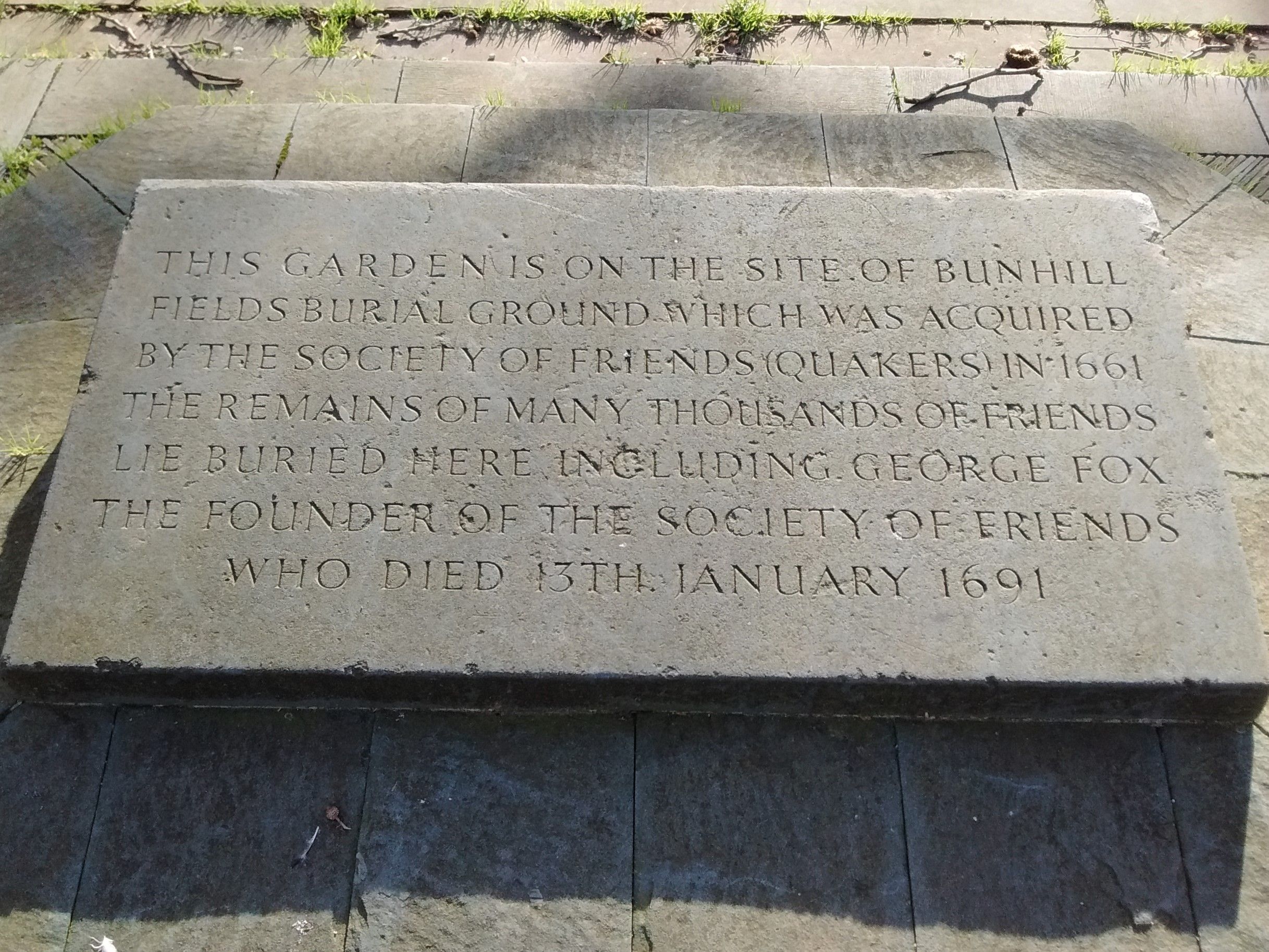
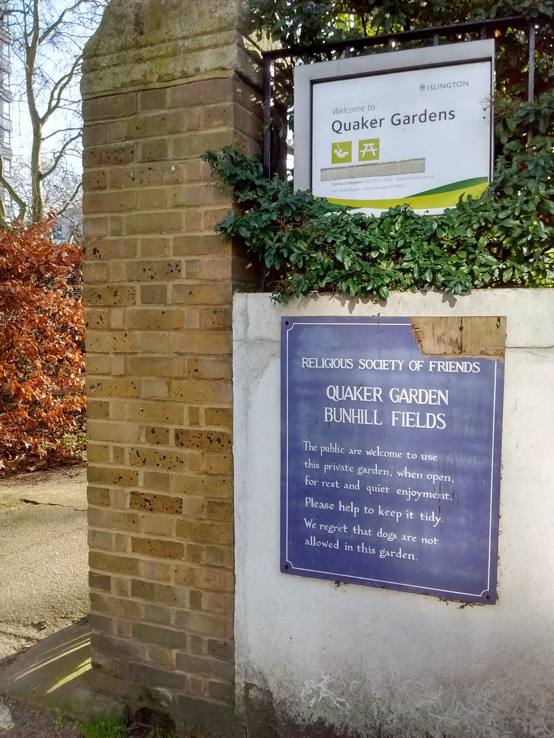
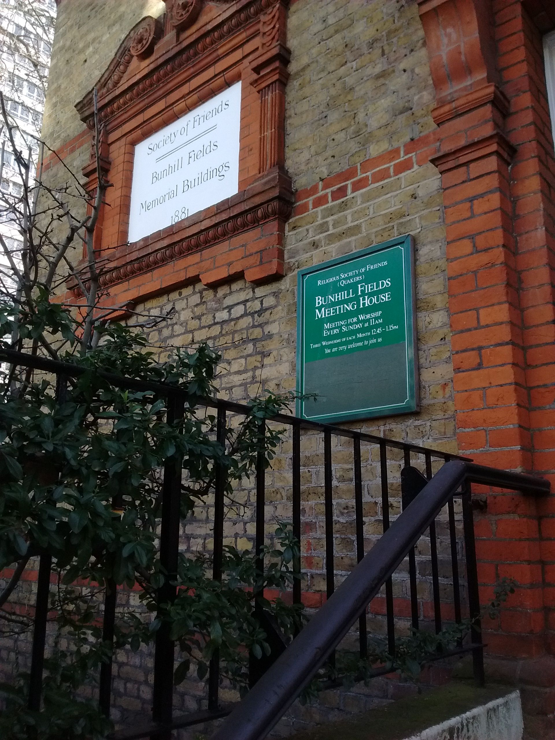
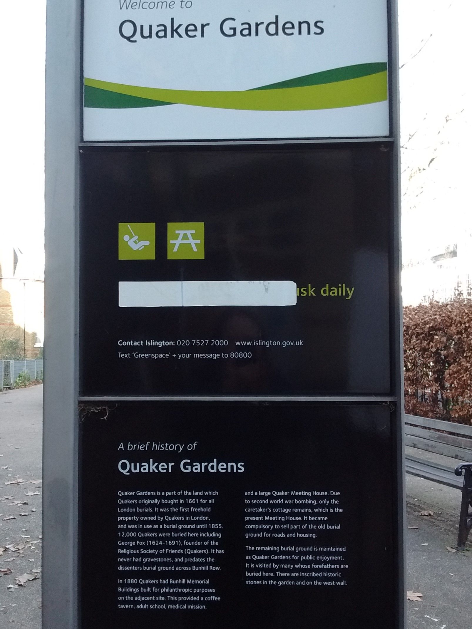
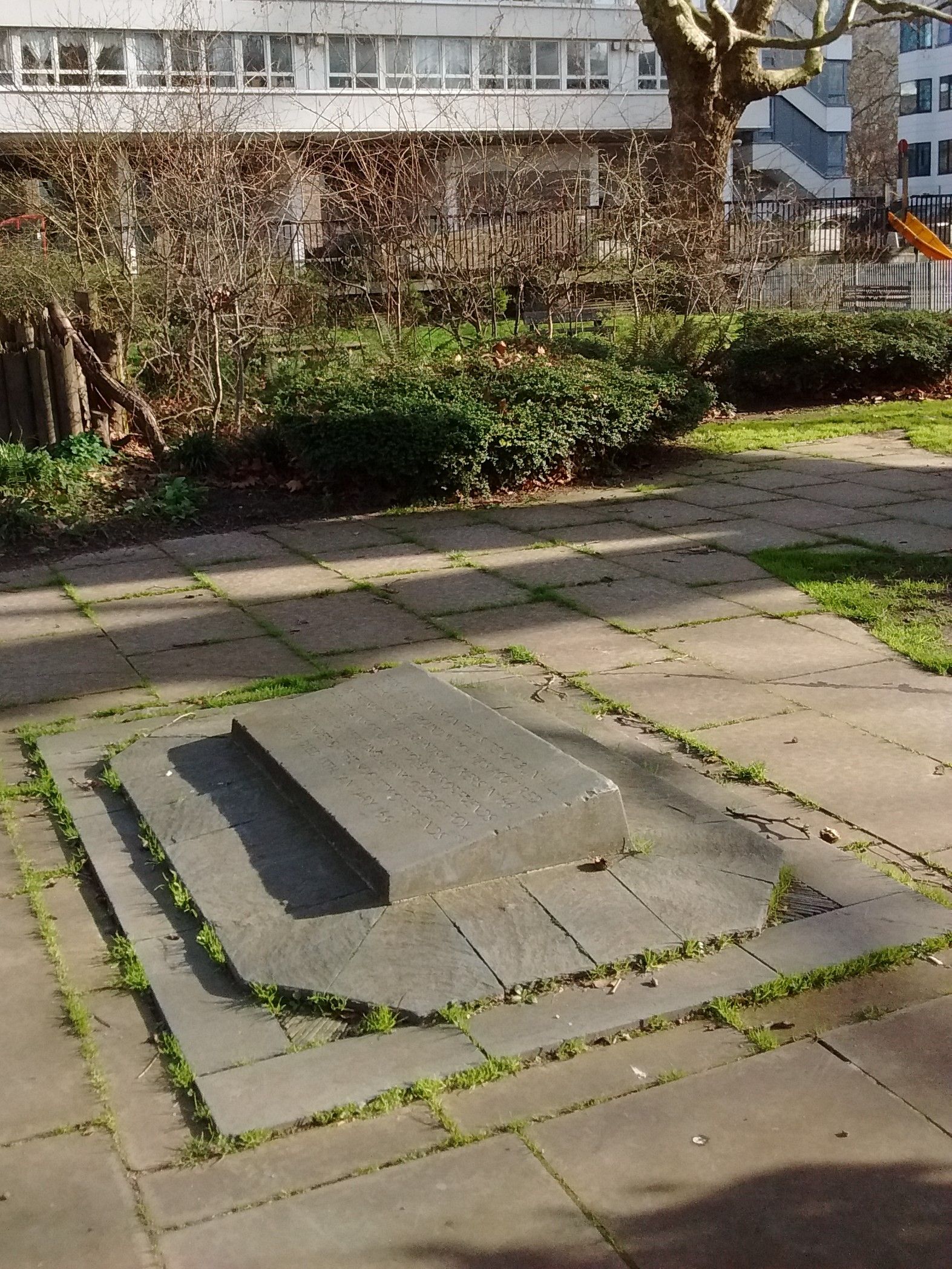
| Description | : | Also known as: "Checker Alley Quaker Burying Ground" "Friends Burial Ground on Checker Alley" The former burial ground is presently known as Quaker Gardens. It is situated adjacent the Bunhill Fields Quaker Meeting House between Banner Street and Chequer Street (formerly called Checker Alley). Lying across the street (Bunhill Row) from the much larger former Bunhill Fields Burial Ground (1665 - 1854), it was established at an earlier date. Approximately 12,000 members of the Society of Friends (Quakers) were buried here. According to Quaker custom, burials were mostly unmarked. Well known Quakers buried here include George Fox, Edward Burrough and John Bellers. Years of use: ... Read More |
frequently asked questions (FAQ):
-
Where is Bunhill Fields Quaker Burying Ground?
Bunhill Fields Quaker Burying Ground is located at 1 Chequer Street Islington, London Borough of Islington ,Greater London , EC1Y 8PJEngland.
-
Bunhill Fields Quaker Burying Ground cemetery's updated grave count on graveviews.com?
32 memorials
-
Where are the coordinates of the Bunhill Fields Quaker Burying Ground?
Latitude: 51.5239250
Longitude: -0.0911890
Nearby Cemetories:
1. Quaker Gardens
London, City of London, England
Coordinate: 51.5239250, -0.0911890
2. Bunhill Fields Burial Ground
London Borough of Islington, England
Coordinate: 51.5236015, -0.0888900
3. St Luke Churchyard
St Luke's, London Borough of Islington, England
Coordinate: 51.5251312, -0.0941940
4. Wesleys Chapel
London Borough of Islington, England
Coordinate: 51.5237140, -0.0865760
5. Plague Grave At Seward Street And Mount Mills
Clerkenwell, London Borough of Islington, England
Coordinate: 51.5259780, -0.0985880
6. St. Giles Cripplegate Churchyard
London, City of London, England
Coordinate: 51.5187100, -0.0939510
7. Charthouse Chapel and Churchyard
City of London, England
Coordinate: 51.5209310, -0.0987080
8. St Clement with St Barnabas and St Matthew
Finsbury, London Borough of Islington, England
Coordinate: 51.5277700, -0.0977600
9. Charterhouse
London Borough of Islington, England
Coordinate: 51.5213890, -0.0997220
10. Old Church of St. Mary Moorfields (Defunct)
London, City of London, England
Coordinate: 51.5187890, -0.0857140
11. St Mary's Moorfields Churchyard
London, City of London, England
Coordinate: 51.5177280, -0.0858980
12. St Bartholomew the Great Churchyard
London, City of London, England
Coordinate: 51.5189300, -0.0995360
13. The Order of St. John Cemetery
Farringdon, London Borough of Islington, England
Coordinate: 51.5231220, -0.1030110
14. St Albans Churchyard (Defunct)
London, City of London, England
Coordinate: 51.5166460, -0.0940880
15. St Mary Aldermanbury Churchyard
London, City of London, England
Coordinate: 51.5164830, -0.0930720
16. Marian Martyrs' Monument
Smithfield, City of London, England
Coordinate: 51.5184100, -0.1001090
17. Holywell Priory
Shoreditch, London Borough of Hackney, England
Coordinate: 51.5238050, -0.0785300
18. Liverpool Street Station
London, City of London, England
Coordinate: 51.5187870, -0.0814920
19. St Botolph Aldersgate Churchyard
London, City of London, England
Coordinate: 51.5169440, -0.0972220
20. Priory of St. Mary of Bethlehem Cemetery
Bishopsgate, City of London, England
Coordinate: 51.5183640, -0.0818180
21. Guildhall
London, City of London, England
Coordinate: 51.5158200, -0.0911380
22. St Anne and St Agnes Churchyard
London, City of London, England
Coordinate: 51.5164490, -0.0963390
23. Postman's Park
London, City of London, England
Coordinate: 51.5168320, -0.0977080
24. St. Bartholomew the Less Churchyard
London, City of London, England
Coordinate: 51.5179240, -0.1006630