| Memorials | : | 0 |
| Location | : | Clerkenwell, London Borough of Islington, England |
| Coordinate | : | 51.5259780, -0.0985880 |
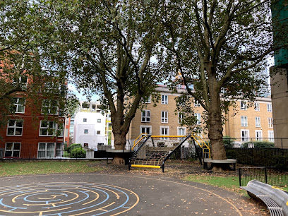
| Description | : | Seward Street / Mount Mills, between Shoreditch and Finsbury Once the site of St. Bartholomew's Hospital Ground, the area was used as a large plague pit between 1664 - 1666. Reputedly a rather shallow grave, residential buildings on top of the site have only recently been constructed. From Daniel Defoe's A Journal of the Plague Year: 'A piece of ground beyond Goswell Street, near Mount Mill... abundance were buried promiscuously from the parishes of Aldersgate, Clerkenwell and even out of the city.' Thousands of bodies are thought to lie here.' Once the site of St. Bartholomew's Hospital Ground, the area was... Read More |
frequently asked questions (FAQ):
-
Where is Plague Grave At Seward Street And Mount Mills?
Plague Grave At Seward Street And Mount Mills is located at Seward Street and Mount Mills Plague Pit Clerkenwell, London Borough of Islington ,Greater London ,England.
-
Plague Grave At Seward Street And Mount Mills cemetery's updated grave count on graveviews.com?
0 memorials
-
Where are the coordinates of the Plague Grave At Seward Street And Mount Mills?
Latitude: 51.5259780
Longitude: -0.0985880
Nearby Cemetories:
1. St Clement with St Barnabas and St Matthew
Finsbury, London Borough of Islington, England
Coordinate: 51.5277700, -0.0977600
2. St Luke Churchyard
St Luke's, London Borough of Islington, England
Coordinate: 51.5251312, -0.0941940
3. The Order of St. John Cemetery
Farringdon, London Borough of Islington, England
Coordinate: 51.5231220, -0.1030110
4. Charterhouse
London Borough of Islington, England
Coordinate: 51.5213890, -0.0997220
5. St. James Churchyard
Clerkenwell, London Borough of Islington, England
Coordinate: 51.5235700, -0.1056500
6. Quaker Gardens
London, City of London, England
Coordinate: 51.5239250, -0.0911890
7. Bunhill Fields Quaker Burying Ground
Islington, London Borough of Islington, England
Coordinate: 51.5239250, -0.0911890
8. Charthouse Chapel and Churchyard
City of London, England
Coordinate: 51.5209310, -0.0987080
9. Bunhill Fields Burial Ground
London Borough of Islington, England
Coordinate: 51.5236015, -0.0888900
10. St Bartholomew the Great Churchyard
London, City of London, England
Coordinate: 51.5189300, -0.0995360
11. Marian Martyrs' Monument
Smithfield, City of London, England
Coordinate: 51.5184100, -0.1001090
12. Wesleys Chapel
London Borough of Islington, England
Coordinate: 51.5237140, -0.0865760
13. St. Giles Cripplegate Churchyard
London, City of London, England
Coordinate: 51.5187100, -0.0939510
14. St. Bartholomew the Less Churchyard
London, City of London, England
Coordinate: 51.5179240, -0.1006630
15. William Wallace's Place of Execution
Smithfield, City of London, England
Coordinate: 51.5174520, -0.1001290
16. St Botolph Aldersgate Churchyard
London, City of London, England
Coordinate: 51.5169440, -0.0972220
17. Postman's Park
London, City of London, England
Coordinate: 51.5168320, -0.0977080
18. Holy Sepulchre London Churchyard
London, City of London, England
Coordinate: 51.5166730, -0.1023240
19. St Anne and St Agnes Churchyard
London, City of London, England
Coordinate: 51.5164490, -0.0963390
20. St Albans Churchyard (Defunct)
London, City of London, England
Coordinate: 51.5166460, -0.0940880
21. Christ Church Greyfriars Churchyard
London, City of London, England
Coordinate: 51.5162000, -0.0996000
22. St. Andrew's Churchyard
Holborn, London Borough of Camden, England
Coordinate: 51.5173050, -0.1066050
23. St Mary Aldermanbury Churchyard
London, City of London, England
Coordinate: 51.5164830, -0.0930720
24. Newgate Prison Cemetery
Newgate, City of London, England
Coordinate: 51.5158120, -0.1017230

